Tornado Watch Issued For Multiple Oklahoma Counties Thursday
A line of storms is moving eastward across the state Thursday afternoon through the southern and southeastern regions.Thursday, March 16th 2023, 2:47 pm
OKLAHOMA CITY -
A line of storms is moving eastward across the state Thursday afternoon through the southern and southeastern regions.
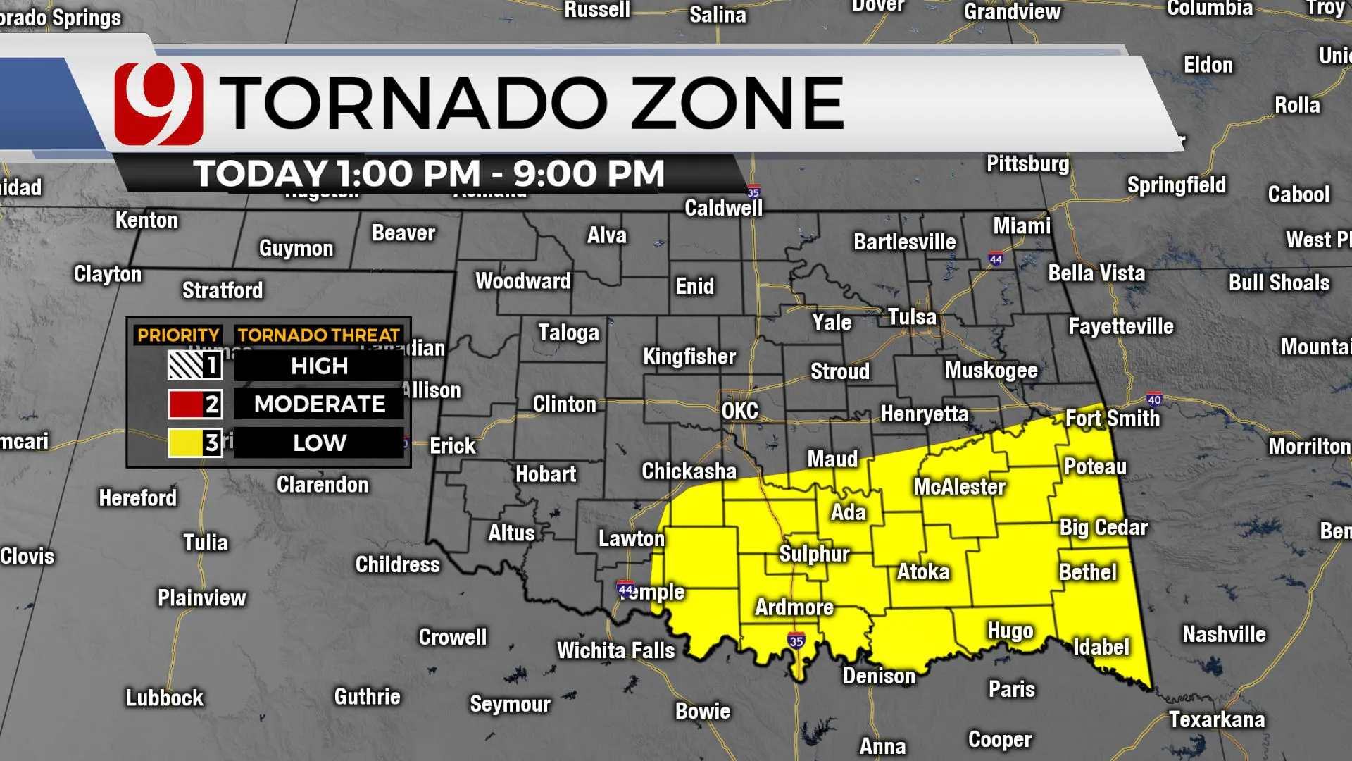
UPDATE: 1:37 p.m..: A Tornado Watch has been issued for Carter, Garvin, Jefferson, Love, Murray, Pontotoc and Stephens County until 8 p.m.
The cold front is already moving into the state! Ahead of this storm, it is windy. You will notice winds 35 to 40 mph out of the south. Drivers of high profile vehicles use caution.
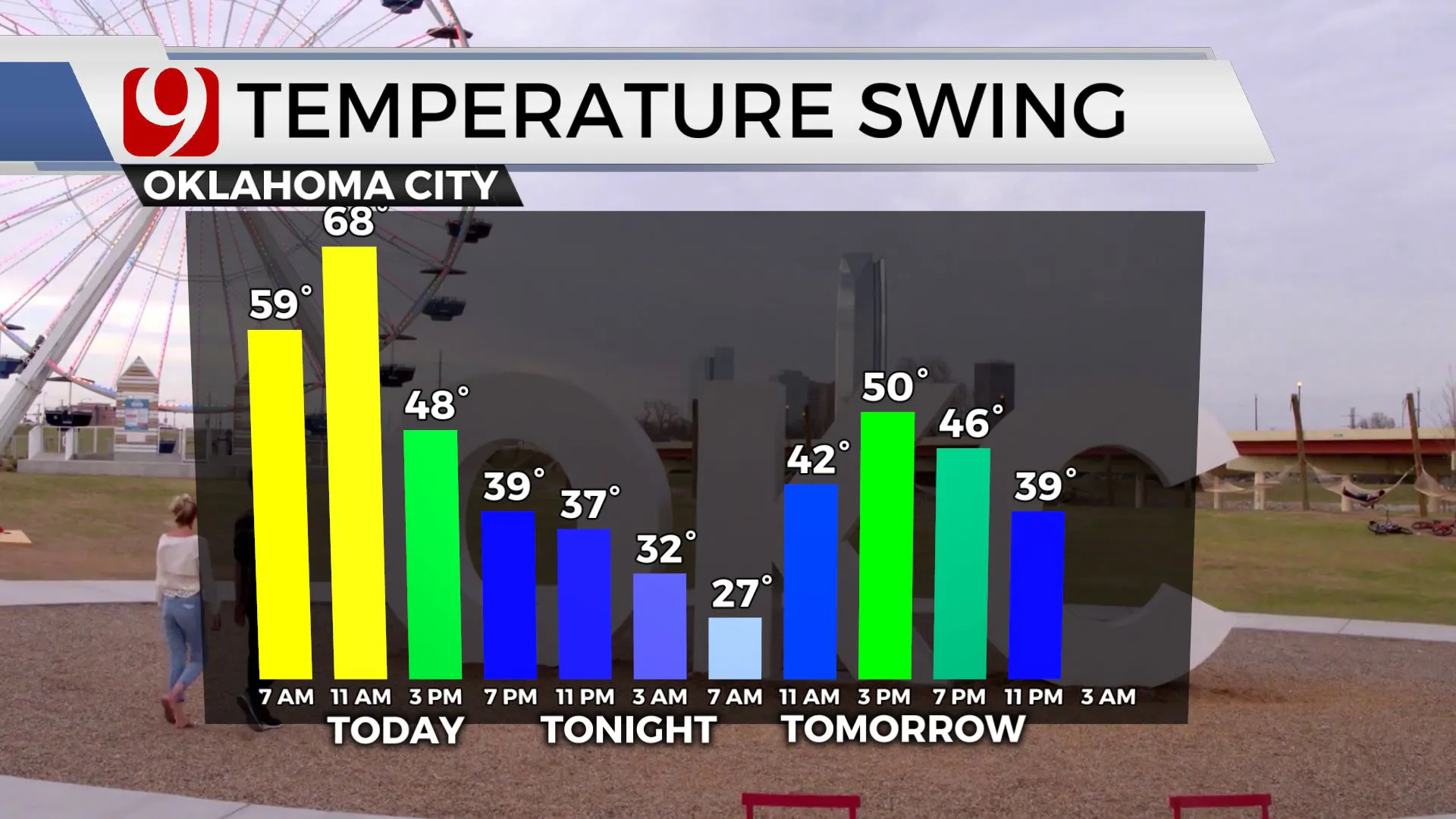
Tracking a few showers this morning across the region. As the day rolls along, expecting severe storms to develop.
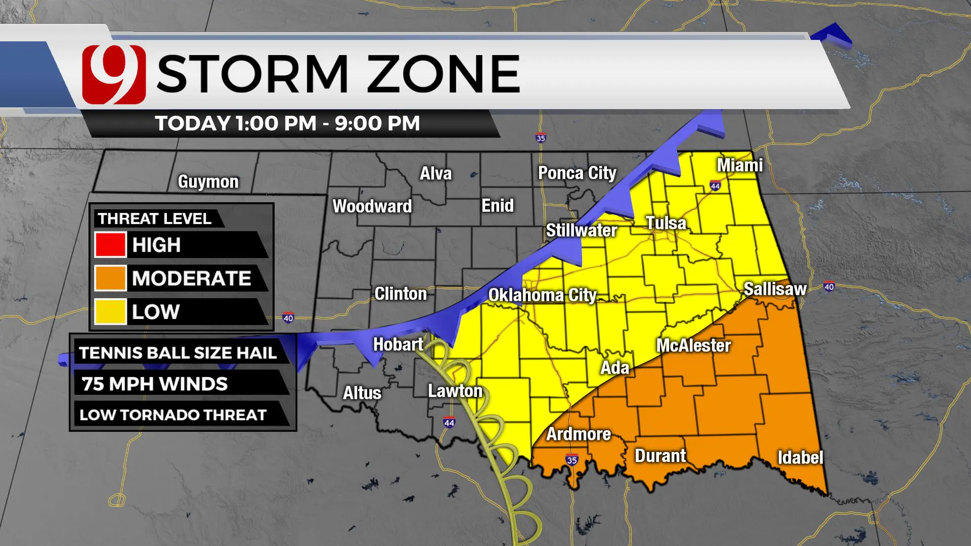
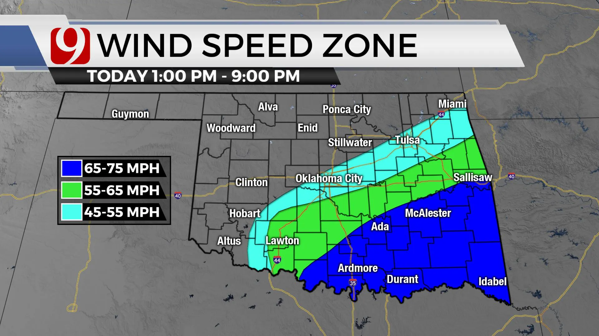
The timing for the metro looks to be from 12 p.m. to 3:00 p.m. The threat for Oklahoma City is nickel to quarter size hail, winds to 65 mph, and intense lighting.
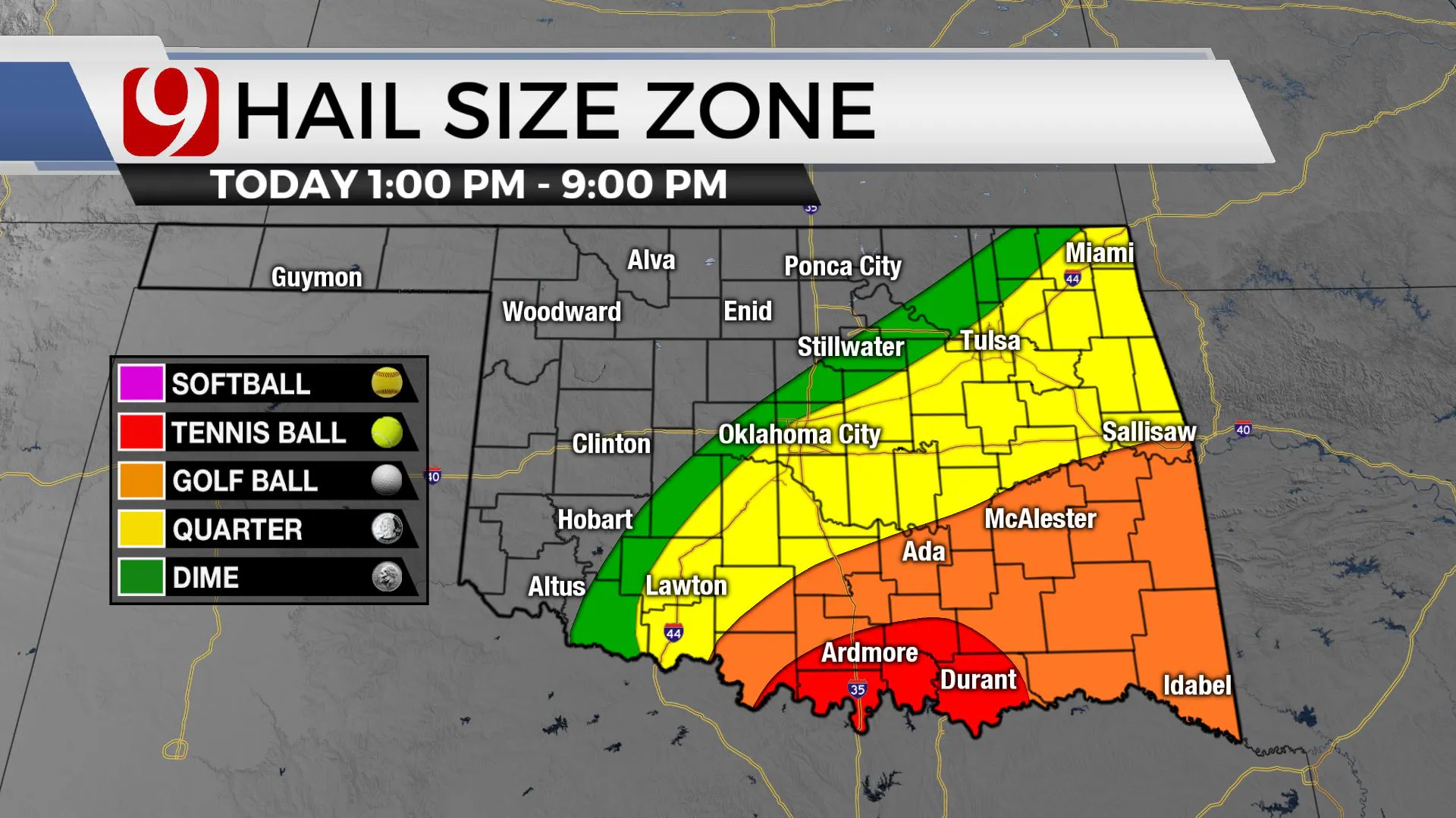
The severe threats ramp up where it will be warmer. It is a moderate threat of severe weather today in southeastern Oklahoma.
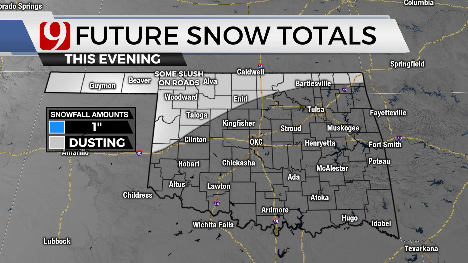
Meanwhile we will be tracking snow in the northwest. Our team of trackers will be out today bringing you updates!
Tonight the precipitation will end and we will see temps plummet into the 20s. Sunny skies and highs near 50 for St. Patrick's day.
More Like This
March 16th, 2023
May 18th, 2023
Top Headlines
November 27th, 2024
November 27th, 2024
November 27th, 2024
November 27th, 2024


