

MAPS 3 Streetcar Route Passed By OKC City Council
Oklahoma City's City Council has officially picked the route for the MAPS 3 rail car project. The chosen downtown route will stretch about 4.5 miles and go as far north as 11th street and as far south as Reno.Tuesday, September 24th 2013, 4:46 pm

Oklahoma City's City Council has officially picked the route for the MAPS 3 rail car project. The chosen downtown route will stretch about 4.5 miles and go as far north as 11th street and as far south as Reno.
It will connect the St. Antony Hospital Campus to Bricktown and will eventually be able to expand to OU Medical Center and the MAPS 3 Park.
"Who is going to ride? very few people," said neighbor Alex Svetgolff, who spoke against the route Tuesday.
"We need to build what we promised voters," said Jeff Bezdek, who served on the modern streetcar subcommittee.
City Council passed by the route by a vote of 5 to 3. Construction on the $130 million project is set to begin next year, with completion of Phase 1 in 2017.
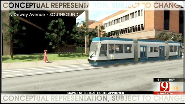
A look at the chosen route and newest street view of the streetcar project.


Karl Torp
Karl Torp anchors our Emmy-winning 4 p.m., 5 p.m., 6 p.m. and 10 p.m. newscasts every weeknight. He has worked at News 9 since 2012.

Get The Daily Update!
Be among the first to get breaking news, weather, and general news updates from News 9 delivered right to your inbox!
More Like This

September 24th, 2013

April 23rd, 2025


Top Headlines

April 25th, 2025

April 25th, 2025

April 25th, 2025

April 25th, 2025