Flash Floods Possible As Storms Move Through SE Oklahoma
Travis Meyer and the News On 6 weather team are tracking severe storms moving across SE Oklahoma.Thursday, March 2nd 2023, 10:36 pm
TULSA, Okla. -
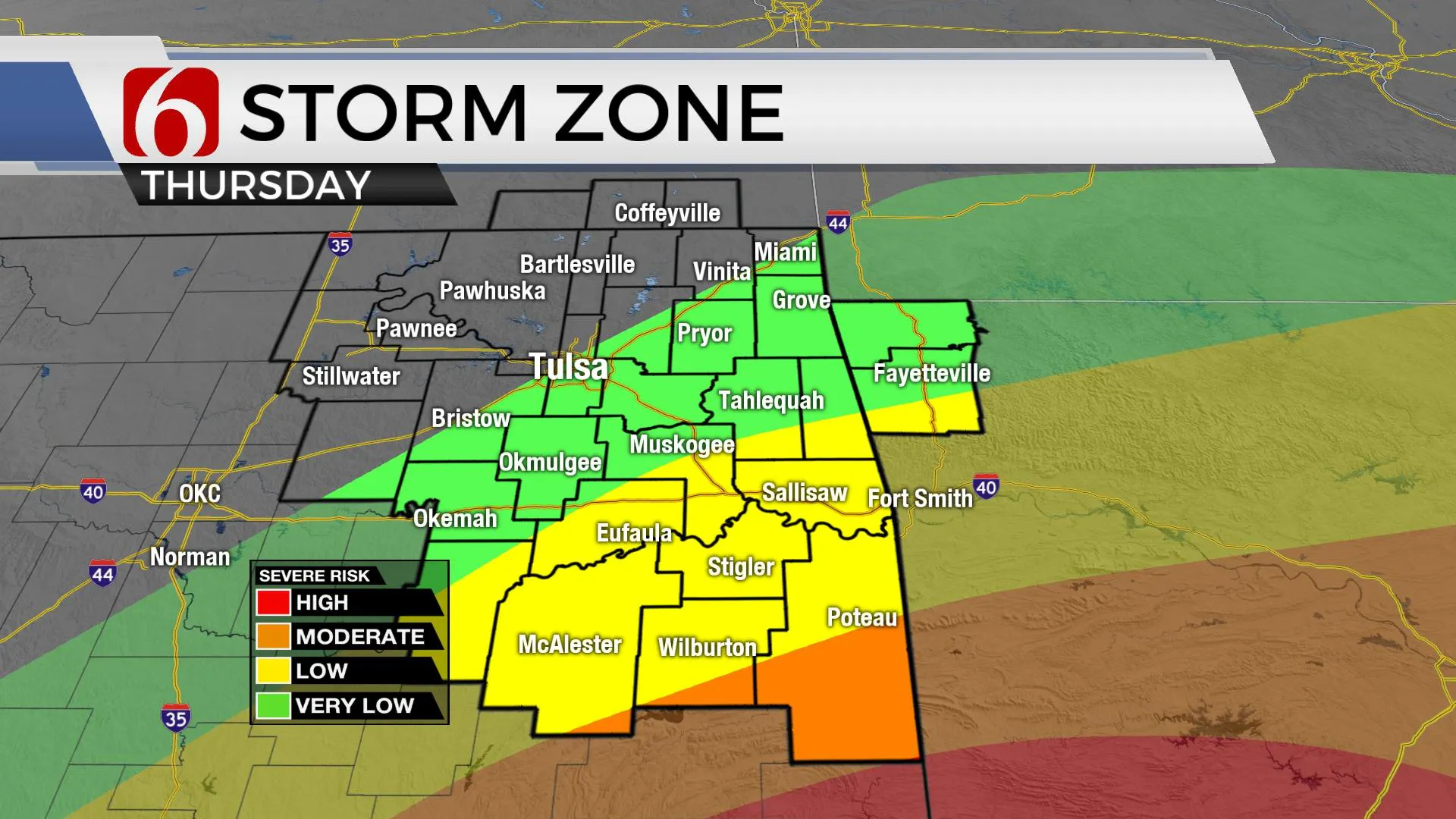
A powerful storm system impacted the area on Thursday with several weather hazards, including the potential for significant severe weather across the far southeastern third of the region.
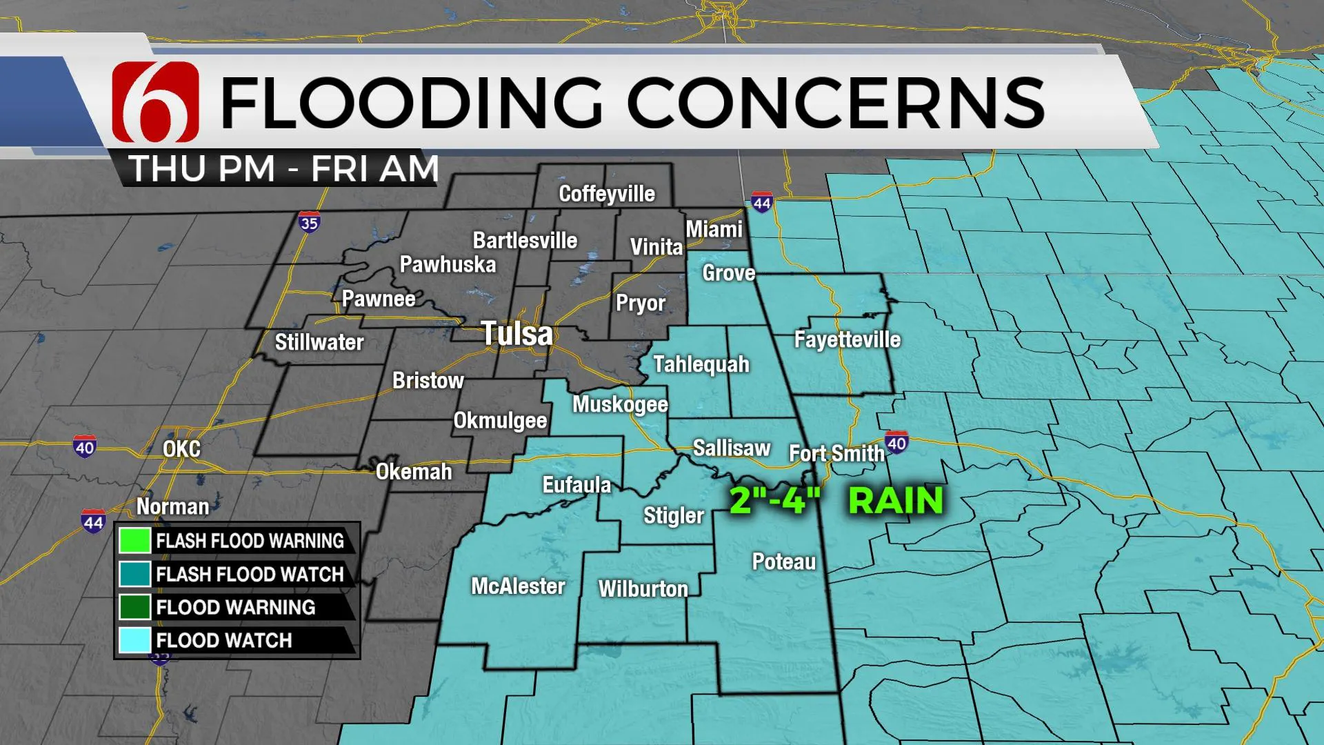
As the main upper-level system arrived later Thursday night, the threat transitions to heavy rain that could result in some localized flooding issues.
Flash Flood Warning for Latimer and Le Flore County in OK until 12:45am Friday.


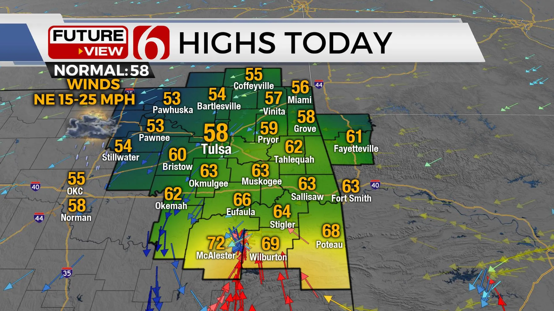
Later tonight into pre-dawn Friday, rain may also mix with or change with snowflakes across part of northern OK and southern Kansas with some minor accumulation on grassy areas. Strong pressure gradient winds will also be likely overnight and early Friday morning from 30 to near 50 mph at times before decreasing quickly Friday morning as the main upper-level system ejects northeast from the area. By Friday afternoon sunshine returns with highs in the 50s.

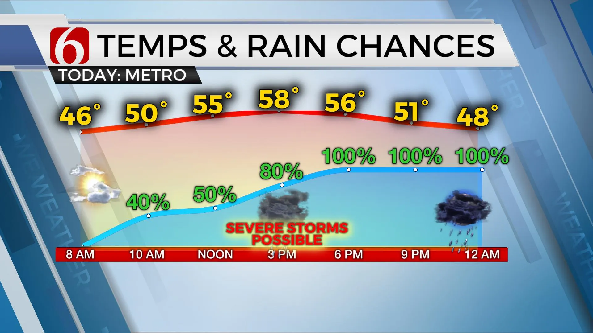
A few scattered storms will become possible across northeastern OK during the next few hours. These will be elevated in nature, capable of producing some hail and gusty winds. A few cells could trigger severe thunderstorm warnings if the hail size becomes large enough. This activity will be highly scattered and will quickly move north and northeast. By late morning into early afternoon, the front that moved across the area yesterday will be moving northwest nearing the Red River or part of southeastern OK as a warm front. Locations along and south of the boundary will become increasingly unstable. The powerful upper-level system west of the state this morning will be drawing closer with strong winds aloft will approach the region. The combination of these factors will allow scattered thunderstorm development, possibly super-cells capable of all modes of severe weather this afternoon. Locations near and south of I-40 and east of I-35 will be supportive of more of these storms with the highest chance along the Red River into northeast Texas. Later tonight, a surface low tracking along the Red River will lift northeast while bringing a pacific boundary from the west to east across the area. A line of storms will develop with embedded super-cell structures capable of more severe weather threats near or south of the Red River. By evening, severe threats move into Arkansas and east Texas while the upper-level system begins to produce heavy rainfall. The colder air aloft nears the region overnight allowing some rain to change to or mix with snowflakes, mostly across far northern sections of the area. Early Friday morning the precipitation will move northeast away from the state by Friday midday at the very latest.

The weekend appears rather benign compared to our weather on Thursday and Friday. Saturday afternoon highs should reach the lower 60s with Sunday nearing the lower to 70s. Warm and breezy weather will be likely Monday with afternoon highs in the mid to upper 70s before another cold front enters the state Tuesday with a slight chance for showers or storms. Most data support another cool-down Tuesday with reinforcing cool air arriving for the remainder of next week with afternoon highs in the upper 40s and lower 50s.

Thanks for reading the Thursday morning weather discussion and blog.
Please remain aware of your weather surroundings as this storm system impacts the area.
Alan Crone
KOTV
More Like This
March 2nd, 2023
December 24th, 2024
December 24th, 2024
December 24th, 2024
Top Headlines
December 24th, 2024
December 24th, 2024
December 24th, 2024
December 24th, 2024


