Weather Blog: Above Normal Highs Today Before Colder Temps Return Thursday
Oklahoma Weather Forecast: Bookmark this page and refresh it often for the latest forecast and daily updates.Wednesday, December 4th 2024, 6:48 am
TULSA, Okla. -
South winds will increase from 15 to 20 mph through midday before a cold front moves across northern Oklahoma this afternoon and tonight.
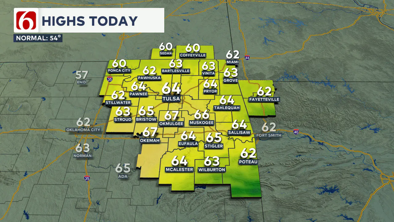
This will bring a return of north winds, with a few clouds and temperatures falling from the 60s into the 40s by early evening.
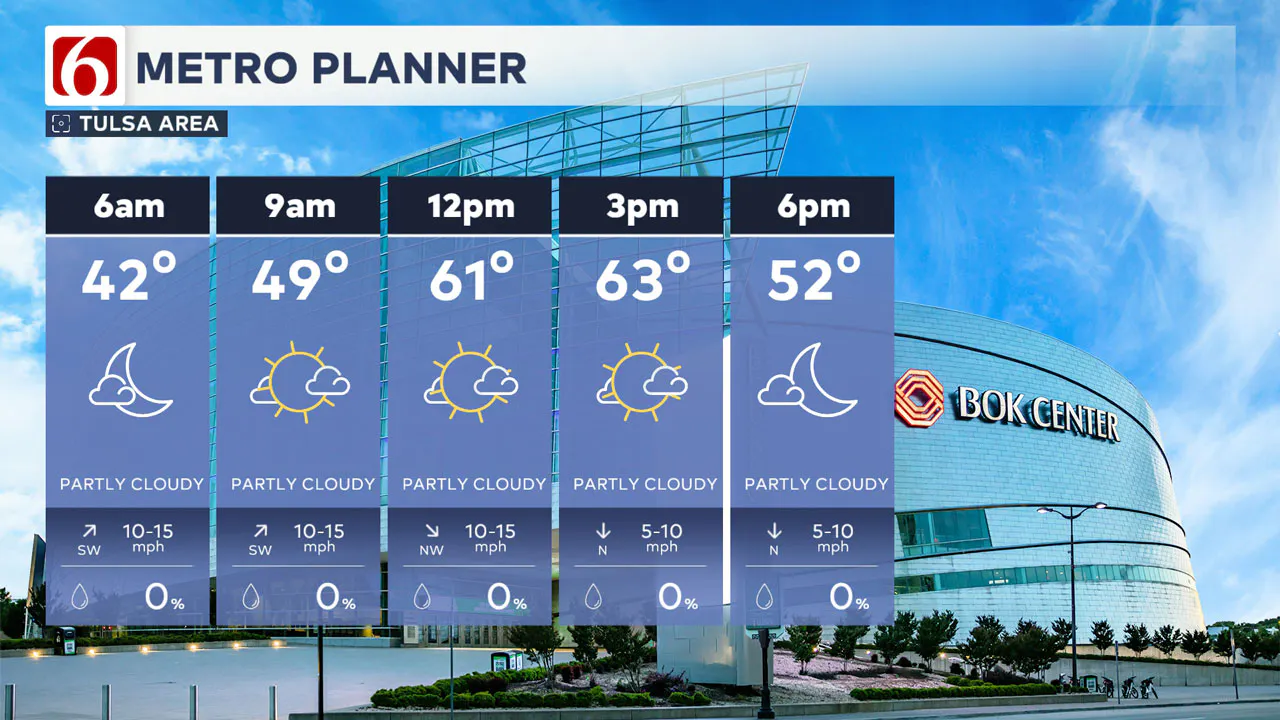
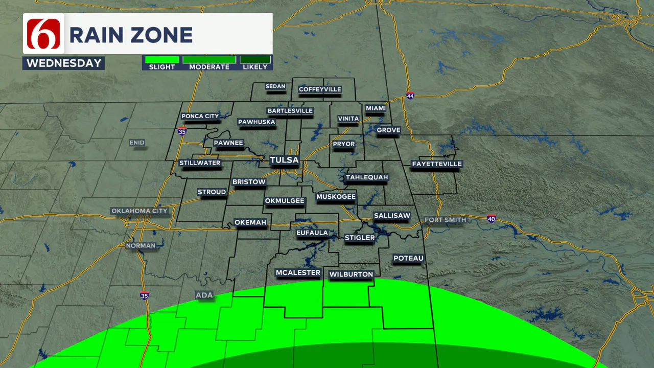
A weak disturbance across Texas will spread spotty showers through the Red River Valley today. There is a slight chance for a shower in far southern Oklahoma, but higher chances will remain along the Red River Valley region.
Behind the afternoon cold front, a surface ridge of high pressure will develop bringing colder weather tomorrow. Thursday morning lows will be in the mid to upper 20s.
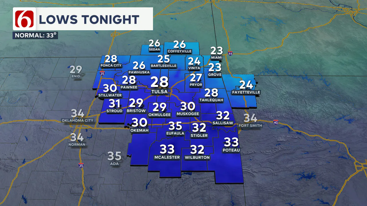
Daytime highs will be in the upper 30s to lower 40s across northern OK and the mid-40s across southeastern Oklahoma. Brisk north winds at 10 to 20 mph will continue early tomorrow morning before diminishing by the afternoon.
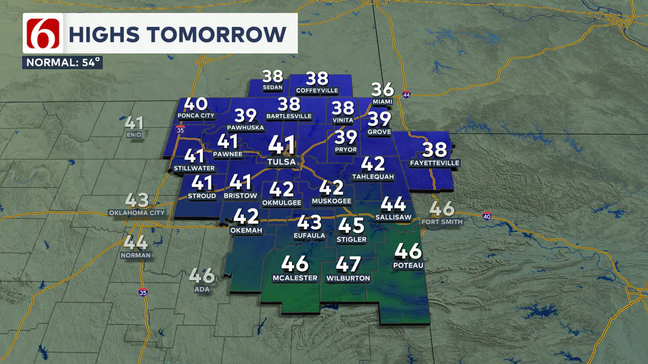
The surface ridge will bring very cold weather early Friday morning, with many locations in the lower to mid-20s. By Friday afternoon, the south wind will return at 7 to 12 mph with mostly clear sky and highs moderating into the lower 50s.
The weekend forecast depends on a cutoff low located across the southwestern United States. The outcome of this feature remains inconsistent in most global model data, but it appears this system will move across the Southern and Central Plains early next week. Before it arrives, showers will be possible Friday night and Saturday morning across North Texas, potentially impacting far southern Oklahoma Saturday morning and again late Saturday evening.
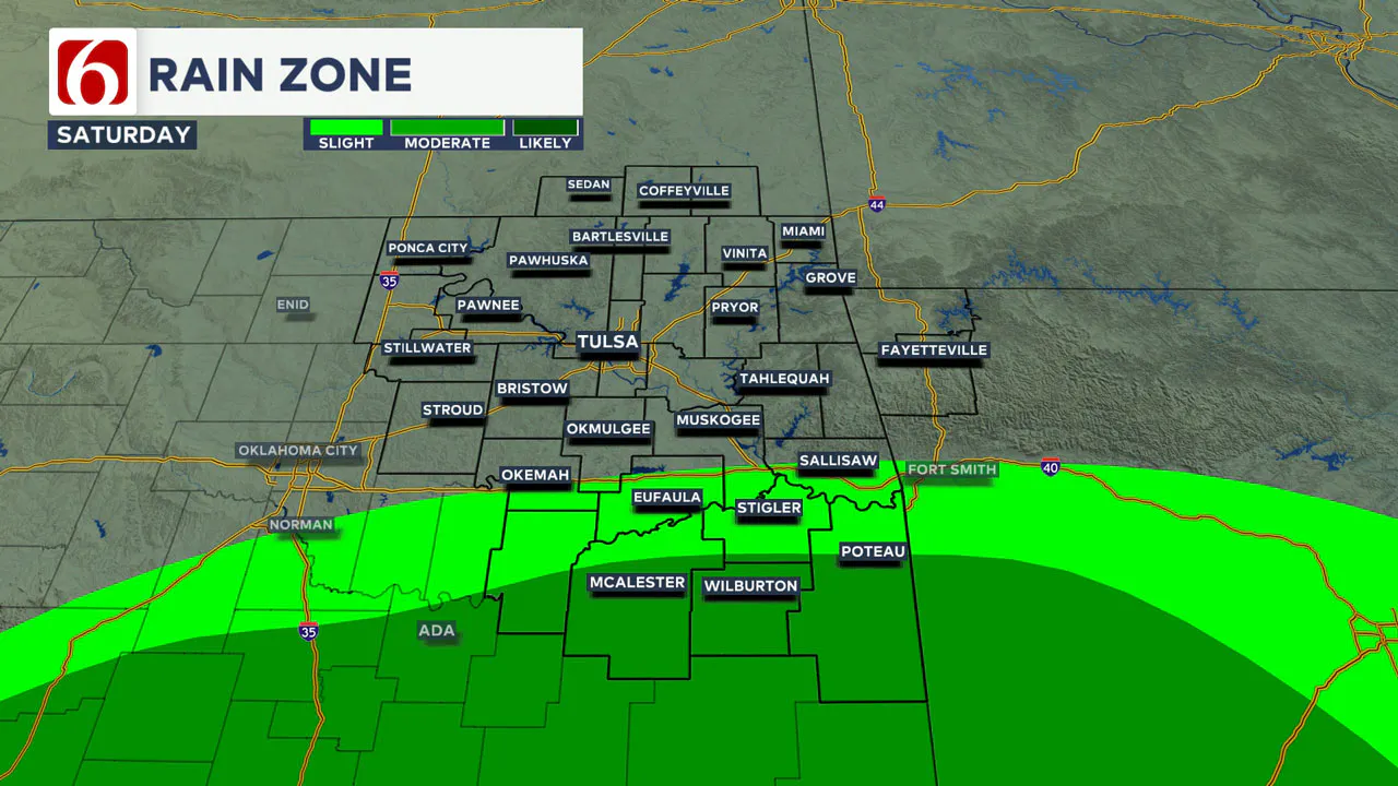
Another lobe of energy will arrive Saturday night and Sunday morning, mostly affecting the southeastern third of the state, particularly along and south of the Highway 270 corridor and along and east of Highway 69.
Saturday morning temperatures will start in the mid-30s and top out in the upper 50s to lower 60s with partly to mostly cloudy conditions along with southwest winds at 10 to 15 mph.

Sunday morning, showers will remain possible in far southern Oklahoma with temperatures in the mid-40s. Sunday afternoon highs in the metro will reach near 63 with gusty south winds at 15 to 25 mph.
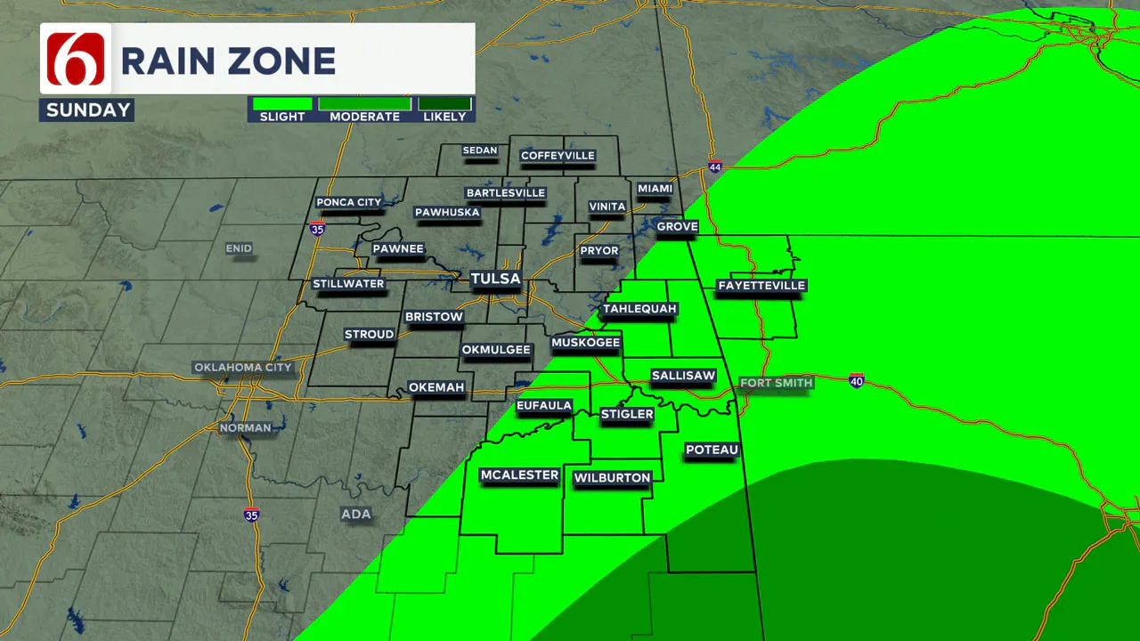
Late Sunday night and Monday morning, another surface boundary will move across the area. Monday morning temperatures will be in the lower 50s, reaching the mid-50s by midday before colder weather arrives in the afternoon.
There is a very slight chance for a few showers or sprinkles with the frontal passage, but measurable precipitation probabilities will remain near or below 10% on Monday.
Temperatures will drop slightly below seasonal averages for Tuesday and Wednesday with morning lows near freezing and daytime highs in the mid to upper 40s.
Frost Flowers Delight Early Risers
Friday morning brought a rare sight in parts of Oklahoma—frostflowers. These delicate formations occur when warm soil pushes moisture through plant stems, freezing them into intricate shapes. Thanks to Sequoyah Quinton, one of our storm trackers, for sharing this unique phenomenon!

Emergency Info: Outages Across Oklahoma:
Northeast Oklahoma has various power companies and electric cooperatives, many of which have overlapping areas of coverage. Below is a link to various outage maps.
Indian Electric Cooperative (IEC) Outage Map
Oklahoma Association of Electric Cooperatives Outage Map — (Note Several Smaller Co-ops Included)
The Alan Crone morning weather podcast link from Spotify:
https://open.spotify.com/episode/62zT1gppNJjlMO4T2NVOxR
The Alan Crone morning weather podcast link from Apple:
Follow the News On 6 Meteorologists on Facebook!

More Like This
December 4th, 2024
December 4th, 2024
December 4th, 2024
December 4th, 2024
Top Headlines
December 4th, 2024
December 4th, 2024
December 4th, 2024
December 4th, 2024


