Weather Blog: Mild Weather Continues With A Mid-Week Rain Chance
Oklahoma Weather Forecast: Bookmark this page and refresh it often for the latest forecast and daily updates.Tuesday, November 12th 2024, 7:39 am
TULSA, Okla. -
Terrific temperatures continue for our Tuesday in Green Country as we track a fast-moving storm system that brings another brief rain chance back to the area soon.
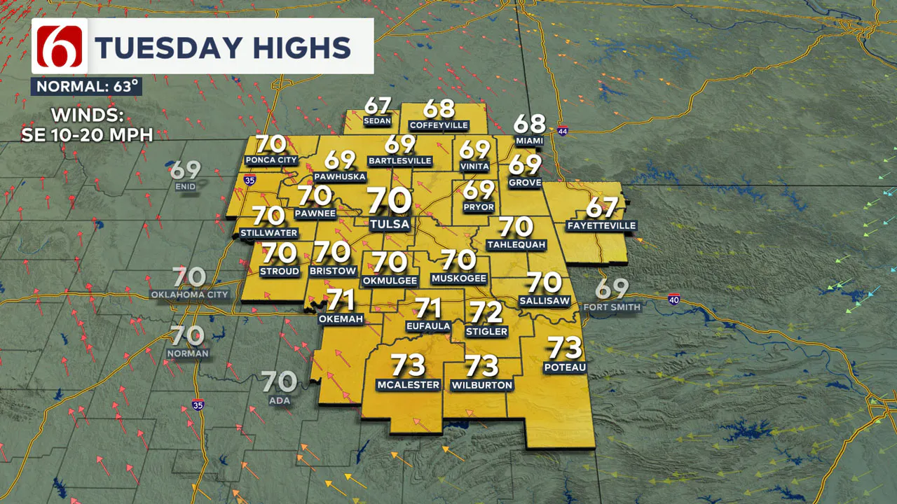
A stronger southeast breeze returns today along with an increase in high clouds. Once again we’ll have a pleasant mild afternoon with highs back around 70 to the lower 70s across eastern Oklahoma!

By late tonight, a fast-moving upper-level trough will swing across the Plains and push a front into western Oklahoma.
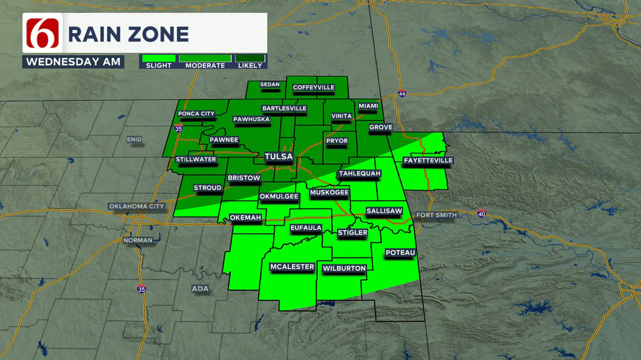
Scattered showers and storms will develop late in the night across western Oklahoma, and by early Wednesday morning that scattered activity will shift into northeastern Oklahoma and southeastern Kansas.

By mid to late morning Wednesday, those widely scattered showers and storms will exit Green Country with a gusty northwest wind and drier air surging on Wednesday afternoon.
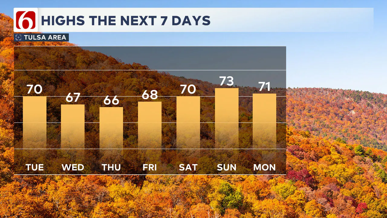
Despite the cold front that zips through on Wednesday, our temperatures will only cool a few degrees for the late-week timeframe.

Highs will still be in the 60s on Thursday and back closer to 70 degrees on Friday, with a steady warm-up kicking in this weekend as south winds return.
A more active weather pattern looks to set up early next week with more storm chances and perhaps a bigger push of cold air looming. We’ll keep you updated!
Emergency Info: Outages Across Oklahoma:
Northeast Oklahoma has various power companies and electric cooperatives, many of which have overlapping areas of coverage. Below is a link to various outage maps.
Indian Electric Cooperative (IEC) Outage Map
Oklahoma Association of Electric Cooperatives Outage Map — (Note Several Smaller Co-ops Included)
The Alan Crone morning weather podcast link from Spotify:
https://open.spotify.com/show/0dCHRWMFjs4fEPKLqTLjvy
The Alan Crone morning weather podcast link from Apple:
Follow the News On 6 Meteorologists on Facebook!

More Like This
November 12th, 2024
November 12th, 2024
November 12th, 2024
November 12th, 2024
Top Headlines
November 12th, 2024
November 12th, 2024
November 12th, 2024
November 12th, 2024


