Weather Blog: Strong Storm System Moves Into Oklahoma Monday
Oklahoma Weather Forecast: Bookmark this page and refresh it often for the latest forecast and daily updates.Monday, November 18th 2024, 9:43 am
TULSA, Okla. -
Showers and storms will remain likely through midday before exiting early Monday afternoon to our east.

What is the weather like on Monday?
The threat of strong to severe storms remains possible but as of 9:30 a.m., there are no active warnings or watches. Cooler and dry conditions are expected for the rest of the week. A surface low is rapidly deepening across portions of southwestern Oklahoma, and will be nearing central Kansas early this Monday afternoon.
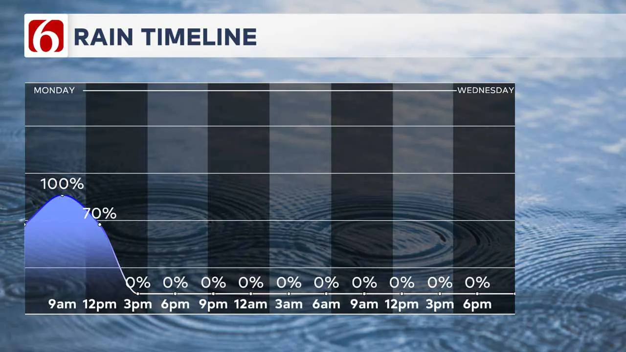
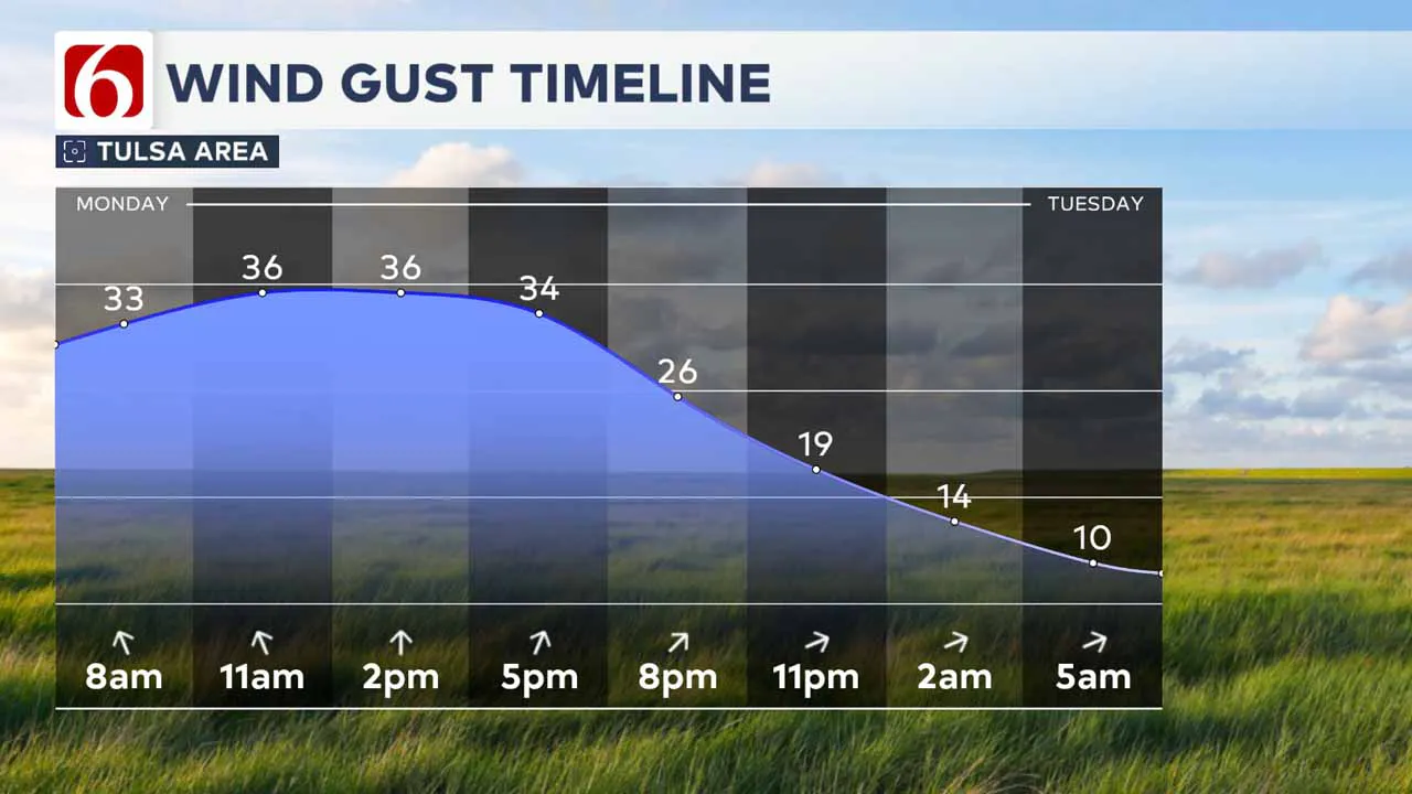
A powerful upper-level system combined with an intense low-level jet also influences Oklahoma this morning bringing showers and thunderstorms in many locations. In addition to more storms later, today will turn windy area-wide. Wind gusts to 45 mph will crank up across eastern Oklahoma, especially from late morning through the afternoon.
What to expect on Monday?
A flood watch is underway for some locations with the possibility of 1 to 3 inches of rain with some localized higher amounts. Severe weather is possible with this system and a tornado watch is currently posted for locations along and west of the I-35 corridor through midmorning.
Later Monday morning, a narrow line of thunderstorm activity is likely to arrive in the Tulsa metro from the west.
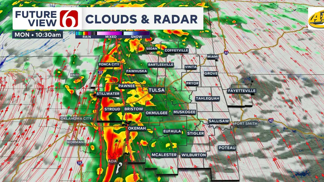
While surface instability may be low, the potential for very strong dynamic energy may still allow for some severe storms to occur.
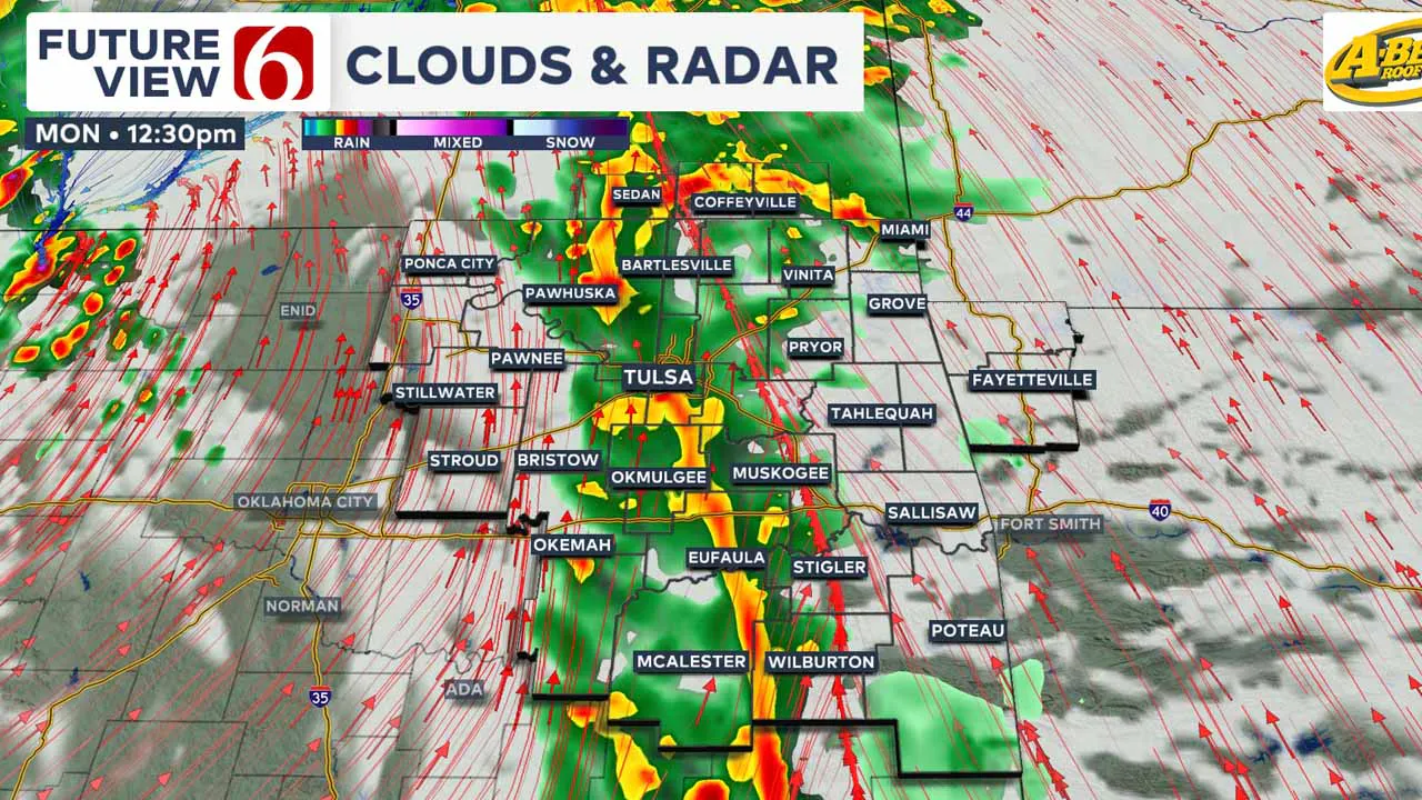
The main threat would be damaging winds, but a quick spin-up within the line of thunderstorm activity cannot be ruled out. This squall line feature is expected to weaken as it continues moving into far eastern Oklahoma and will exit into Arkansas between 2 p.m. and 3 p.m.
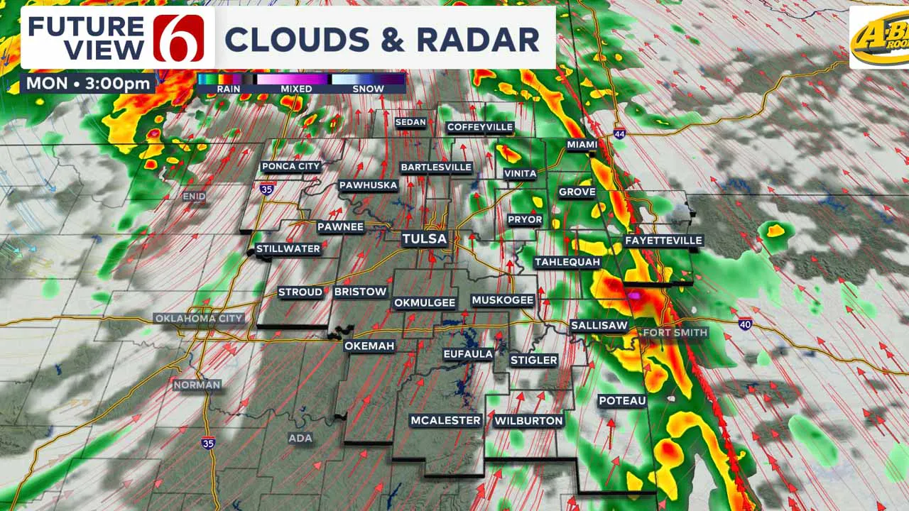
Environmental winds are likely from 25 to near 45 mph today, and a wind advisory is underway for areas along and northwest of the I-44 corridor.
As the line of thunderstorm activity moves from the west to east by midmorning into early afternoon, drier air arrives across the northwestern areas by afternoon.
This dry slot will effectively shut down precipitation chances for northeast Oklahoma while continuing to produce very strong winds and decreasing clouds.
The upper air trough will be positioned across northwest Oklahoma this afternoon and may produce a few low-topped supercells. This afternoon activity will remain across northwestern Oklahoma and southwestern Kansas Monday afternoon.
Temperatures will reach the upper 60s to lower 70s. Later Monday night, a Pacific front will move across the area and bring slightly cooler weather Tuesday morning.
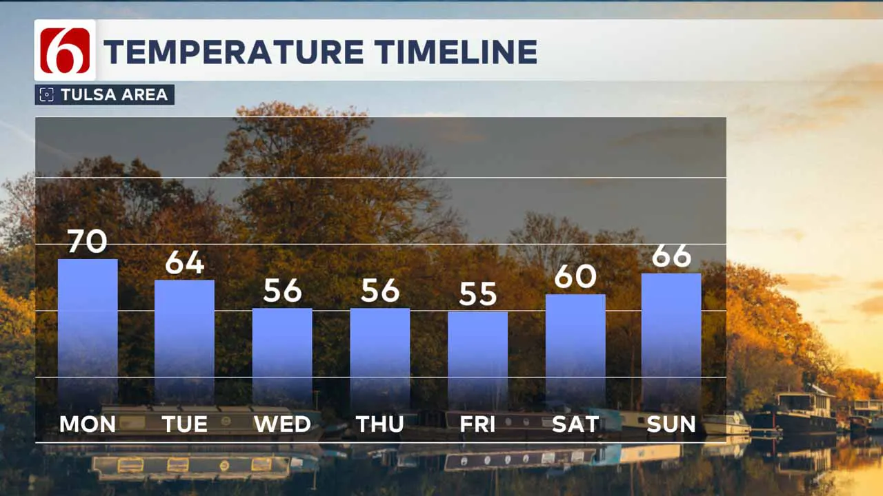
Tuesday morning temperatures will start in the 40s and finish with daytime highs in the lower 60s.
A weak upper-level wave will move from southeastern Colorado across far northern Oklahoma Tuesday night and early Wednesday morning.
Most, if not all, data bring this wave across the area with no precipitation. However, this will bring cooler weather for Wednesday through Friday. Morning lows will drop into the 30s with daytime highs in the 50s.
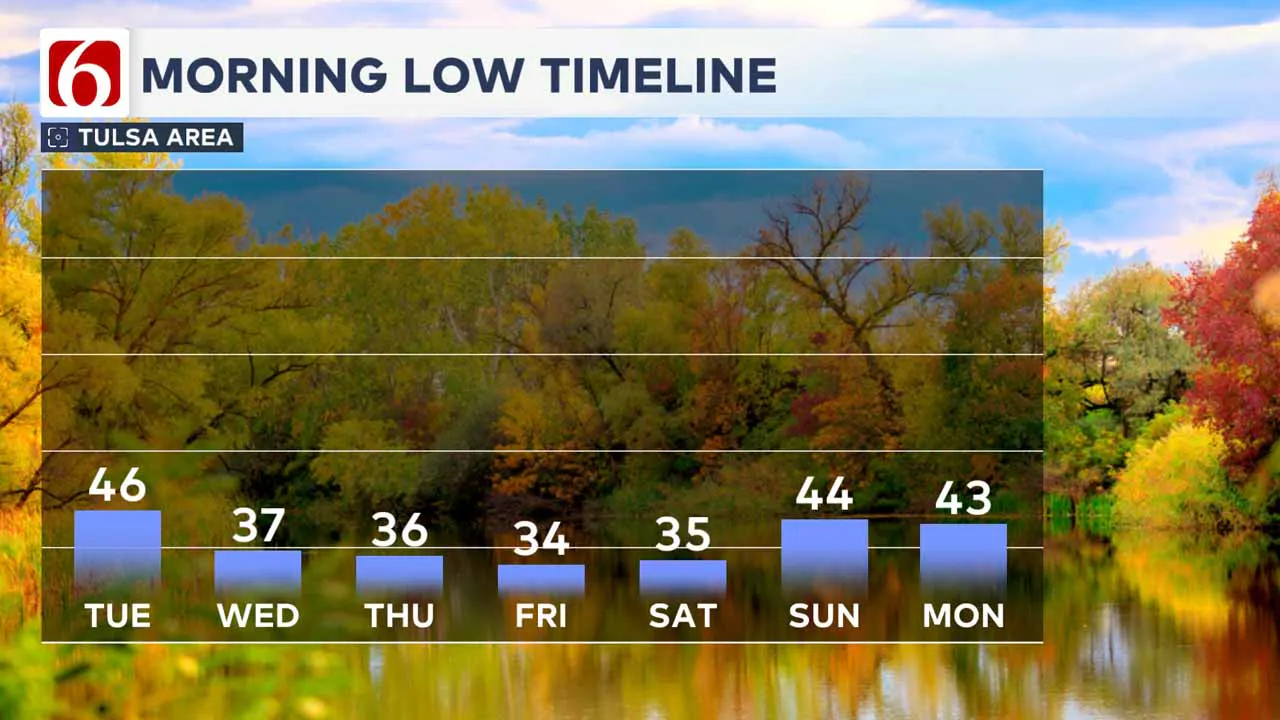
Friday through the weekend will see a relative warm-up, with afternoon highs reaching the lower 60s before our next front approaches Sunday into early Monday, bringing a few showers or storms, followed by another robust cooldown early next week.
Hurricane Update
The National Hurricane Center continues to monitor Tropical Storm Sarah (without an "H"), which is moving west-northwest toward Belize and Guatemala. While the system is expected to dissipate in the Gulf of Mexico, its remnants could merge with the storm system affecting Oklahoma, enhancing rainfall across parts of the southeastern United States.
Stay weather-aware through Monday, and enjoy the mild start to the weekend before the stormy conditions arrive.
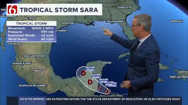 Image Provided By: Griffin Media
---
Emergency Info: Outages Across Oklahoma:
Northeast Oklahoma has various power companies and electric cooperatives, many of which have overlapping areas of coverage. Below is a link to various outage maps.
Indian Electric Cooperative (IEC) Outage Map
Oklahoma Association of Electric Cooperatives Outage Map — (Note Several Smaller Co-ops Included)
The Alan Crone morning weather podcast link from Spotify:
https://open.spotify.com/show/0dCHRWMFjs4fEPKLqTLjvy
The Alan Crone morning weather podcast link from Apple:
Follow the News On 6 Meteorologists on Facebook!

More Like This
November 18th, 2024
November 18th, 2024
November 18th, 2024
November 18th, 2024
Top Headlines
November 18th, 2024
November 18th, 2024
November 18th, 2024
November 18th, 2024


