Weather Blog: Midweek Warm-Up On The Way For Green Country
Oklahoma Weather Forecast: Bookmark this page and refresh it often for the latest forecast and daily updates.Tuesday, December 3rd 2024, 10:37 pm
TULSA, Okla. -
After yesterday’s frontal passage, a surface ridge of high pressure near and east of the area is creating very cold weather this morning. Temperatures are in the lower to mid-20s, with some valley locations starting in the upper teens.
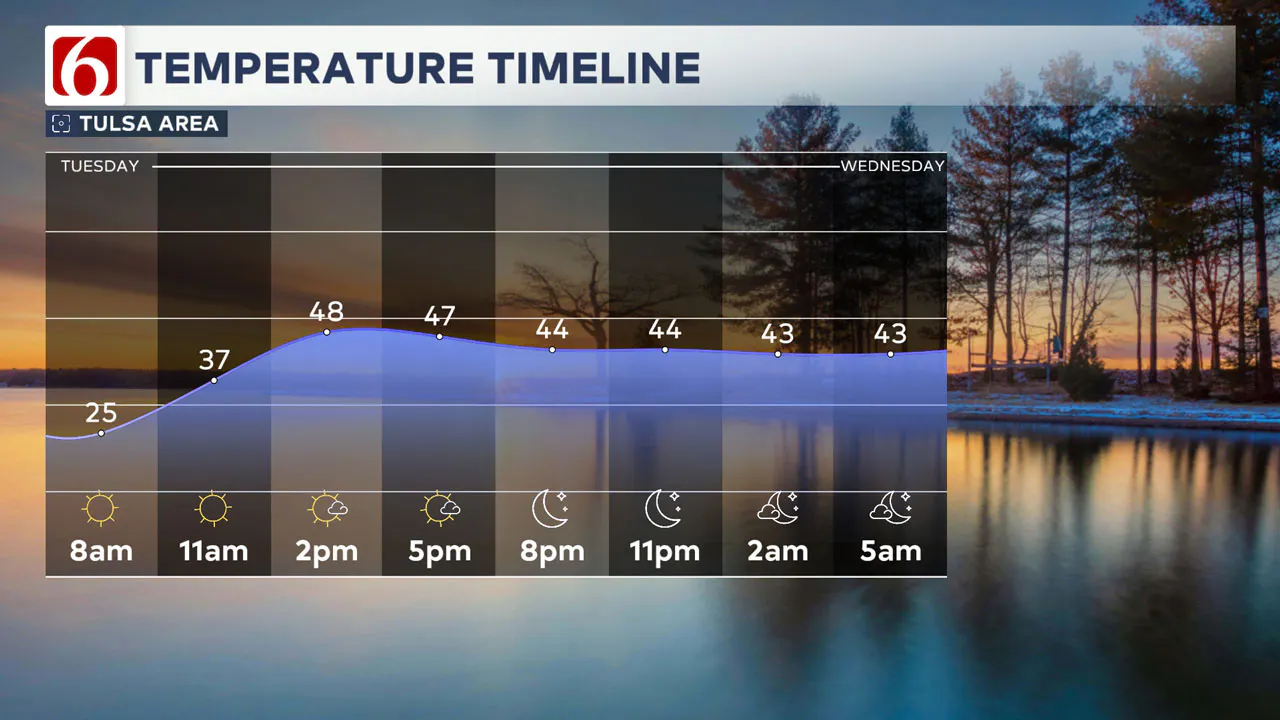
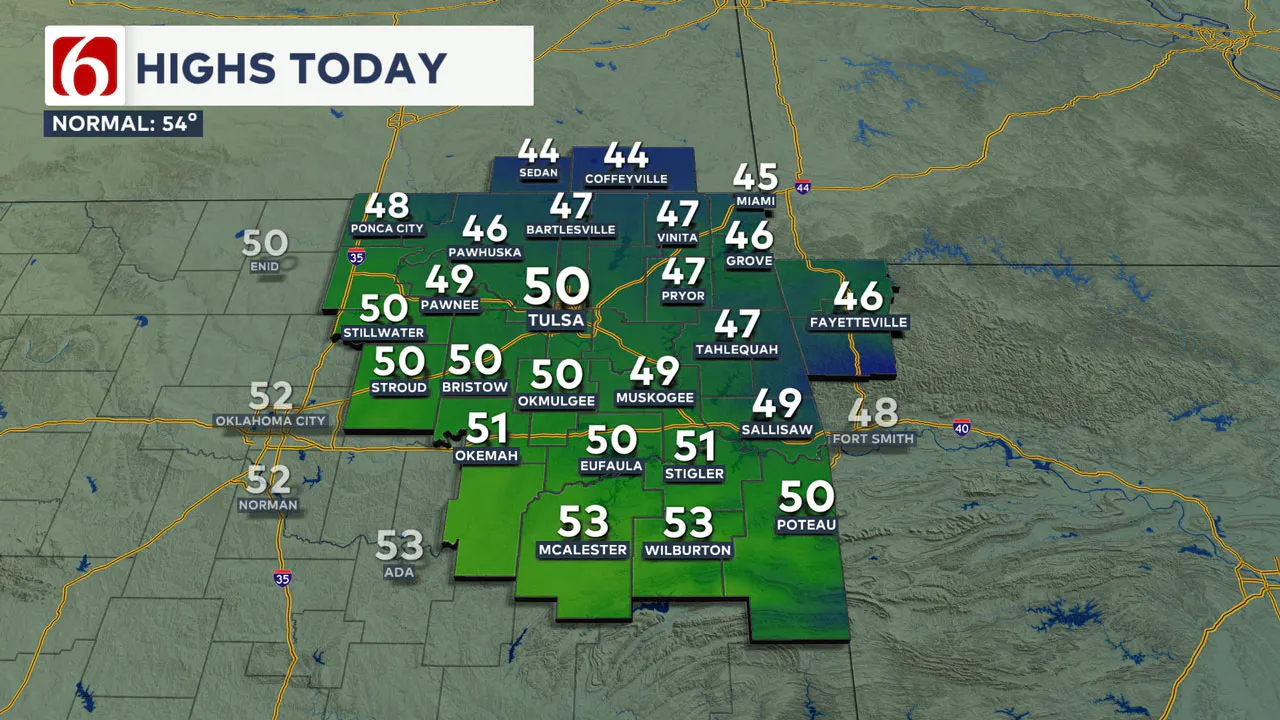
As the surface ridge moves east and our next disturbance develops to the west, south winds will return today at around 10 mph with sunshine. Afternoon highs will reach the upper 40s to lower 50s.

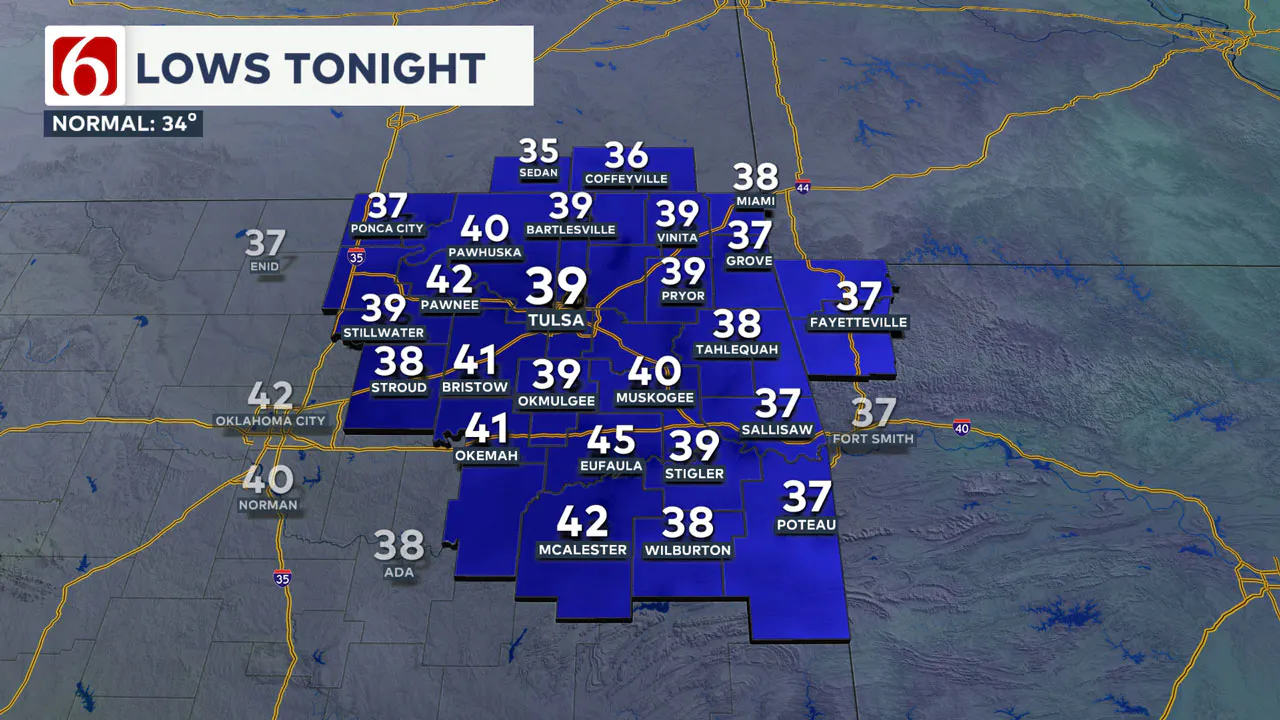
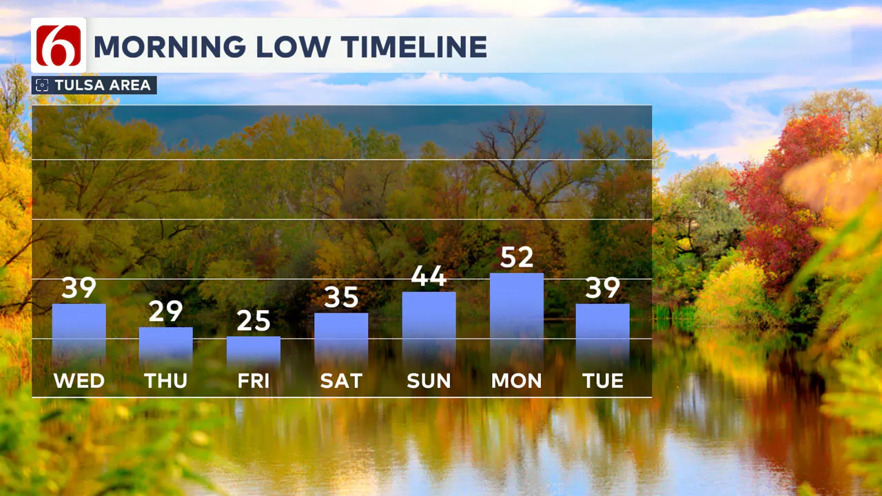
A robust warming trend will continue later tonight through Wednesday, with morning lows in the 40s on Wednesday.
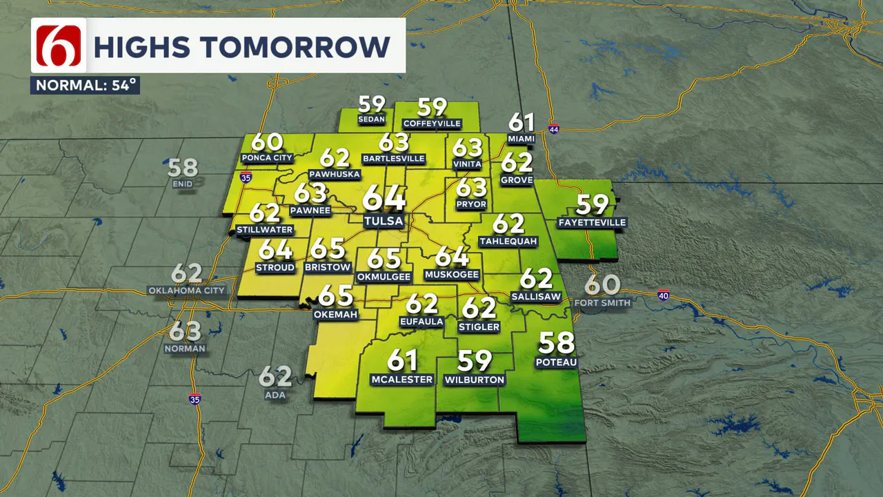
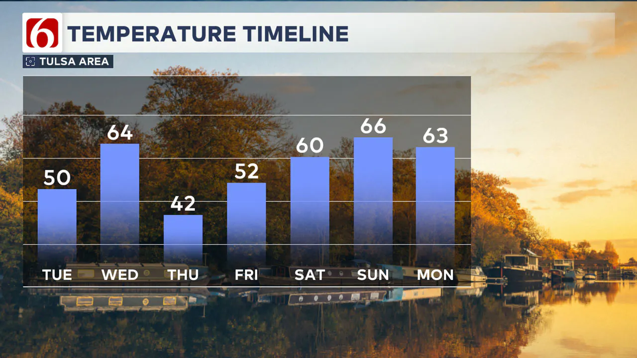
Daytime highs will approach the lower 60s with south-to-southwest winds at 10 to 20 mph.
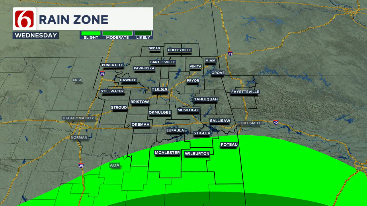
A weak system in the southern stream will impact parts of North Texas and far southern Oklahoma, providing a low chance for a few showers in southeastern sections of the state on Wednesday. The chance for measurable precipitation along the Highway 270 corridor remains near or less than 20% with higher probabilities in the next row of counties southward. This system will stay well south of the Tulsa Metro.
As this system moves east, another cold front will approach from the north. We’ll see cold and chilly weather returning late Wednesday night into Thursday.
Thursday morning lows will be in the upper 20s and lower 30s, with daytime highs lower 40s for northern OK and the mid to upper 40s across southeastern Oklahoma.
Temperatures will moderate on Friday, with morning lows in the 30s and highs in the upper 40s and lower 50s.
The upper air pattern will bring a storm system from the southwest near our area either this weekend or early next week, resulting in shower and storm chances for portions of the region.
The data is highly inconsistent regarding this exact scenario, but the pattern suggests shower and storm chances will be possible once the cutoff low begins moving closer to our area.
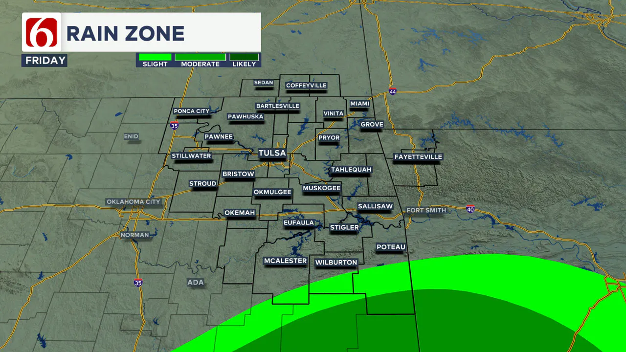
While some changes to the weekend forecast are possible, our probabilities for northern Oklahoma remain very low and mostly for early Monday. Before the main system ejects, It is prudent to mention that some data suggests showers and storms will be possible late Friday night and early Saturday morning along the Red River Valley.
We continue to monitor these different scenarios and will update the forecast accordingly.
Saturday morning lows will be in the mid-30s with afternoon highs reaching the upper 50s to lower 60s. Sunday morning’s lows will be in the mid to upper 30s, with daytime highs in the lower 60s.
Highs will still reach the 60s Monday midday before another strong front brings colder weather Tuesday and Wednesday.
Next week, the upper air pattern will become more favorable for storm systems to influence the state, including measurable precipitation over a larger area of the state.
Frost Flowers Delight Early Risers
Friday morning brought a rare sight in parts of Oklahoma—frostflowers. These delicate formations occur when warm soil pushes moisture through plant stems, freezing them into intricate shapes. Thanks to Sequoyah Quinton, one of our storm trackers, for sharing this unique phenomenon!

Emergency Info: Outages Across Oklahoma:
Northeast Oklahoma has various power companies and electric cooperatives, many of which have overlapping areas of coverage. Below is a link to various outage maps.
Indian Electric Cooperative (IEC) Outage Map
Oklahoma Association of Electric Cooperatives Outage Map — (Note Several Smaller Co-ops Included)
The Alan Crone morning weather podcast link from Spotify:
https://open.spotify.com/show/0dCHRWMFjs4fEPKLqTLjvy
The Alan Crone morning weather podcast link from Apple:
Follow the News On 6 Meteorologists on Facebook!

More Like This
December 3rd, 2024
December 3rd, 2024
December 3rd, 2024
Top Headlines
December 3rd, 2024
December 3rd, 2024
December 3rd, 2024
December 3rd, 2024


