Severe Storms Possible With Next System Moving Toward Oklahoma
A potent storm is brewing off to our west. This will bring the threat for damaging winds, large hail, tornadoes, and then snow for some.Thursday, November 3rd 2022, 7:14 am
OKLAHOMA CITY -
A potent storm is brewing off to our west. This will bring the threat for damaging winds, large hail, tornadoes, and then snow for some.
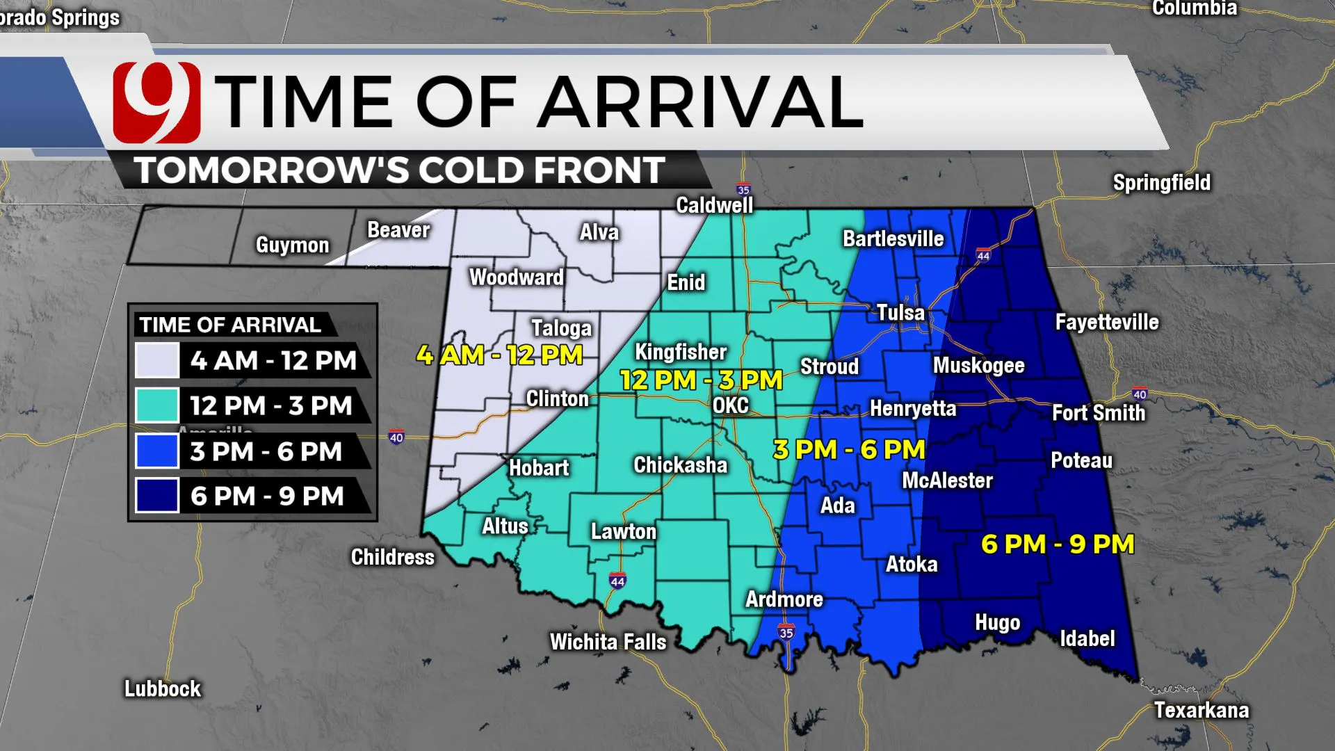
Today look for breezy conditions with highs in the 60s and low 70s, and tonight scattered showers and a few t-storms across the state. The threat for stronger severe storms goes up along the cold front in northwestern Oklahoma tomorrow morning.
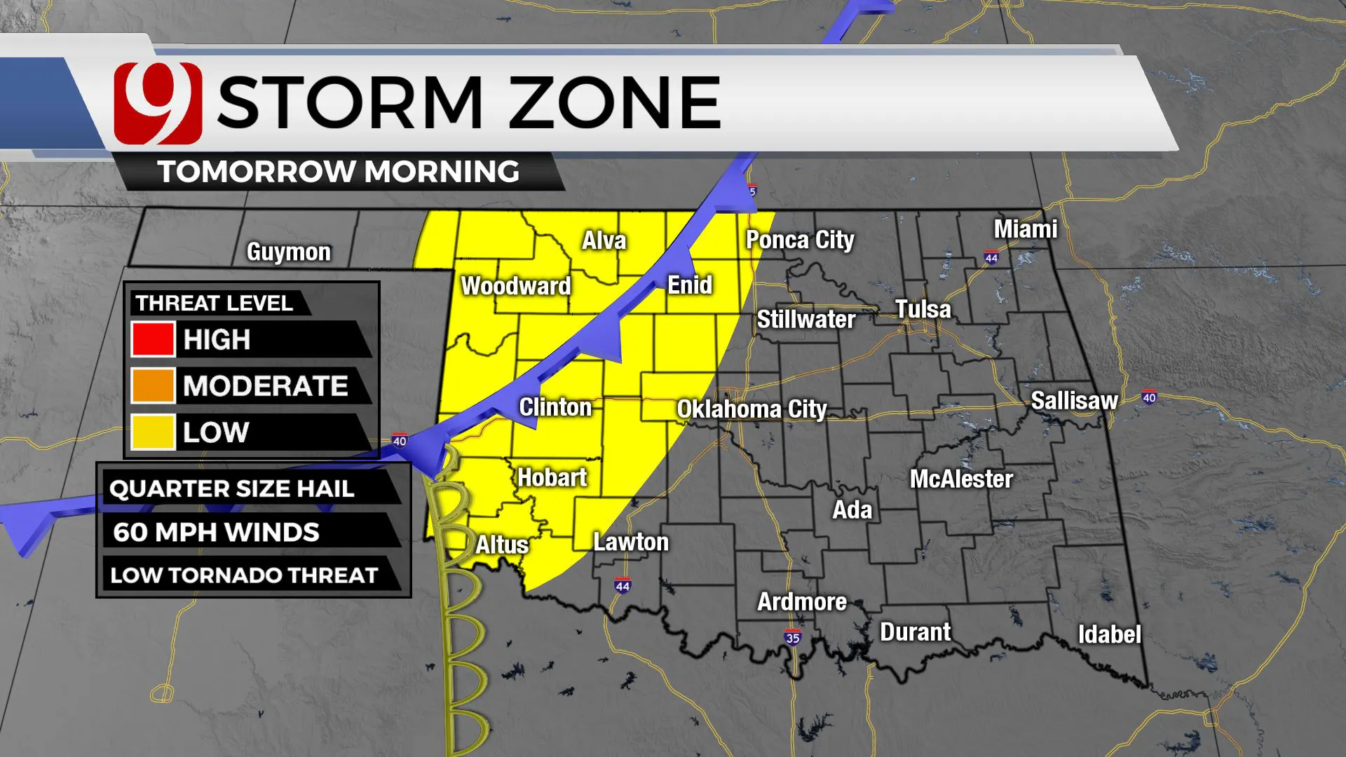
As the storms race into eastern Oklahoma, the environment will be more favorable for severe impacts. There is a moderate threat east where more numerous severe storms are possible.
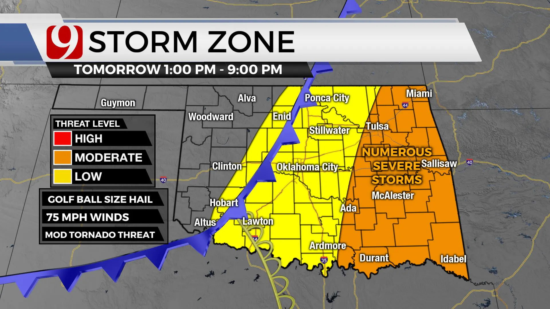
Remember, these storms could be moving at 50 to 60 mph tomorrow afternoon and will be out of the state by 10:00 p. Our trackers will be out all day and our team will keep you advised.
As the front races to the south, the storm chances go up in central and eastern Oklahoma in the afternoon and evening. There is a low threat for severe storms in central Oklahoma with damaging winds, hail, and a low tornado threat.
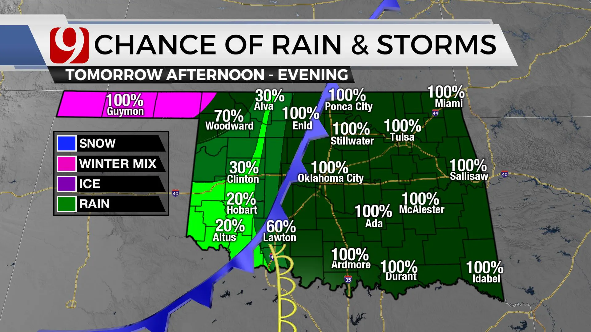
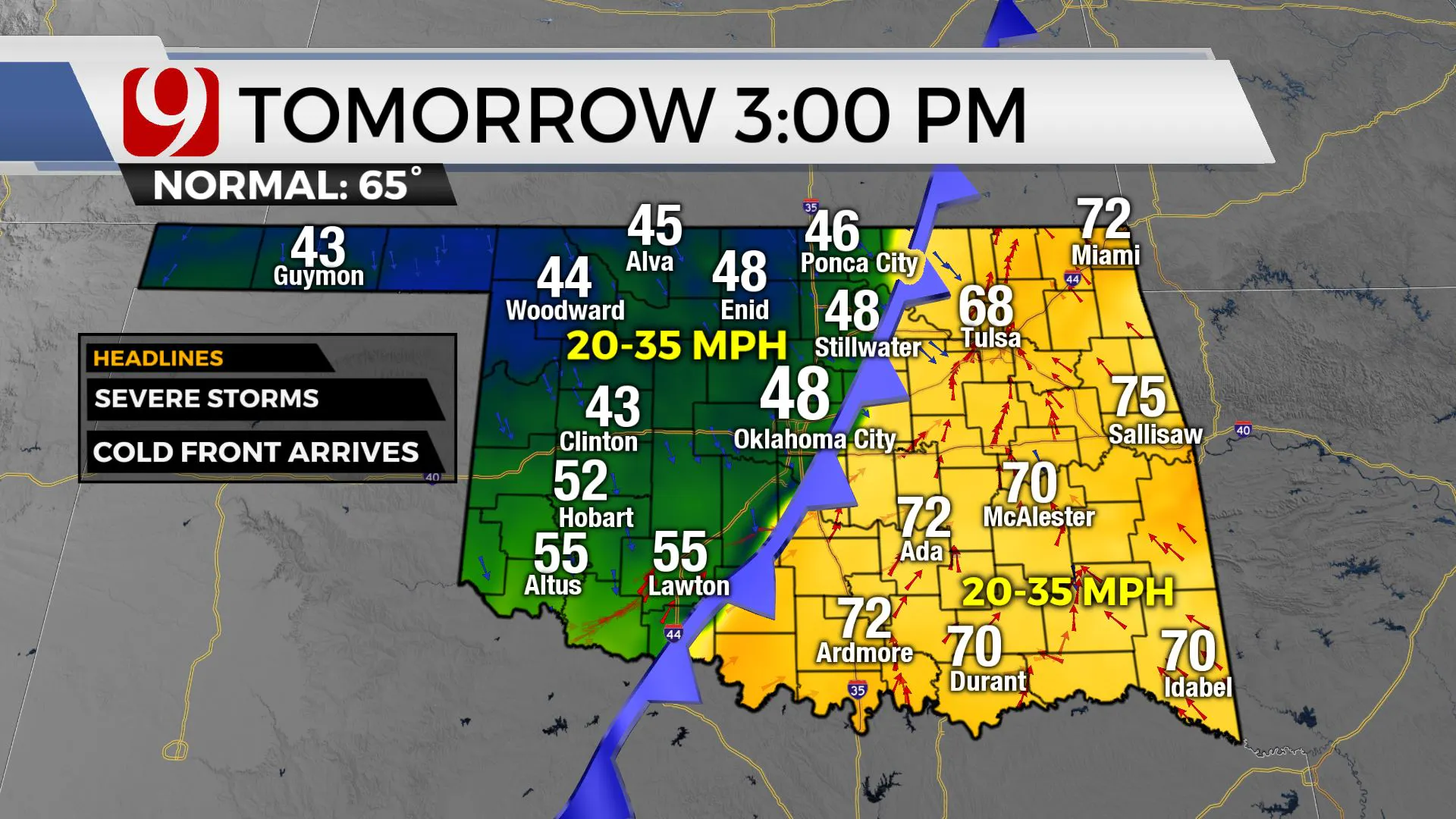
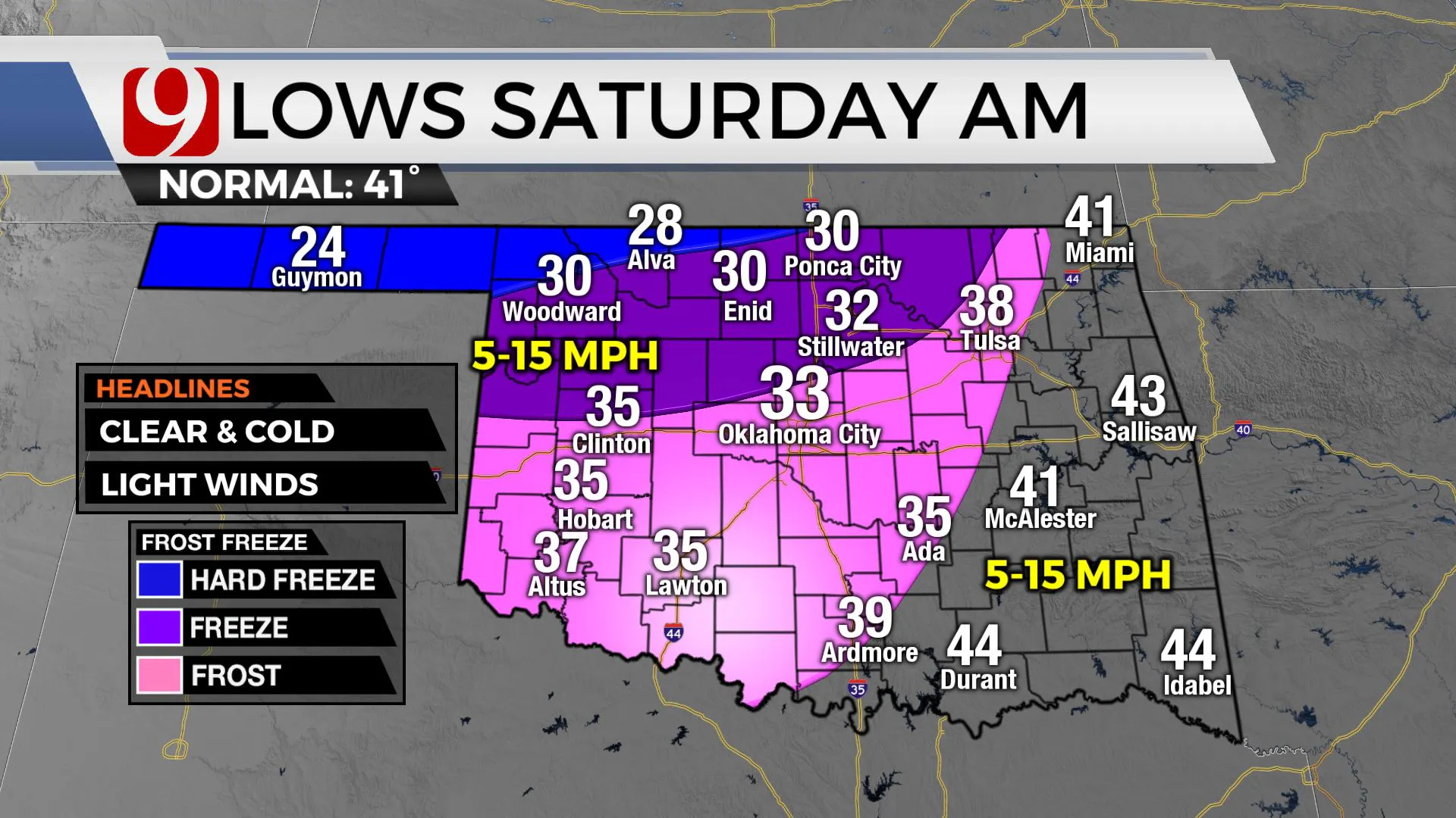
While we are tracking the severe threat along and ahead of the cold front, temperatures will plummet behind the front. Temperatures in Oklahoma City will drop into the 40s with wind chills in the 30s tomorrow afternoon. We could see snow mixing with rain in our panhandle! By Saturday morning frost and freezing conditions are expected.
More Like This
November 3rd, 2022
May 18th, 2023
Top Headlines
January 1st, 2025
January 1st, 2025
January 1st, 2025
January 1st, 2025


