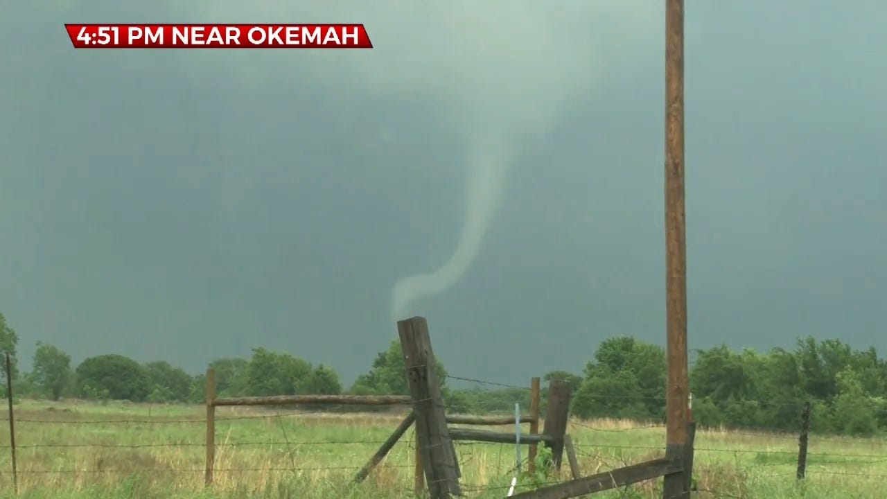
Tornadoes Touch Down East Of OKC Metro As PDS Tornado Watch Continues For SW, Central Oklahoma
A PDS (particularly dangerous situation) tornado watch has been issued for southwest, south and central Oklahoma until 10 p.m. Wednesday.Wednesday, May 22nd 2019, 6:39 am
A PDS (particularly dangerous situation) tornado watch has been issued for southwest, south and central Oklahoma until 10 p.m. Wednesday.
In the afternoon, thick gulf moisture will surge back north across much of the state.
A stationary boundary will set up across northern Oklahoma. This will be the focus area for scattered storms. With the extreme instability, the lower levels are looking favorable for rotating storms. These rotating storms will feed off of the ripe air giving the opportunity for some big severe storms.
Twin tornadoes were seen touching down in Seminole County near Cromwell by StormTrackers Von Castor and Alan Broerse.
A tornado warning was issued for a storm in Logan County into Noble and Payne counties, but it weakened without dropping a tornado into a severe thunderstorm as it went northeast.

The tornado risk will go up after 3 p.m. to around 10 p.m.

Hail is expected to get very large with the threat of it getting baseball size. Winds could gust up to 80 mph. Flooding is also likely locally, with up to an additional 3 to 4 inches possible. This threat will not be wide spread, but storm track related.

In Oklahoma City, It looks dry this morning with a chance for showers and possibly a storm developing by early afternoon. The chance for storms is about 30%. The tornado threat is currently low for the OKC Metro.
Stay with News 9, we'll keep you advised.
More Like This
May 22nd, 2019
November 13th, 2024
October 28th, 2024
October 17th, 2024
Top Headlines
February 17th, 2025
February 17th, 2025
February 17th, 2025
February 17th, 2025


