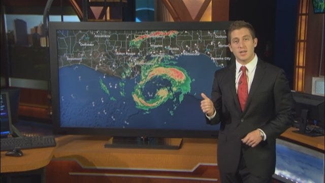
Hurricane Isaac Intensifies As It Moves Closer To Gulf Coast
Isaac continues to slowly intensify as it trudges north and west towards the coast of Louisiana.Tuesday, August 28th 2012, 4:08 pm
Isaac continues to slowly intensify as it trudges north and west towards the coast of Louisiana. As of the 1 p.m. CDT Advisory from the National Hurricane Center, Isaac is a Category One hurricane with sustained winds of 75 mph and gusts to 92 mph. The next advisory is scheduled for 4 p.m. CDT.
Hurricane force winds greater than 74 mph are already being felt just offshore of Louisiana. The Miss Canyon Oil Platform, approximately 40 miles south of the Louisiana coastline, recorded an 83 mph wind gust at 2:35 p.m. CDT.
LIVE RADAR: Track Hurricane Isaac
The outer bands of Isaac have been lashing the northern Gulf Coast all morning long with pounding rain, gusty winds and even tornado warnings for Orleans Parish – just northeast of New Orleans. Conditions are only expected to deteriorate as Isaac continues to slowly grind away at the coastline.
The true effects of Isaac are yet to be felt. Prolonged, heavy rains will tally up over a foot for southern parts of Louisiana and Mississippi – localized amounts close to 20 inches are possible. A storm surge of 6 to 12 feet is expected immediately to the east of where the eye of Isaac makes landfall, which at this present time is perilously close to the west side of New Orleans.
Current observation and analysis of Isaac indicate that it may begin to move along more of a westerly track over the next 24 for 48 hours. This will increase the likelihood of rain across central, and especially eastern Oklahoma. The track and intensity of Isaac is likely to change and be refined over the next 24 hours, as more data becomes available.
Stay with News 9, we'll keep you advised.
More Like This
August 28th, 2012
November 13th, 2024
October 28th, 2024
October 17th, 2024
Top Headlines
December 11th, 2024
December 11th, 2024
December 11th, 2024
December 11th, 2024


