Okla. To See Severe Storms Tuesday With Threat Of Wind, Hail, Tornados
Okla. To See Severe Storms Tuesday With Threat Of Wind, Hail, TornadosTuesday, April 28th 2020, 6:21 am
Severe storms will develop Tuesday afternoon and will be ongoing into the evening.
A cold front will move into northern Oklahoma in the afternoon. Along the boundary, isolated storms will develop between 2 to 5 p.m.
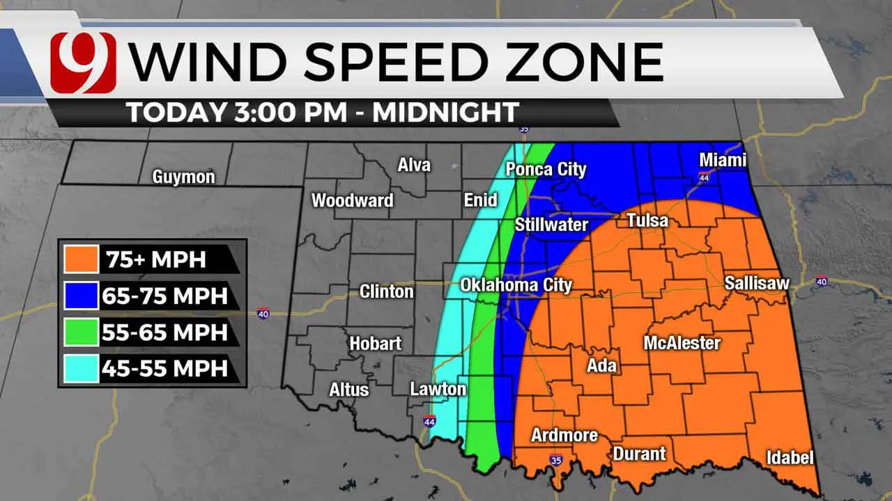
These storms will form into a line as they race to the southeast. This squall line of storms will be capable of large hail up to the size of baseballs. Winds up to 75 mph will be possible.


The timeline for the Oklahoma City Metro is 5 to 7 p.m. Not everyone in the OKC metro will see storms. The highest chance will be east of Interstate-35.

The tornado threat along the squall line will be low, but isolated spin ups will be possible.

If a storm forms ahead of the cold front, it would pose a higher tornado threat. Tuesday evening into the night the storms will quickly exit the state, and we will be quiet and cool.
Our team of trackers will be out, Jim Gardner will be in the air, and we will keep you advised.
More Like This
November 15th, 2021
September 27th, 2021
Top Headlines
January 8th, 2025
January 8th, 2025
January 8th, 2025


