Oklahoma To See Strong Winds, Extreme Wildfire Threat
Oklahoma To See Strong Winds, Extreme Wildfire ThreatTuesday, June 9th 2020, 6:20 am
Very strong winds are the story for Tuesday.
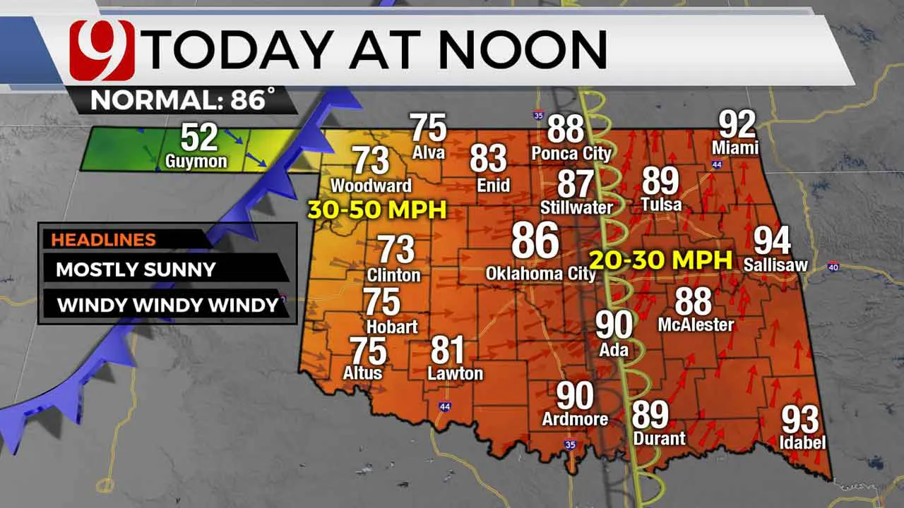
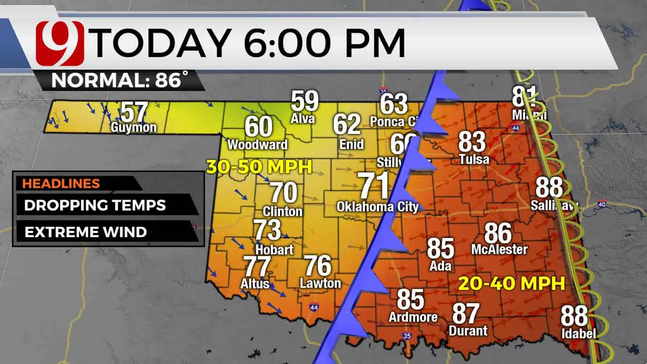
A powerful storm is moving through the southern Plains and will spark severe weather in Kansas. A dryline will march across Oklahoma followed by a cold front in the afternoon. This means temperatures will actually be cooler when people are coming home in the evening, than they are out the door this morning.


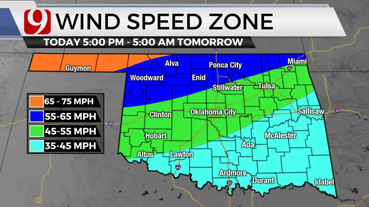
Winds will really ramp up Tuesday evening and into the night and could gust 50 to 55 mph in the Oklahoma City Metro. Winds will be even stronger in northern and northwest Oklahoma and could gusts over 65 mph at times.

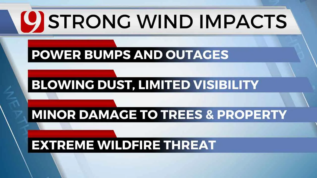
Behind the fronts, the humidity will drop like a rock. This combined with the strong winds will mean an extreme wildfire threat Tuesday. Power bumps and outages will be possible during the day and night. Blowing dust could limit visibility at times as well. Damage to trees and property will be possible.

Winds will relax through the day tomorrow.
More Like This
June 9th, 2020
January 13th, 2025
January 12th, 2025
November 19th, 2024
Top Headlines
January 15th, 2025
January 15th, 2025
January 15th, 2025
January 15th, 2025


