Hot, Humid Morning; Severe Storms Possible Overnight In OKC Metro
Tuesday will be hot and very humid to start the day. It will be the warmest morning of the summer so far in Oklahoma City.Tuesday, July 14th 2020, 7:15 am
OKLAHOMA CITY -
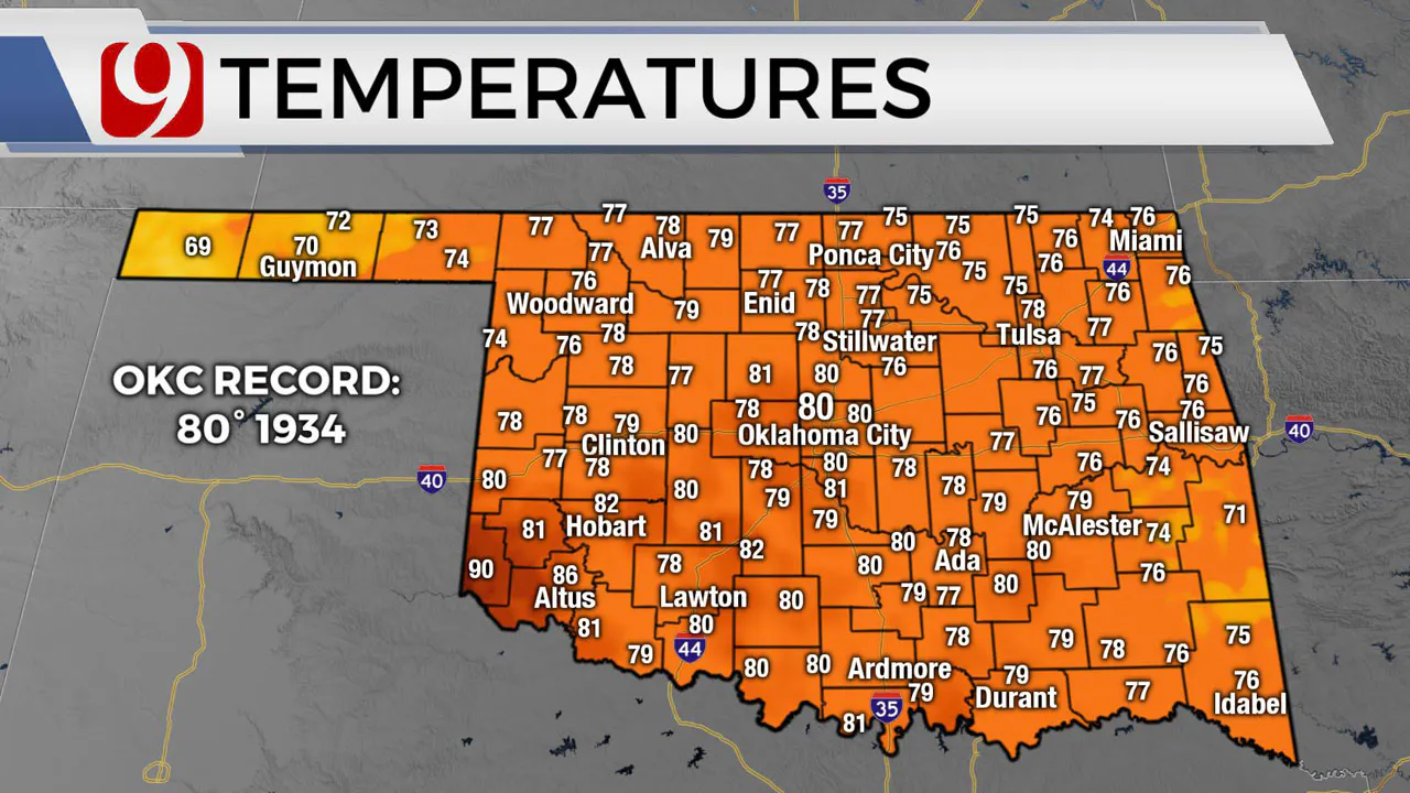
Tuesday will be hot and very humid to start the day. It will be the warmest morning of the summer so far in Oklahoma City.

Scattered showers and a few storms are possible through mid-morning, then we will dry out in the afternoon.
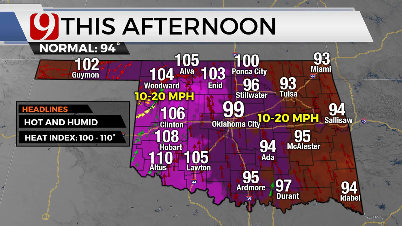
Highs will soar into the 90s and 100s later in the day. Southwest Oklahoma could see highs from 105 to 110.
The rest of the state will be very humid, so the heat index could climb up to 110.

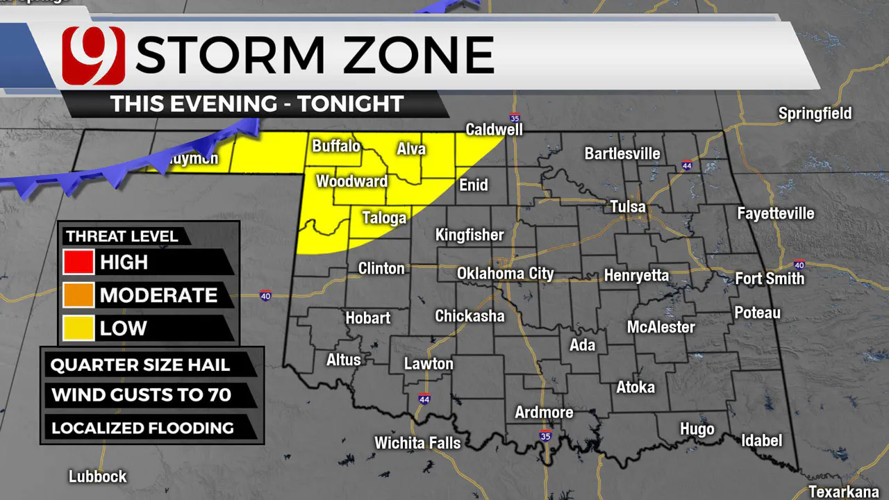
Late Tuesday evening we will be tracking a cold front moving into the panhandle. This will be the focal point of thunderstorms. These storm could be severe as they move into Northwest Oklahoma.

Trackers will be out. Hail and damaging winds will be the main concerns.
These storms could make a run at the metro overnight into Wednesday morning.
More Like This
November 19th, 2024
November 14th, 2024
November 4th, 2024
Top Headlines
December 26th, 2024
December 26th, 2024
December 26th, 2024


