Rare, Historic October Ice Storm Sets Sights On Oklahoma
A major winter storm in the middle of October has central Oklahoma on high alert for treacherous road conditions and possible widespread power outages.Monday, October 26th 2020, 5:35 pm
OKLAHOMA CITY -
A major winter storm in the middle of October has central Oklahoma on high alert for treacherous road conditions and possible widespread power outages.
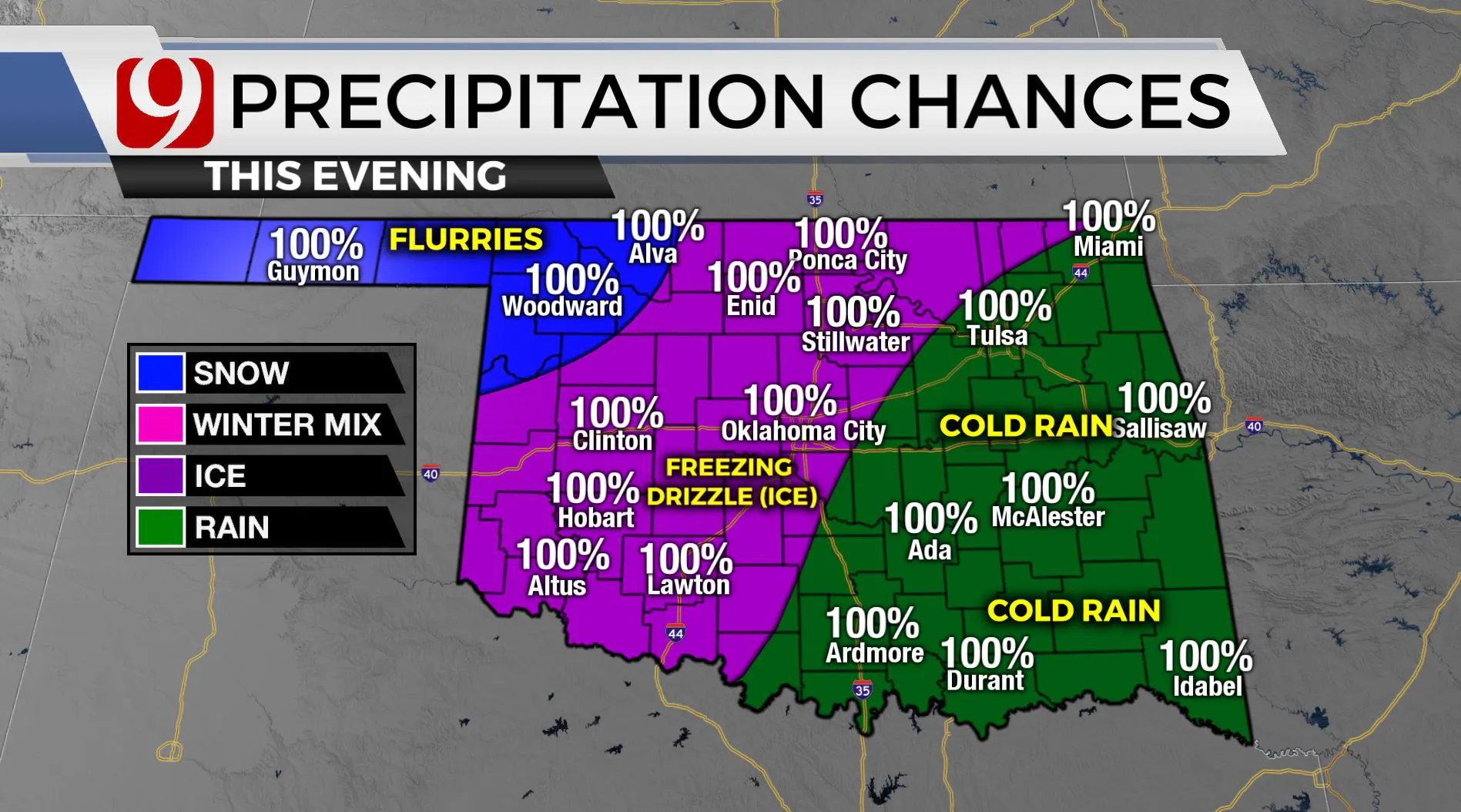
Roads in northwest Oklahoma are already considered dangerous, according to the Oklahoma Department of Public Safety, and highways and side streets in the Oklahoma City metro area are expected to deteriorate greatly overnight Monday into Tuesday, as a second round of freezing precipitation falls across the state. Current models indicate that the precipitation will mostly be in the form of freezing rain, which could be particularly bad for power outages. As of 10 p.m. Monday, more than 74,300 OG&E customers are without power, according to the utility's System Watch application. Another 18,500-plus electric cooperative members are without power Monday night.
According to News 9 Chief Meteorologist David Payne, a band of Oklahoma from just east of Oklahoma City to just southeast of Woodward is certain to see more freezing rain or sleet Monday night.

If what falls happens to be more sleet than freezing rain, it could mean worsened road conditions but perhaps a reprieve on the number of power outages seen across the state. Regardless, this is expected to be an historic ice storm, particularly considering it comes at the tail end of October and not November, December or January.
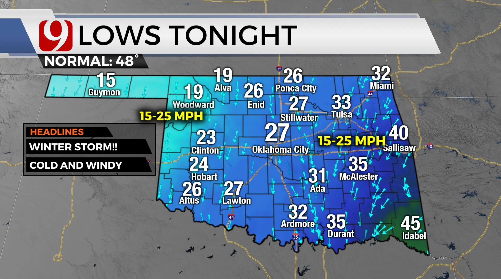
Speaking of road conditions, the lows across central Oklahoma Monday night will get down to about 27, five degrees below freezing. Anything that's wet as of sundown won't be melting any time soon. This makes travel especially dangerous. Bridges and overpasses freeze first.

Far northwestern Oklahoma and the Panhandle will dip below 20 degrees Monday night and see snow flurries.
The heaviest precipitation -- a second round of it -- will fall overnight into the wee hours of Tuesday morning. News 9 This Morning will be tracking everything from school closings to road conditions and power outages starting at 4 a.m.
If you need to get out and drive, and you're in the Oklahoma City area, be sure and give this snow routes map a close look.
More Like This
October 26th, 2020
November 19th, 2024
November 14th, 2024
November 4th, 2024
Top Headlines
January 8th, 2025
January 8th, 2025
January 7th, 2025


