Warm Highs Ahead of Expected Thunderstorms And Snow
A wild forecast is expected for the week, as we will likely see thunderstorms and snow in the state at the same time later this week.Monday, February 14th 2022, 6:23 am
A wild forecast is expected for the week, as we will likely see thunderstorms and snow in the state at the same time later this week.
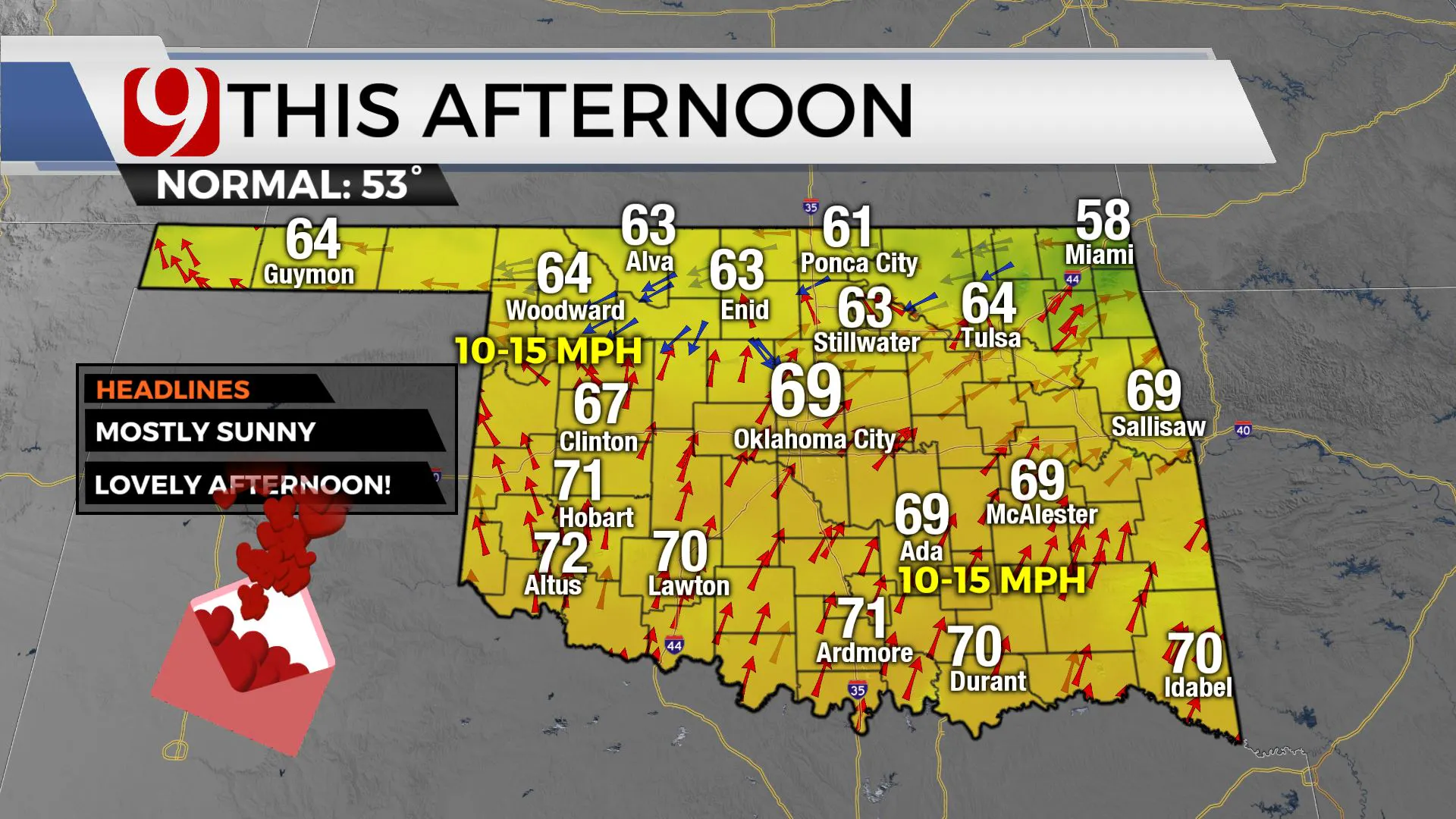
For now, Monday is looking lovely as we'll see highs in the 60s and 70s with sunny skies.
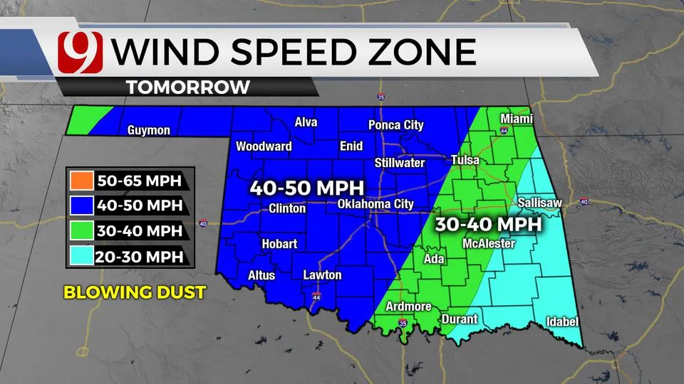
Please be very careful on Tuesday, because fire danger will be high to extreme. Very strong winds and low humidity are expected ahead of our upper level storm.
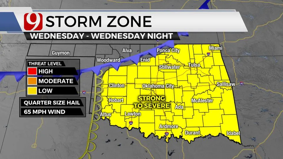
On Wednesday afternoon, scattered showers in eastern parts of the state while a dryline and cold front moves in out west.
Look for storms developing in the evening and lasting into the overnight. A few strong to severe storms will be possible.
As of right now, the threats look to be winds up to 60 mph and quarter-size hail.
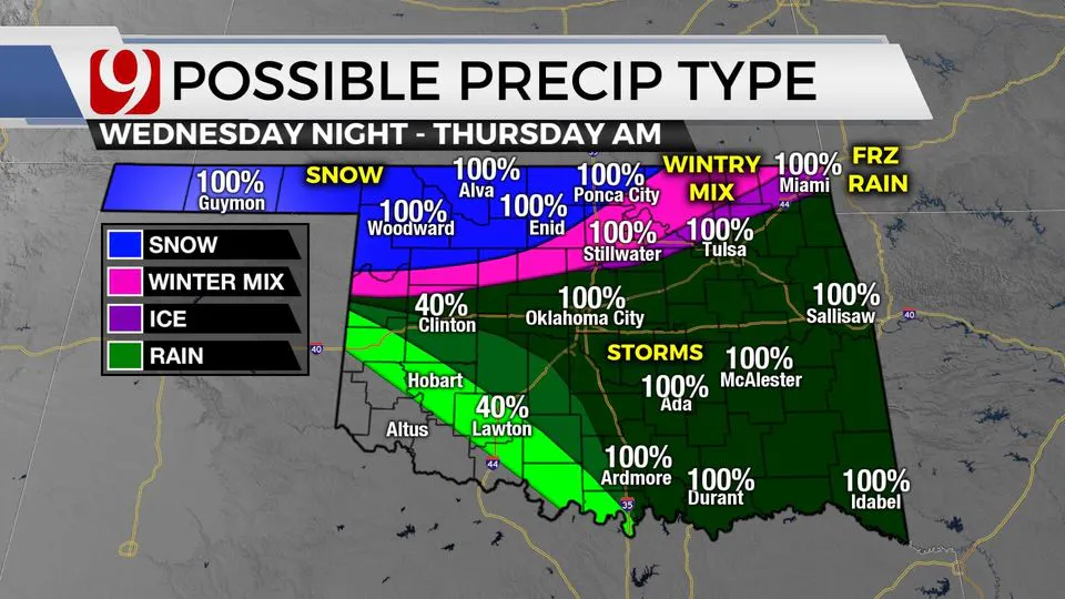
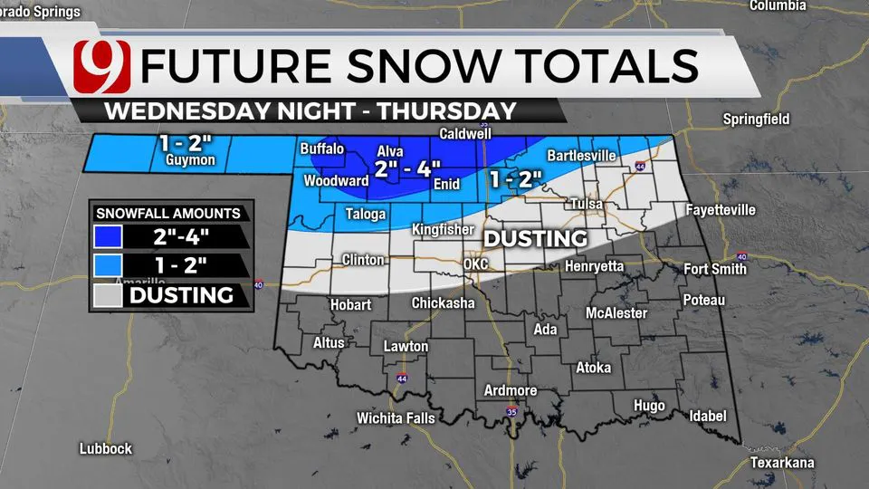
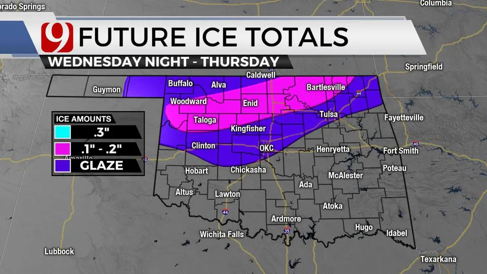
While the storms are moving across the state Wednesday night, freezing rain, sleet and snow will develop in the northwest.
We will have trackers in storms and trackers in the wintry weather.
For Thursday, look for a changeover to sleet and snow.
Ground temps will be warm and it will take a while for them to cool.
The highest winter weather impacts will be in northern and northwest OK.
For OKC, we could see up to 1 inch of rain and then a trace of snow.
Keep in mind, this system is still several days away.
The Oklahoma Weather Experts at News 9 will keep updating the zones over the coming days.
More Like This
February 14th, 2022
November 19th, 2024
November 14th, 2024
November 4th, 2024
Top Headlines
December 25th, 2024
December 25th, 2024
December 25th, 2024


