Warm Temperatures And Strong Winds, Storms On The Way
A potent system is pushing onto the Pacific coast Monday morning. This will ramp up the winds across Oklahoma!Monday, March 28th 2022, 6:54 am
A potent system is pushing onto the Pacific coast Monday morning.
This will ramp up the winds across Oklahoma!
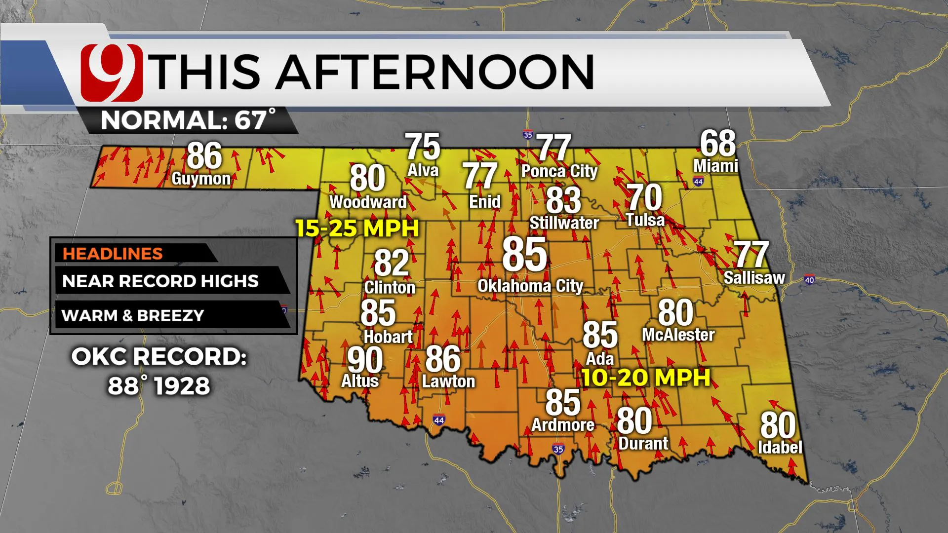
Monday highs will be in the 80s with winds 15 to 25 mph.
Monday night lows will be in the 60s with south winds 20-45 mph.
Tuesday will be warm again with very windy conditions and south winds of 30-45 mph.
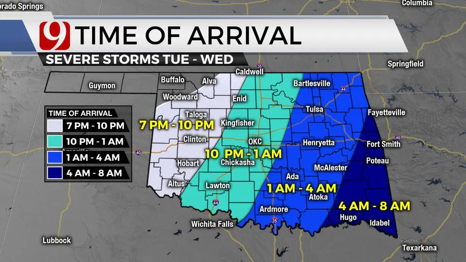
On Tuesday evening after 7:00 p.m., storms fire in western Oklahoma.
These will be isolated at first and will eventually develop into a squall line.
This line of storms will march across the state into the overnight hours.
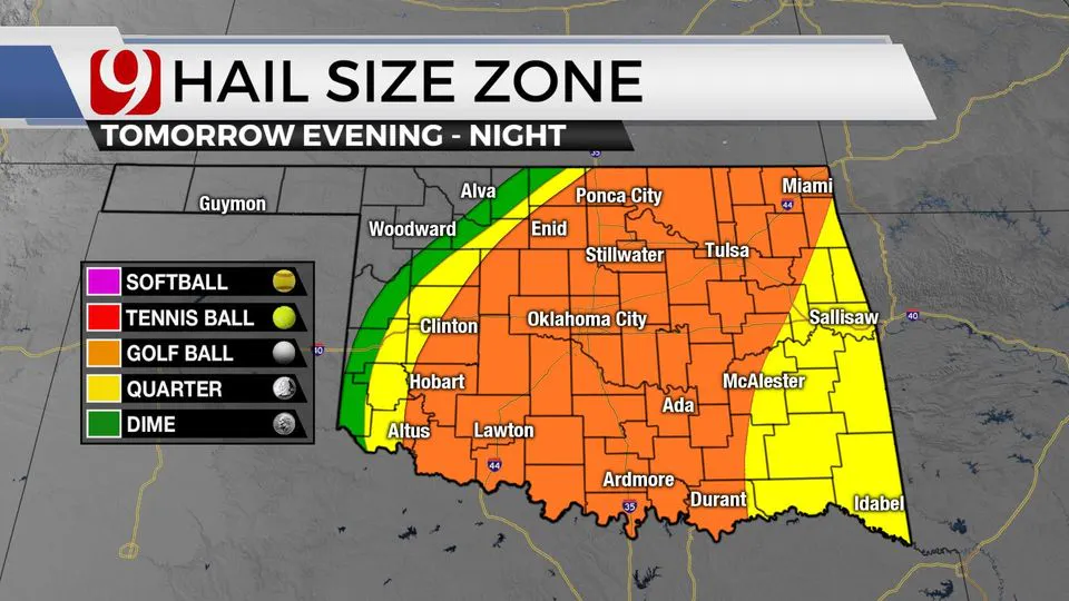
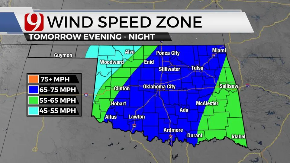
The threats along the line will be large hail up to the size of golf balls with wind gusts up to 75 mph.
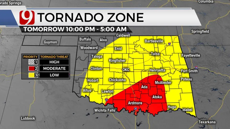
There will be a low tornado threat as well.
After the sun sets, low-level winds will be favorable for areas of spin along the line.
This can cause short fuse tornadoes to develop.
These types of tornadoes are usually weak and don't last very long.
Our team of trackers will be tracking the line from its development to eastern Oklahoma.
More Like This
March 28th, 2022
January 13th, 2025
January 12th, 2025
November 19th, 2024
Top Headlines
January 15th, 2025
January 15th, 2025
January 15th, 2025
January 14th, 2025


