Wintry Weather Issues Return
Winter weather returns to Green Country on Monday.Monday, January 30th 2023, 6:31 am
If you’re into podcasts or in a rush, check out my daily weather update. Search for NewsOn6 and ‘Weather Out The Door’ on most podcast providers, including Spotify, Stitcher and Tune-In, or Click Here to listen on Apple Podcasts.
TULSA, Okla. - Winter weather returns to Green Country on Monday.
Here are the details from News On 6 Meteorologist Alan Crone:
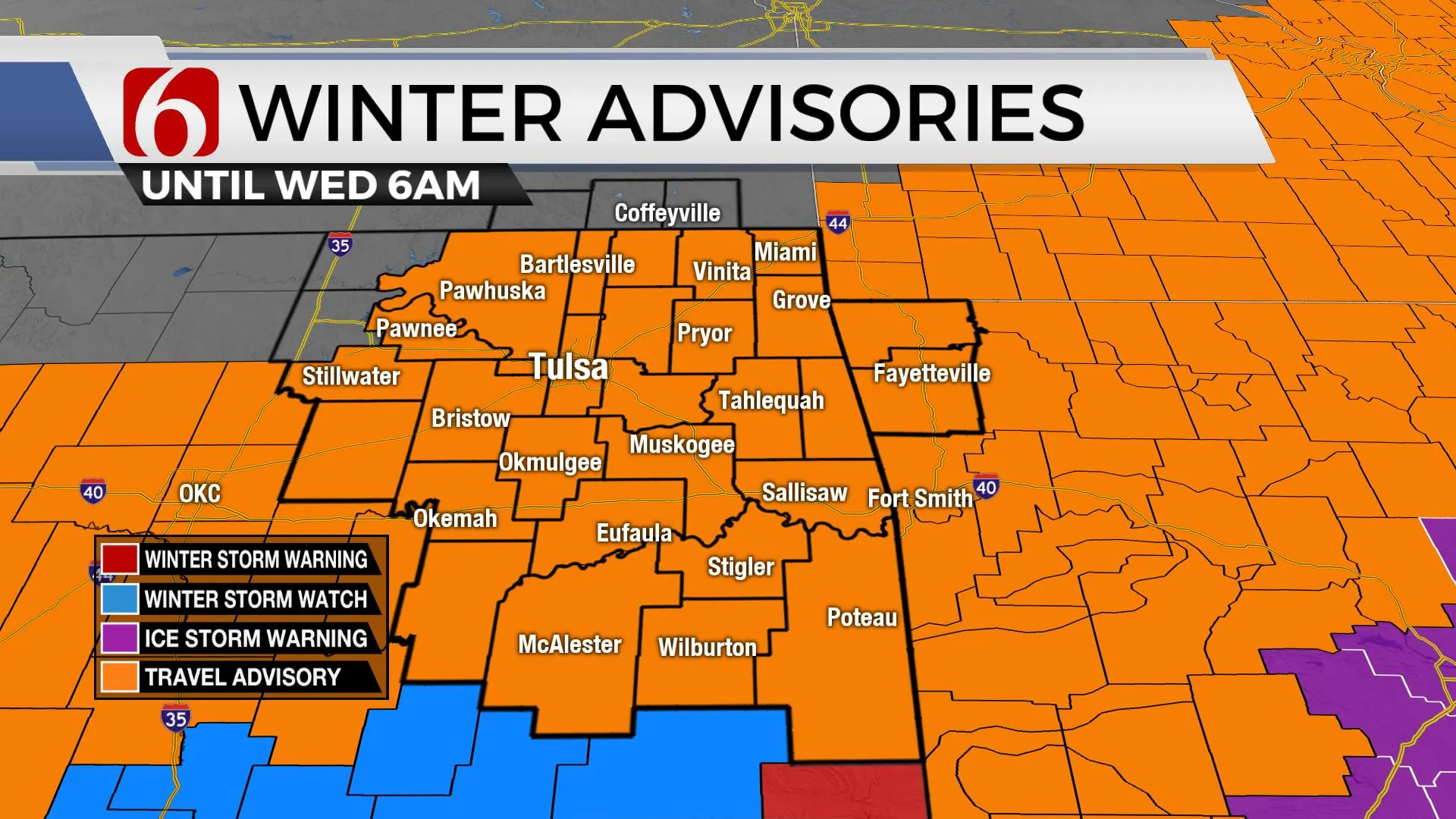
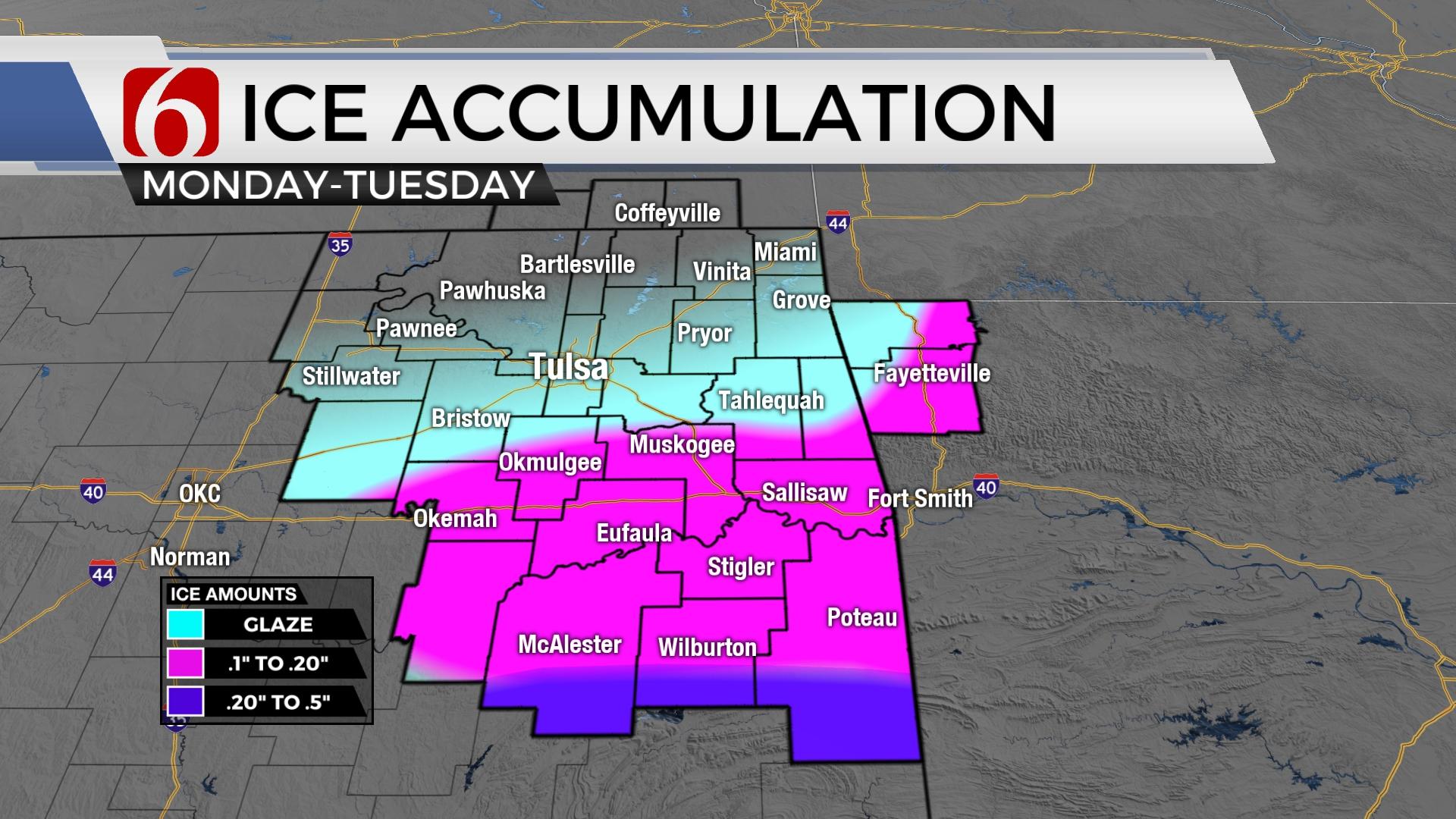
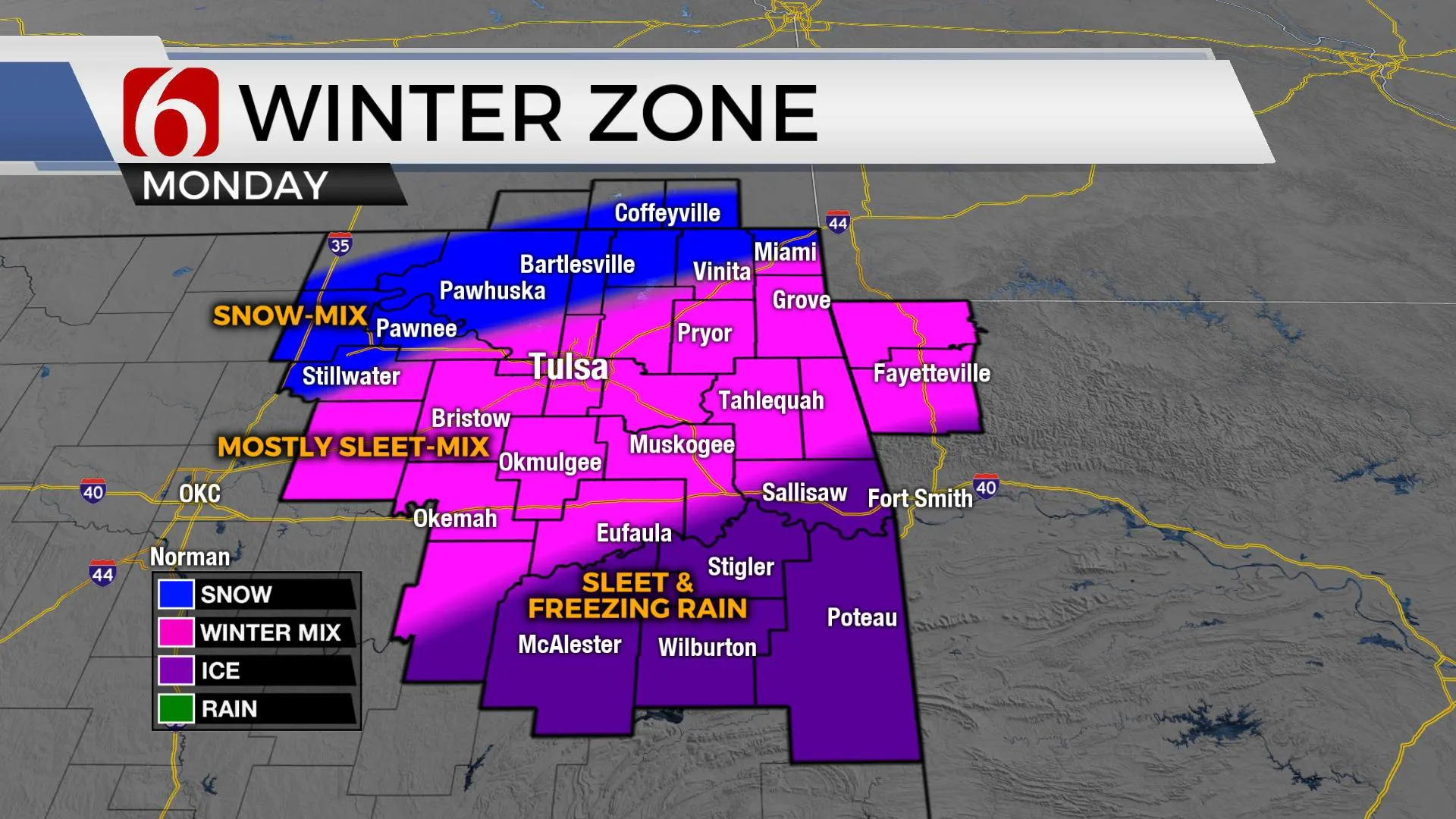
The shallow arctic air will remain entrenched across the state through at least Wednesday before attempting to modify Thursday into the weekend. This pattern will bring several waves of wintry precipitation across the area resulting in highly varied types of wintry precipitation depending upon your exact location. A general overview supports more sleet and snow across the northern sections with a mixture of sleet and freezing rain across the southern areas. The deepest cold air will support snow and sleet, with the shallowest air supporting freezing rain. As of this morning, higher chances for more impactful freezing rain chances will remain south of I-40 with higher chances along the Red River Valley into north central Texas. Most data currently place this slightly south of the McAlester region. Regardless, I'll encourage you to remain alert to rapidly changing winter weather conditions as several disturbances move across the area. Even freezing drizzle can cause extremely dangerous travel conditions in these patterns.
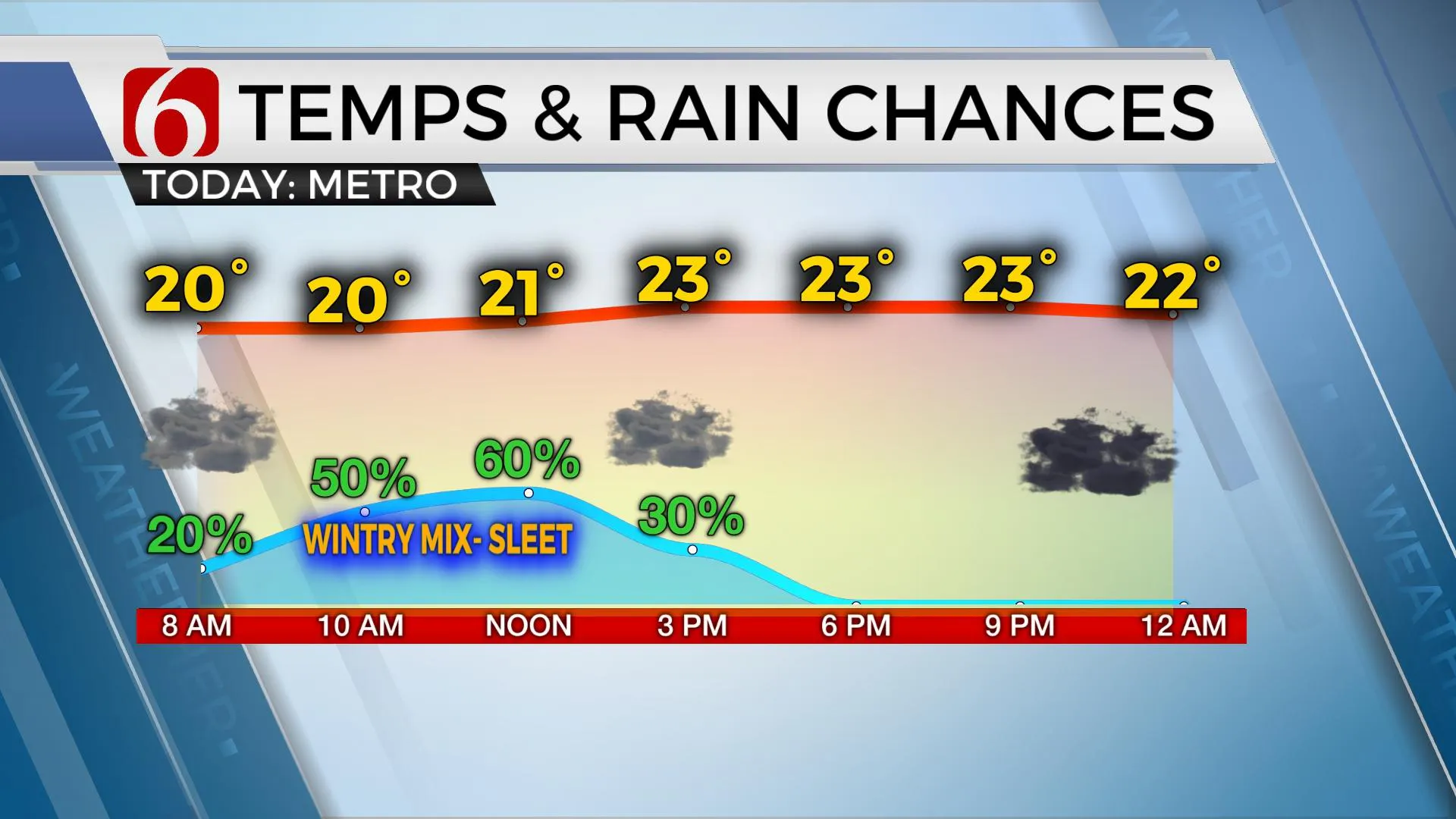
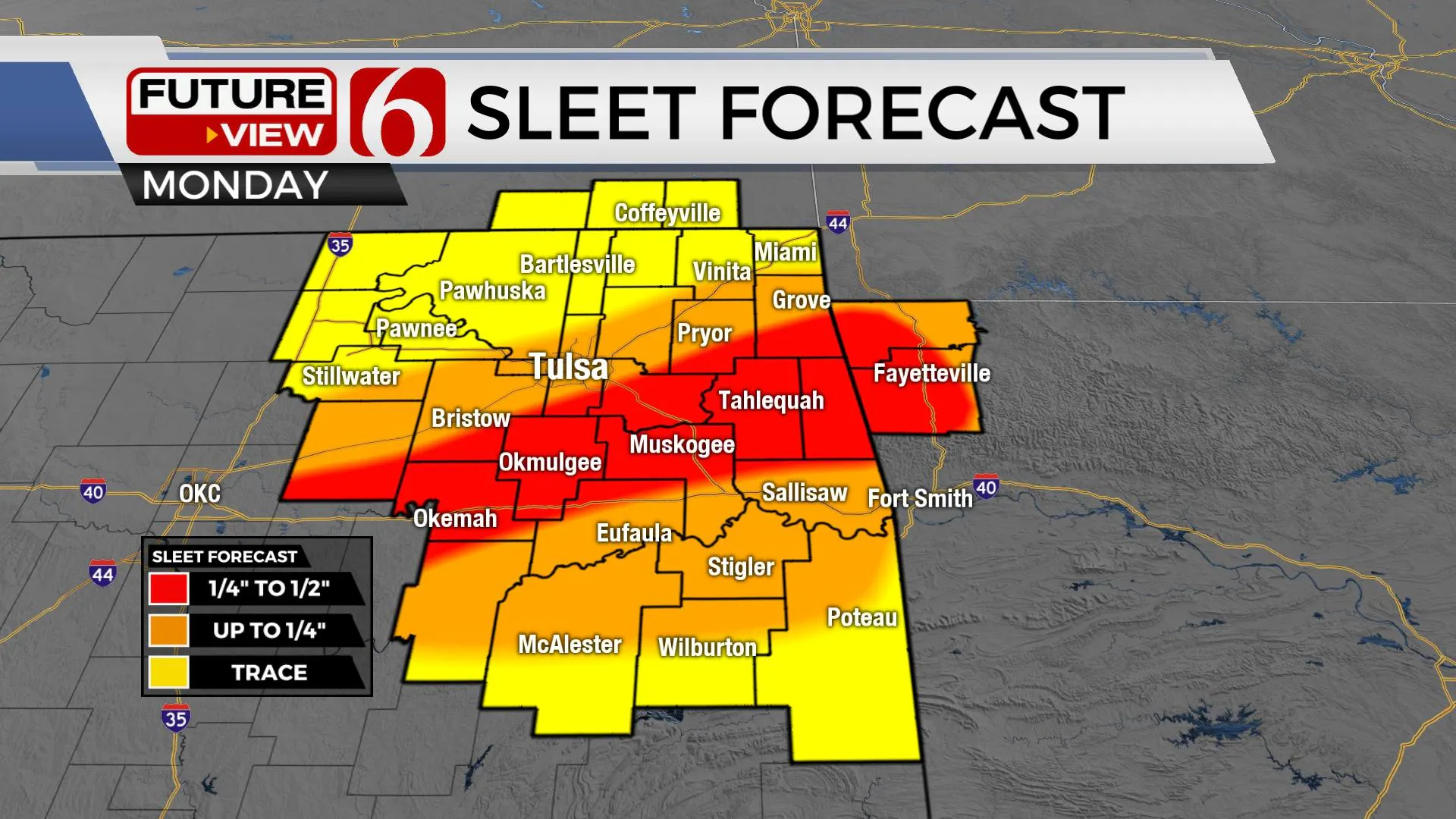
The main upper-level trough will remain positioned to our west early this week with several waves of instability traveling around the base of this feature and up and over the shallow cold air. One wave arrives early this morning through midday bringing some sleet and freezing rain. The bulk of this precip shield will be near and south and east of Tulsa. The metro will be included in this chance of wintry mix-sleet for the morning to midday. Elevated instability may also support some thunder which would enhance precipitation rates. Any areas receiving thunder sleet could see a local uptick in accumulation between ¼ to ½ of sleet. Higher likelihood will remain near and south of the metro, to along both sides of I-40 from east-central OK into Northwestern Arkansas. This first wave should exit around midday to early afternoon.
The second wave is likely to arrive early Tuesday morning through the afternoon from the southwest with a slightly more robust precipitation rate. This should result in higher freezing rain totals across the far southern sections and a sleet-snow across part of northern OK. This will create an extremely challenging precip-type forecast as snowfall, sleet, and ice ratios are highly different.
The third wave is expected Wednesday into early Thursday as the main upper-level low begins ejecting northeast. The bulk of this wave may stay slightly south along the southern third of the state. Friday into the weekend features a return of highs in the mid to upper 40s or lower 50s. Saturday morning starts near freezing before reaching the mid to upper 50s into Sunday as well.
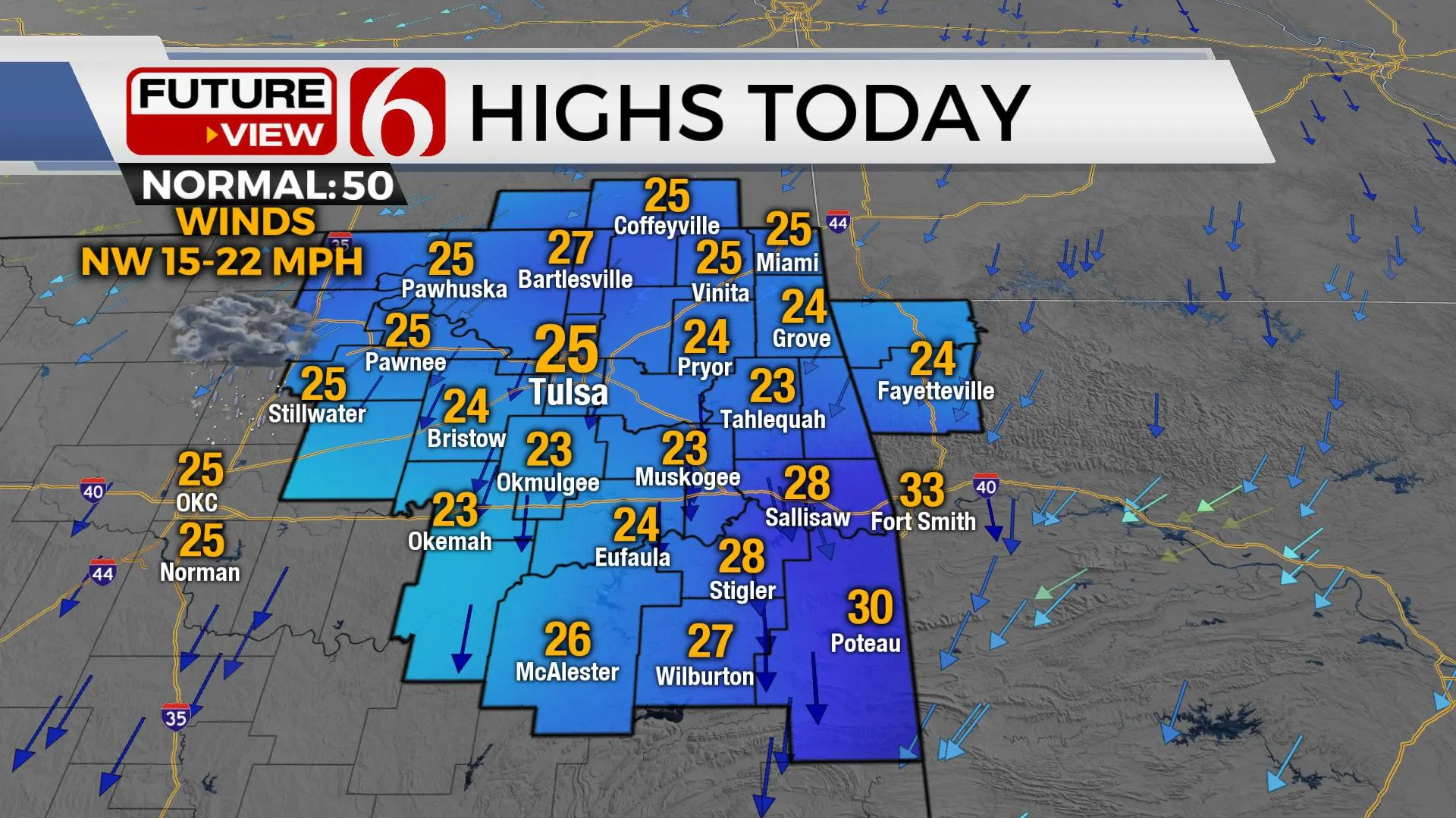
Before we arrive to the end of the week, very cold weather will remain. Highs today will stay in the mid-20s. Tuesday morning starts in the teens and lower 20s with highs also in the upper 20s. Wednesday morning lows are projected in the lower 20s with afternoon highs slightly above freezing. Thursday starts at 28 and ends with highs in the mid-40s.
Please remain aware of your weather surroundings for the next few days. Slick and hazardous travel is likely at times, but it may not be the same magnitude in every location.
Thanks for reading the Monday morning weather discussion and blog.
Have a super great yet safe day.
Alan Crone
KOTV
More Like This
January 30th, 2023
April 24th, 2025
April 24th, 2025
April 24th, 2025
Top Headlines
April 24th, 2025
April 24th, 2025


