Severe Weather Threats Returning Soon
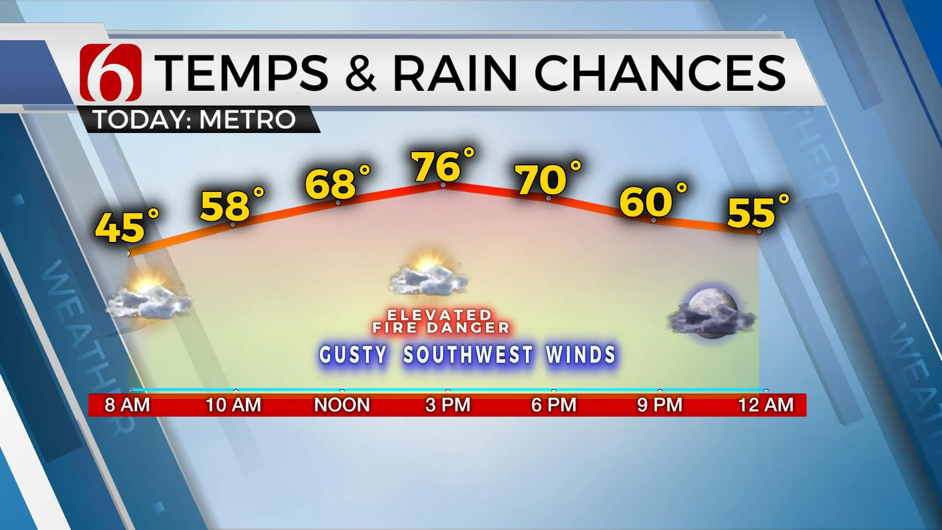
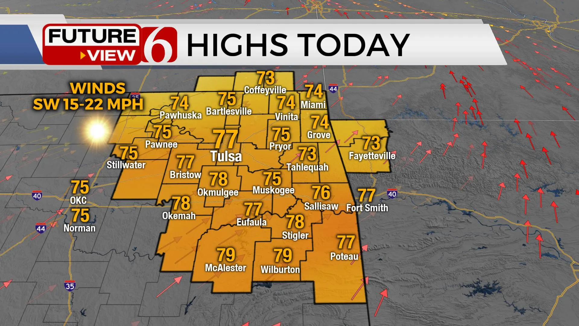
Warm weather sticks around on Tuesday, but storm chances could soon return to Green Country.Tuesday, February 28th 2023, 6:35 am
If you’re into podcasts or in a rush, check out my daily weather update. Search for NewsOn6 and ‘Weather Out The Door’ on most podcast providers, including Spotify, Stitcher and Tune-In, or Click Here to listen on Apple Podcasts.
TULSA, Okla. - Warm weather sticks around on Tuesday, but storm chances could soon return to Green Country.
Here are the details from News On 6 Meteorologist Alan Crone:
The next strong storm system will approach the state Thursday bringing increasing shower and storm chances across the region. A window for severe weather exists Thursday evening across the south and eastern quadrants of the state with the possibility of some rain mixing with snowflakes Friday morning across the far northern sections. Colder air briefly filters into the northeastern sections Friday as the main upper-level system exits the area. Improving weather is likely this weekend.
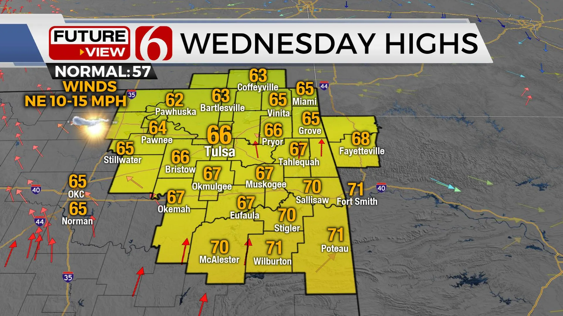
The next powerful upper-level low, currently located across northern California, will take a dive southeast and arrive along the Red River Valley Thursday. Before this arrives, a weak boundary crosses the state Wednesday morning bringing north winds across most of the area. Moisture convergence and some upper-level support arriving from the southwest will produce a few scattered storms Wednesday across far southeastern OK, where a few isolated strong to severe storms will be possible.
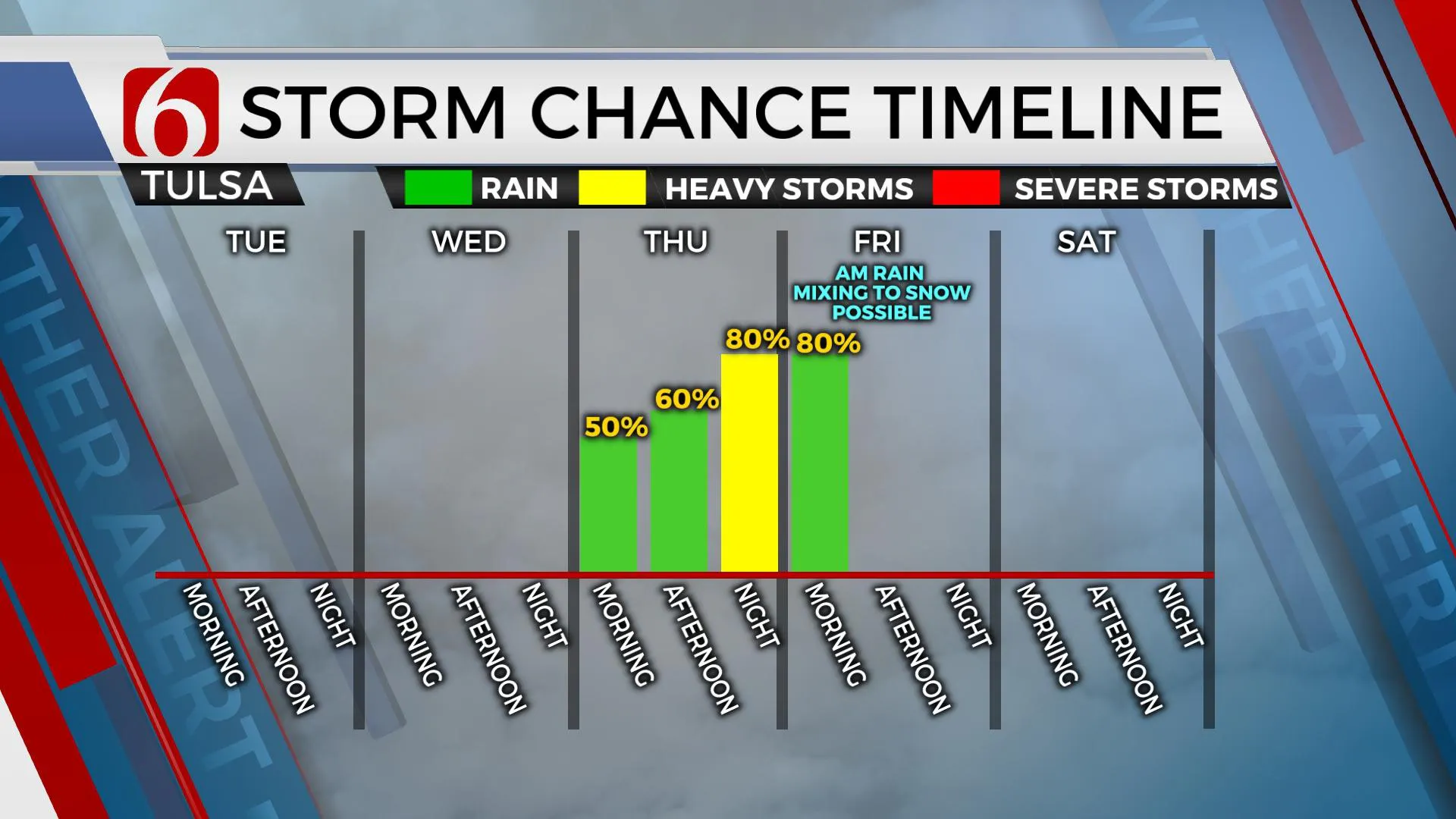
As the main upper-level trough nears the state, the boundary will lift northwest Thursday bringing low-level moisture and warmer weather into at least the southeastern quadrant of Oklahoma. Locations north, including the Tulsa metro, will stay on the cool side of the boundary, with northeast winds and highs in the upper 50s near 60 Thursday. Warmer weather and higher moisture content is expected across the southern half of the region with highs in the 70s. As the stronger winds aloft approach the Red River Thursday afternoon, thunderstorms will attempt to develop along the Red River Valley and become strong and severe. Most of the severe threats will remain slightly south of the Tulsa metro, but some locations along I-40 and east of I-35 will have a window for some significant severe storms. All modes of severe weather will be possible. The timing and location of the highest severe weather threats may still change some over the next day or so. We’ll encourage you to remain aware of the latest severe weather risk assessment for Thursday and Thursday night.
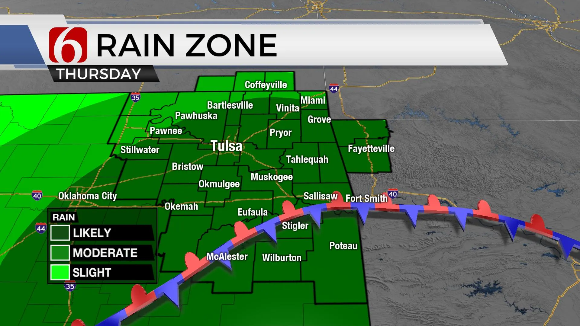
As the upper-level system turns northeast and ejects across the Mid-Missouri valley, colder air aloft may change some rain early Friday morning into a rain-slow mix with little to no accumulation across far northeastern OK. Strong north winds combined with temps in the 30s will produce wind chills in the teens and upper 20s. Precipitation will quickly leave Friday morning with afternoon highs reaching the upper 40s and lower 50s. The weekend appears pleasant with highs in the 50s Saturday and 60s Sunday.
Thanks for reading the Tuesday morning weather discussion and blog.
Have a super great day!
Alan Crone
KOTV
More Like This
February 28th, 2023
January 1st, 2025
January 1st, 2025
January 1st, 2025
Top Headlines
January 1st, 2025
January 1st, 2025
January 1st, 2025
January 1st, 2025


