Mild Temps Followed By Another Threat For Severe Weather
Another beautiful day across Oklahoma! The wind will ramp up today and that will increase the fire danger. Look for sunny skies and highs in the 70s.Tuesday, February 28th 2023, 7:00 am
OKLAHOMA CITY -
Another beautiful day across Oklahoma! The wind will ramp up today and that will increase the fire danger. Look for sunny skies and highs in the 70s.
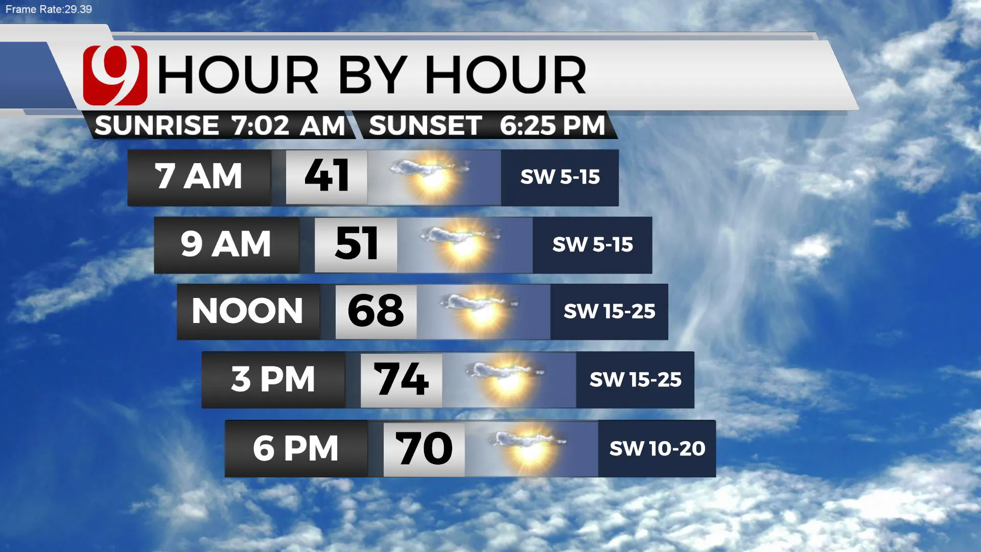
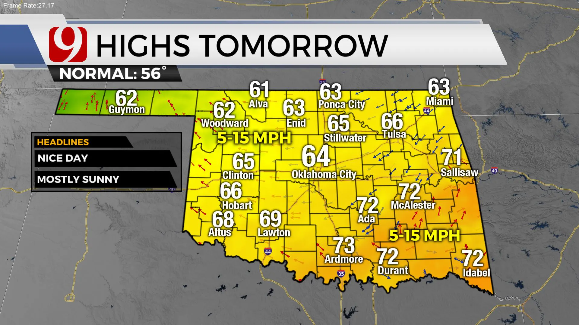
Tonight lows will dip into the 30s and 40s. A cold front arrives tonight and it will be a little cooler tomorrow. Look for 60s.
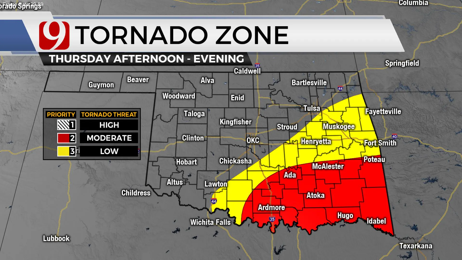
Thursday our next upper-level storm arrives. This brings another spring-like setup. Gulf moisture/instability rushes back and the jetstream winds will be racing overhead.
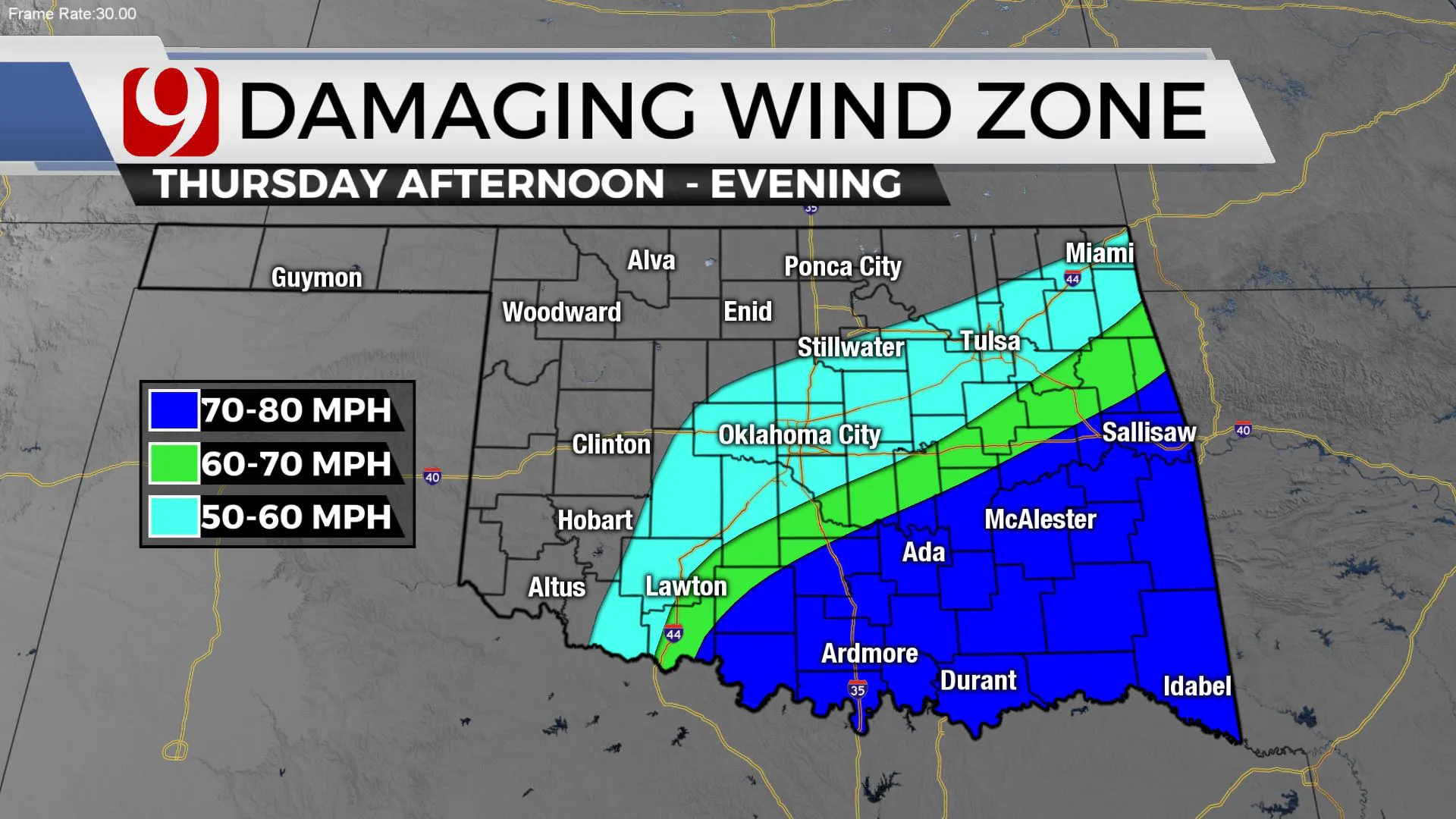
This morning there is still some questions about how far north the severe threat will extend. Some data keeps a north wind around in the Oklahoma City metro, this mean no severe weather in central Oklahoma. Staytuned.
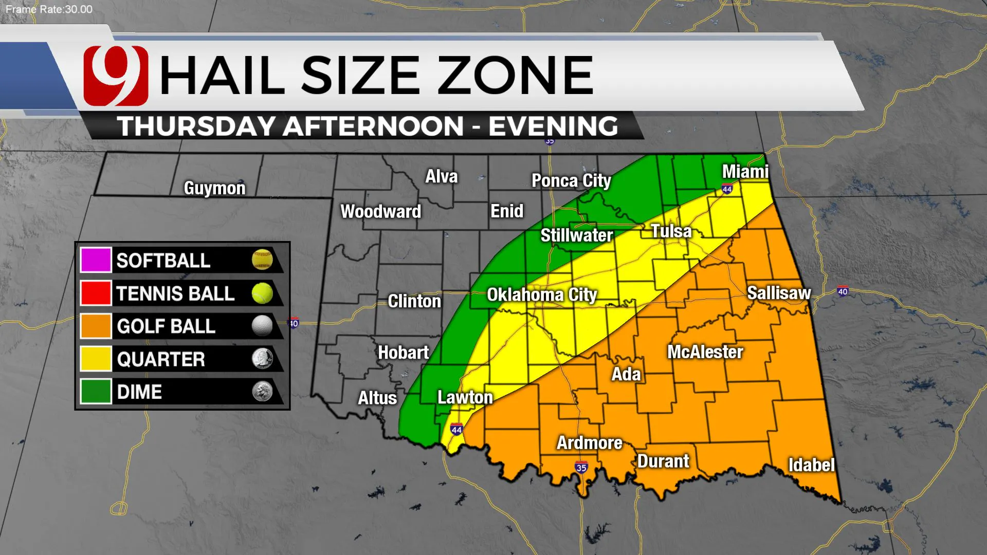
The threat is higher to the south and east. Winds to 75 mph, hail up to golf balls, and a few tornadoes possible. On the backside of this storm snow will be possible. Grassy surfaces may turn white before sunrise Friday morning.
More Like This
February 28th, 2023
May 18th, 2023
Top Headlines
January 12th, 2025
January 12th, 2025
January 12th, 2025
January 12th, 2025


