Weather Blog: Fall Exits As Summer Slowly Returns
Oklahoma Weather Forecast: Bookmark this page and refresh it often for the latest forecast and daily updates.Thursday, September 12th 2024, 6:32 am
TULSA, Okla. -
Afternoon highs will reach slightly above normal on Thursday and continue to slowly rise through the upcoming weekend.
A low-end chance for a few showers will remain possible for small periods this weekend with above-normal highs.
What are the chances of rain on Thursday?
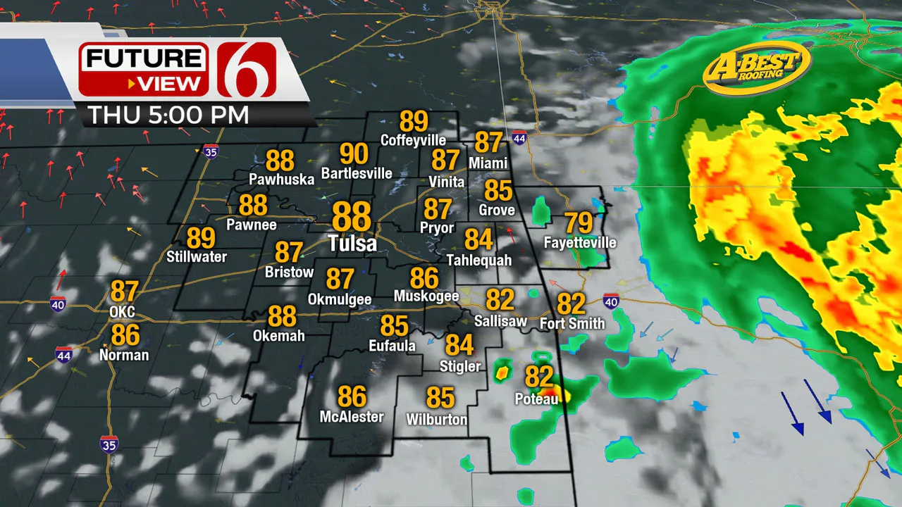
The impact of Tropical Storm Francine is expected to stay mostly to the east of our immediate area. However, a few clouds may brush across extreme eastern Oklahoma and Western Arkansas today and early tomorrow. The probability of any shower activity other than extreme southeastern OK is very low.
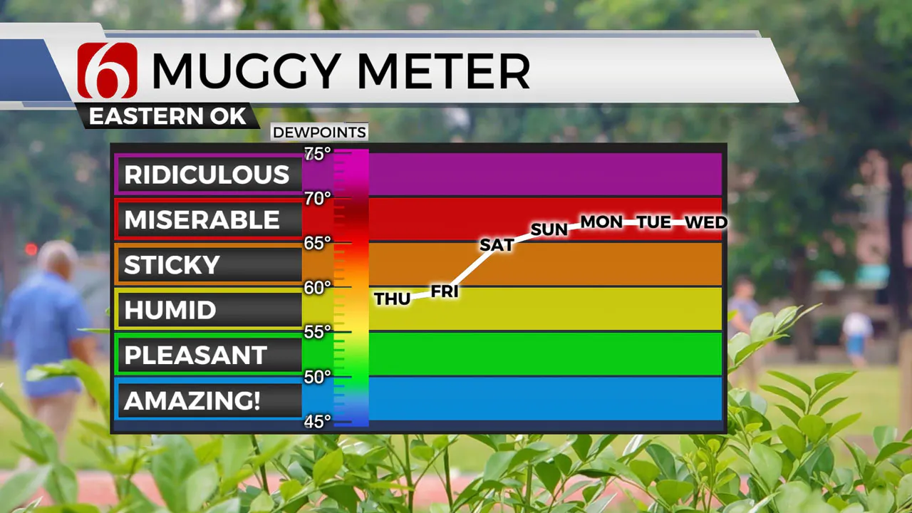
Low-level moisture has increased across eastern Oklahoma compared to previous days, which means there will be a slight increase in local heat index values throughout the weekend. The upper airflow will continue from the northwest this weekend as the remnants of the tropical system stay east and a series of upper-level troughs moves from the southwestern U.S. into the Central Plains states.

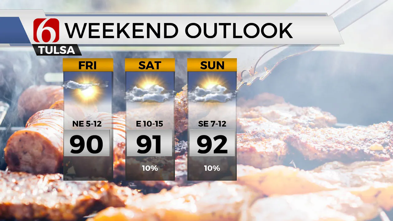
This flow will be relatively weak, but the possibility of a few sporadic showers during the weekend, particularly during the late night and early morning hours, cannot be completely ruled out. This probability remains very low, represented by a 10% chance on the seven-day forecast.
Over the next several weeks, troughs from the southwestern U.S. are expected to increase as the upper air pattern begins to shift from the northern plains into the Southern Plains.
These troughs will initially be strong, but as they move toward the Southern and Central Plains states and eject to the north and east, they are expected to weaken.
Consequently, scattered showers and storm chances will increase by the middle of next week and into the following weekend, based on this pattern.

Morning temperatures will begin in the 60s today, climbing to the upper 80s and lower 90s by the afternoon. While no significant heat index values are expected, it may feel slightly warmer than it has the past few days.
This weekend's temperature pattern will continue to slowly rise, with morning lows in the 60s and daytime highs in the lower 90s across the eastern third of the state. In some locations where drying vegetation is more pronounced, local temps may run into the mid-90s Sunday into early next week. 
Emergency Info: Outages Across Oklahoma:
Northeast Oklahoma has various power companies and electric cooperatives, many of which have overlapping areas of coverage. Below is a link to various outage maps.
Indian Electric Cooperative (IEC) Outage Map
Oklahoma Association of Electric Cooperatives Outage Map - (Note Several Smaller Co-ops Included)
The Alan Crone morning weather podcast link from Spotify:
https://open.spotify.com/episode/0D152DkLiaizNA3EFbJUmz
The Alan Crone morning weather podcast link from Apple:
https://podcasts.apple.com/us/podcast/weather-out-the-door/id1499556141?i=1000668593485
Follow the News On 6 Meteorologists on Facebook!

More Like This
September 12th, 2024
September 12th, 2024
September 12th, 2024
September 12th, 2024
Top Headlines
September 12th, 2024
September 12th, 2024
September 12th, 2024
September 12th, 2024


