Weather Blog: Tracking Our Next Rain Maker
Oklahoma Weather Forecast: Bookmark this page and refresh it often for the latest forecast and daily updates.Friday, November 15th 2024, 5:55 am
TULSA, Okla. -
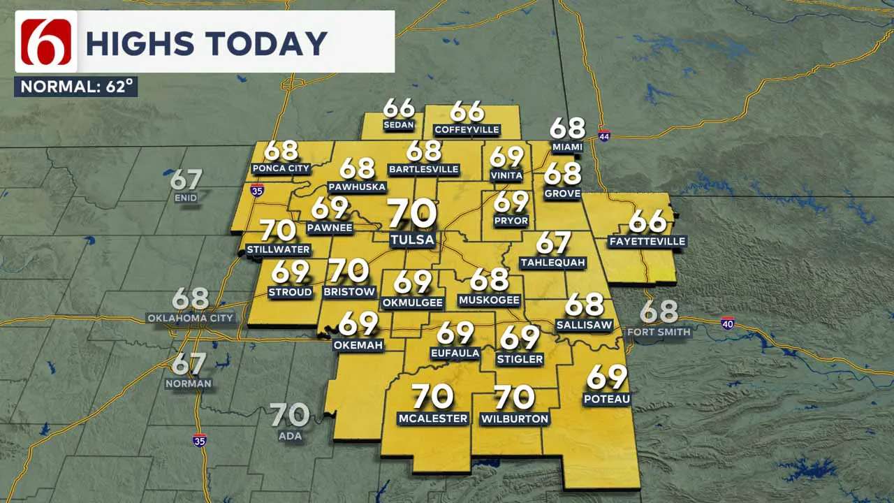
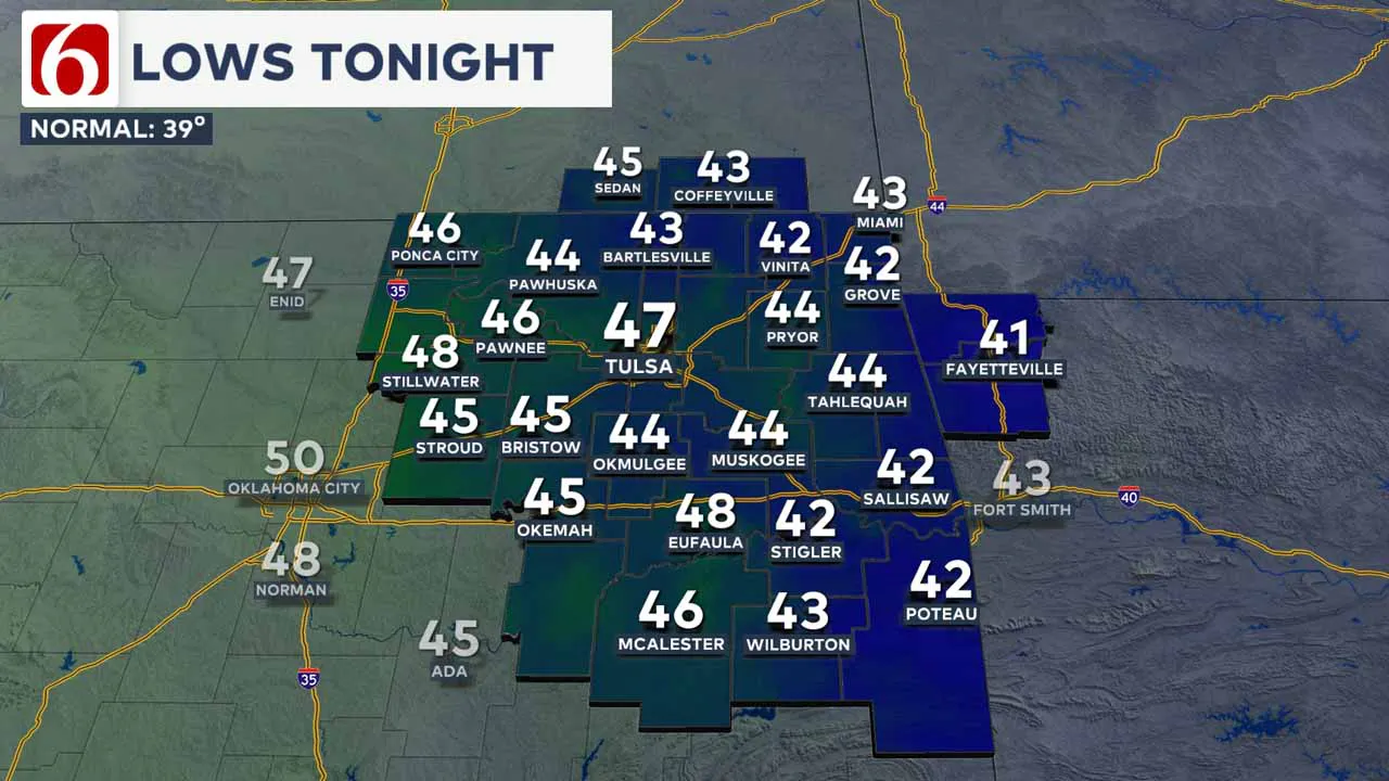
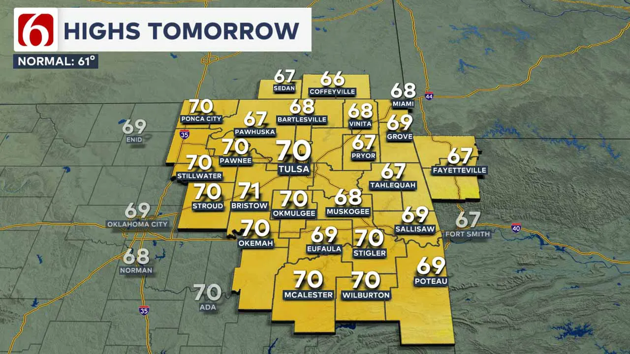
Clear and cold conditions will support temperatures in the 30s and lower 40s early Friday morning before rising to the upper 60s near 70 in the afternoon.

What is the weather like on Friday?
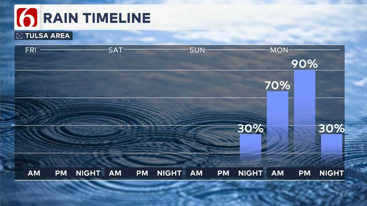
Expect mostly sunny skies with south winds at 10 to nearly 15 mph before a strong storm system impacts the area this weekend, especially into Monday with increasing showers and storms.
Robust moisture will flow into the system before its arrival, bringing pockets of moderate to heavy rainfall on Monday. Additionally, the strong dynamics of the storm system could present the possibility of severe weather.
Currently the main limiting factor in most datasets would be instability but this high shear and low Cape system may still produce some severe weather.
The strong wave will eject through the area Monday afternoon and evening, but a possibility exists for a weak trailing wave behind the system that may produce some very light precipitation late Tuesday night or early Wednesday morning.
Any amounts with this system would be very light and liquid. Colder conditions are expected for the middle to the end of next week, but the magnitude of the cooldown is not quite as low as previous datasets.
Regardless, Wednesday through the end of next week supports temperatures in the 30s for morning lows and daytime highs upper 40s near 50.
Our Monday storm system has entered the West Coast today as an open trough but will continue to dig southward while gaining strength this weekend.
Surface pressures are expected to fall rapidly late tonight through early tomorrow, with strong south winds developing at 15 to 25 mph Saturday morning to afternoon.
Surface wind speeds may relax somewhat for most of Sunday but will be increasing by evening into Monday as the system nears the state.
A strong surface area of low pressure is expected to rapidly deepen late Sunday night into Monday as it travels through the Panhandle and into Kansas by Monday afternoon. This should cause strong south winds Monday at 25 to near 45 mph.
Some showers and storms will be likely late Sunday night, but the bulk of the activity will occur Monday. As the surface low is moving northeast, a warm front will develop across Texas and attempt to move northward into portions of Oklahoma through the day Monday.
The strong dynamics combined with the deep moisture will present pockets of moderate to heavy rainfall. Amounts from one to three inches seemed likely, but the speed of the system may mitigate flooding threats.
The highest instability may be along or south of the I-40 corridor across portions of the Red River Valley into Texas. As the system leaves Monday afternoon and evening, gusty northwest winds will develop, bringing Tuesday morning temperatures into the mid-40s and afternoon highs into the lower 60s
The trailing wave moving from the west to the east should arrive Tuesday night or early Wednesday morning with a few spotty showers as temperatures will be into the upper 30s.
Wednesday afternoon's highs will be near 50 with strong northwest winds at 15 to 30 mph. Thursday morning lows will be near freezing at daytime highs in the upper 40s with sunshine and northwest winds at 12 to 25 mph.
---
Emergency Info: Outages Across Oklahoma:
Northeast Oklahoma has various power companies and electric cooperatives, many of which have overlapping areas of coverage. Below is a link to various outage maps.
Indian Electric Cooperative (IEC) Outage Map
Oklahoma Association of Electric Cooperatives Outage Map — (Note Several Smaller Co-ops Included)
The Alan Crone morning weather podcast link from Spotify:
https://open.spotify.com/show/0dCHRWMFjs4fEPKLqTLjvy
The Alan Crone morning weather podcast link from Apple:
Follow the News On 6 Meteorologists on Facebook!

More Like This
November 15th, 2024
November 15th, 2024
November 15th, 2024
November 15th, 2024
Top Headlines
November 15th, 2024
November 15th, 2024
November 15th, 2024
November 15th, 2024


