Storms roll in Monday night, severe weather risk goes up
Storms are expected to roll in on Monday with a slight risk for severe weather. Meteorologist Lacey Swope has your full forecast.Monday, March 3rd 2025, 6:16 pm
OKLAHOMA CITY -
Monday will be cloudy and windy, and during the evening storms will begin to develop in the northwest.
This will be a broken line of storms that will race to the east overnight into Tuesday.
Threats along the line are primarily damaging winds, and large hail. However, the tornado threat goes up overnight as well.
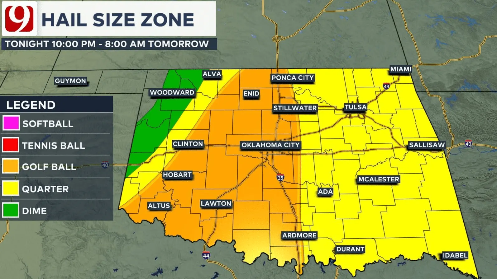
The overall threat of tornadoes is low. The concern will be for those short-fused spin ups that occur along the line. We call those QLCS tornadoes, and most of the time they are on the weak side.
Storm Timeline
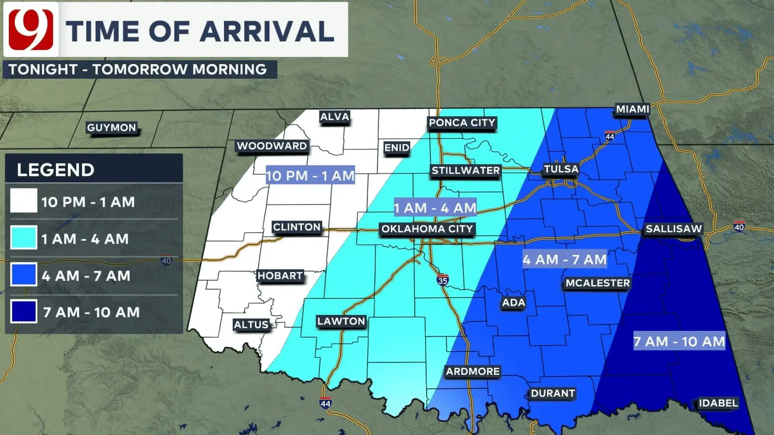
Storms fire up in the northwest from 10 p.m. to 12 a.m. Tuesday. They will move through the Oklahoma City Metro from 1 a.m. to 4 a.m.
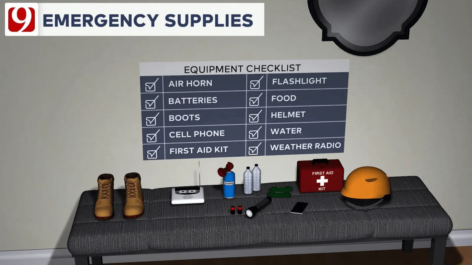
Prepare yourself and your household by going over your safe spot and safety plans.
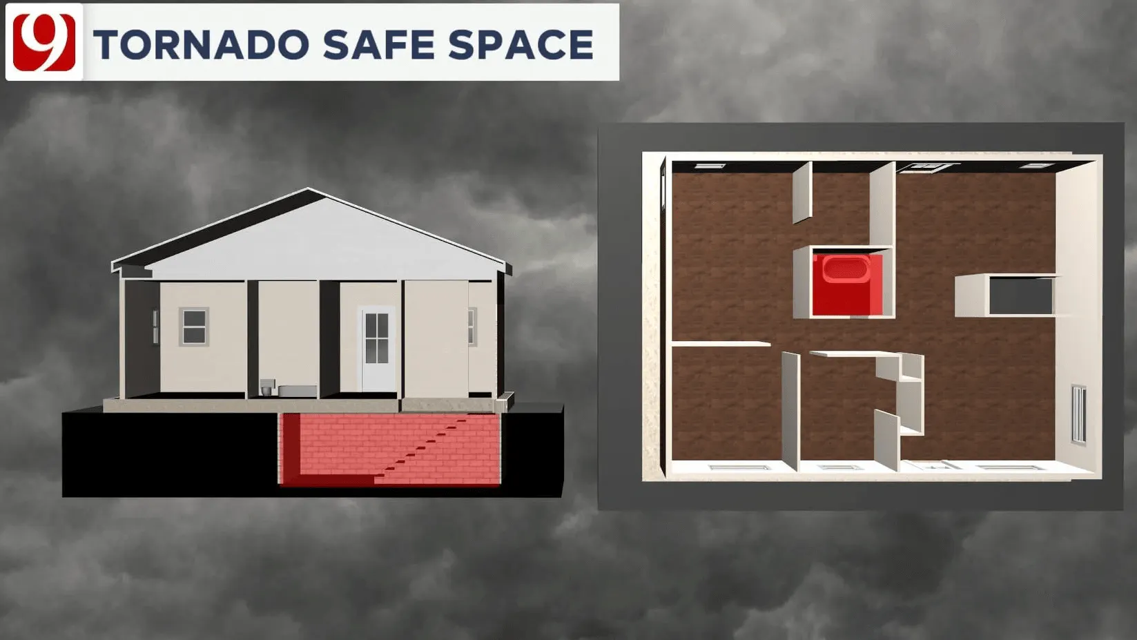
Make sure the family knows what to do if a warning is issued for your area. If you are prepared, there's no reason to be scared.
We may go through the night with no tornadoes at all.
Trackers will be out and our weather team will be in the studio. We will bring you live updates as these storms roll through.
On Tuesday, high winds will be the big story! Winds will gust over 50 mph with some gusts to 60 mph.
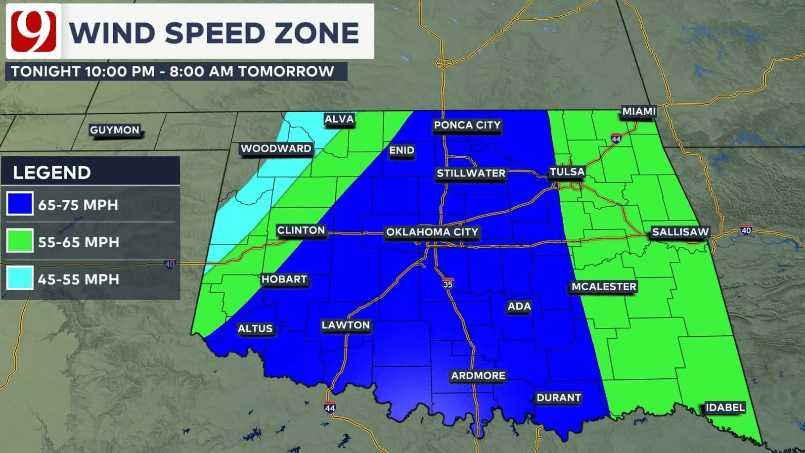
This will mean high fire danger, and will also cause some blowing dust. The high winds could cause some power outages.
There will be a few showers Tuesday afternoon.
WINTER WEATHER PREP:
- 3 Ways To Save Money On Energy Bills During The Winter
- Q&A With OKC Fire Captain On Ways Homeowners Can Prevent, Prepare For Winter Fires
- OG&E Shares Winter Readiness And Power Outage Tips
- Space Heater Safety Tips For The Winter Season
- Tips On How To Beat Seasonal Affective Disorder And The Winter Blues
----
Follow our meteorologists!
More Like This
March 3rd, 2025
March 3rd, 2025
Top Headlines
March 3rd, 2025
March 3rd, 2025
March 3rd, 2025


