Severe storm chances increase Friday, weekend severe threat goes up
Storm chances go up Friday, with heavy weekend rain ahead. Meterorologist Megan Gold has the latest forecast.Friday, April 18th 2025, 10:53 am
OKLAHOMA CITY -
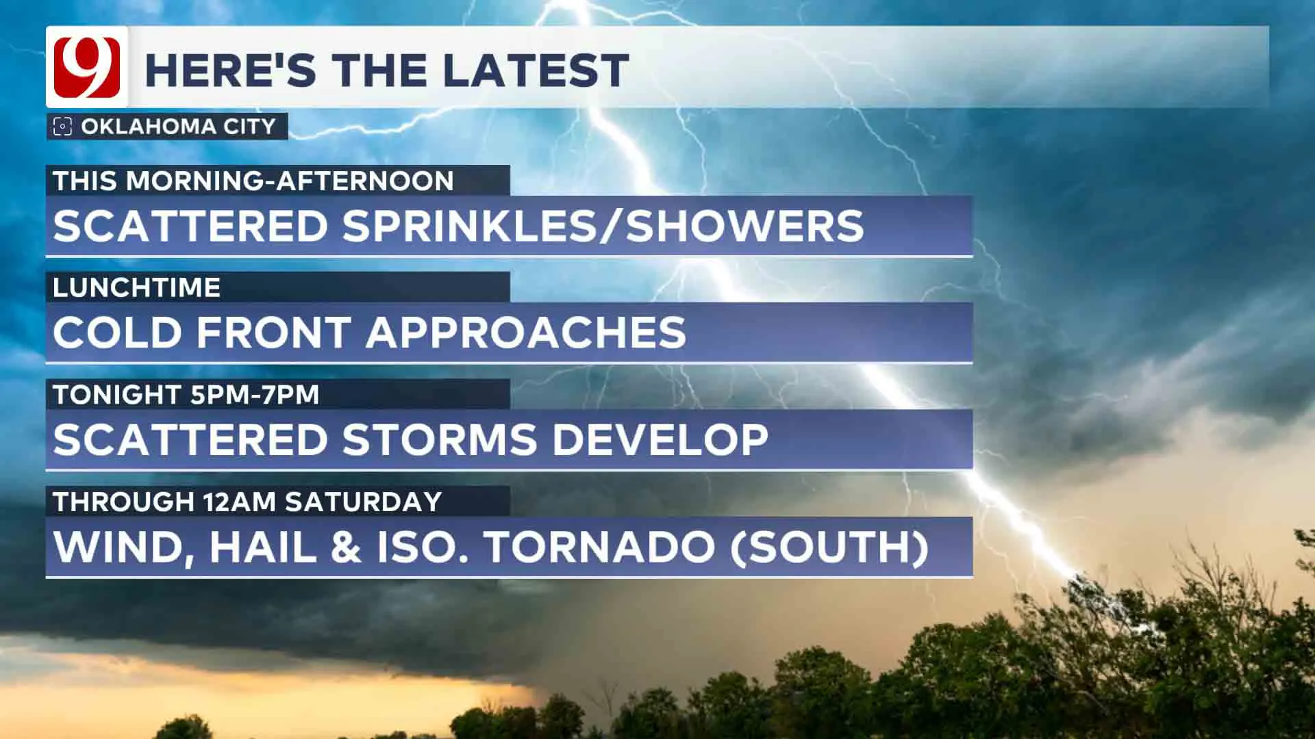
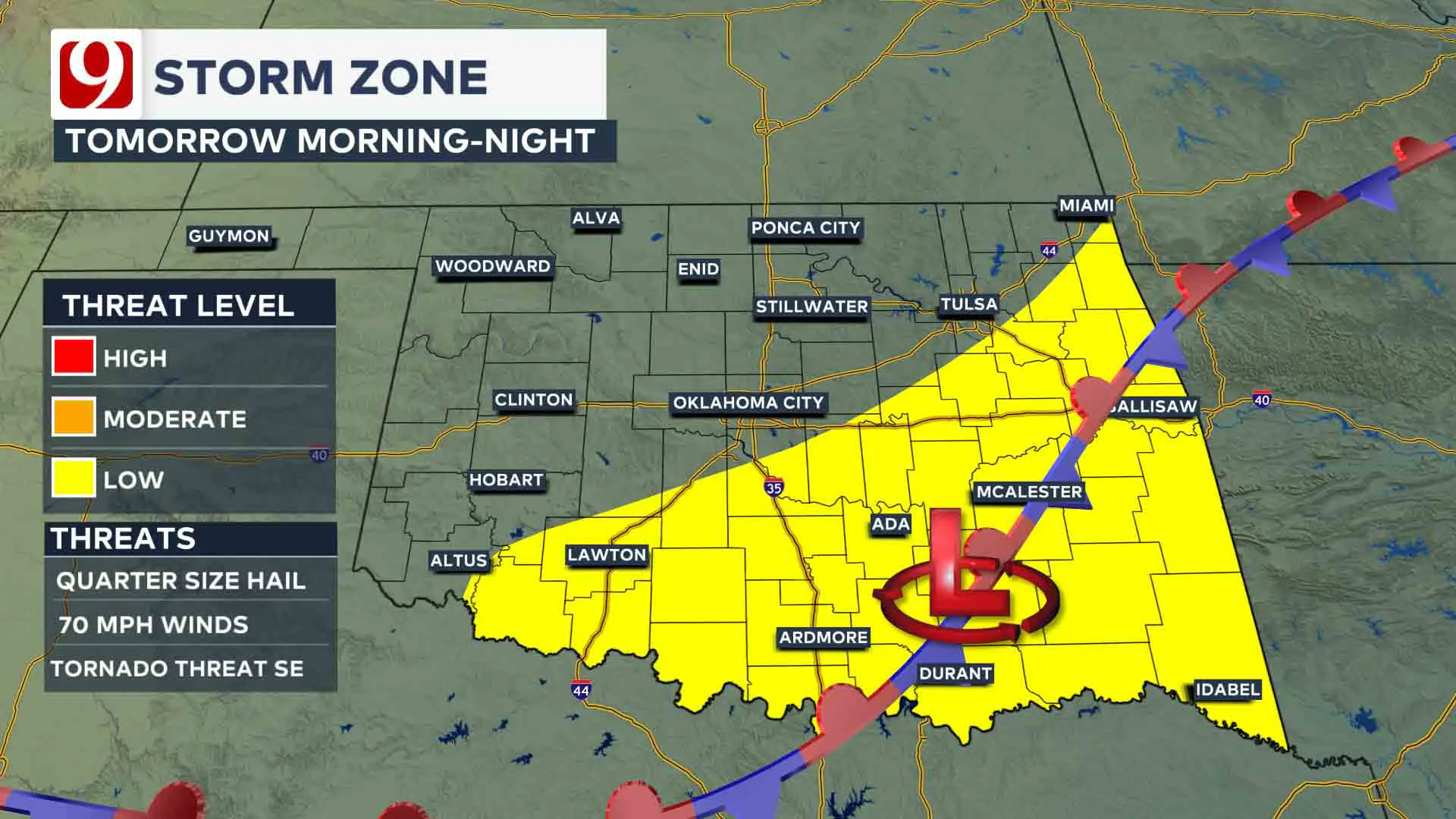
Severe weather chances return Friday evening with a wind, hail and isolated tornado threat.
What is the weather like on Friday?
A strong cold front is moving through Oklahoma Friday morning and will stall near Oklahoma City.
The biggest question remains exactly where the front stalls.
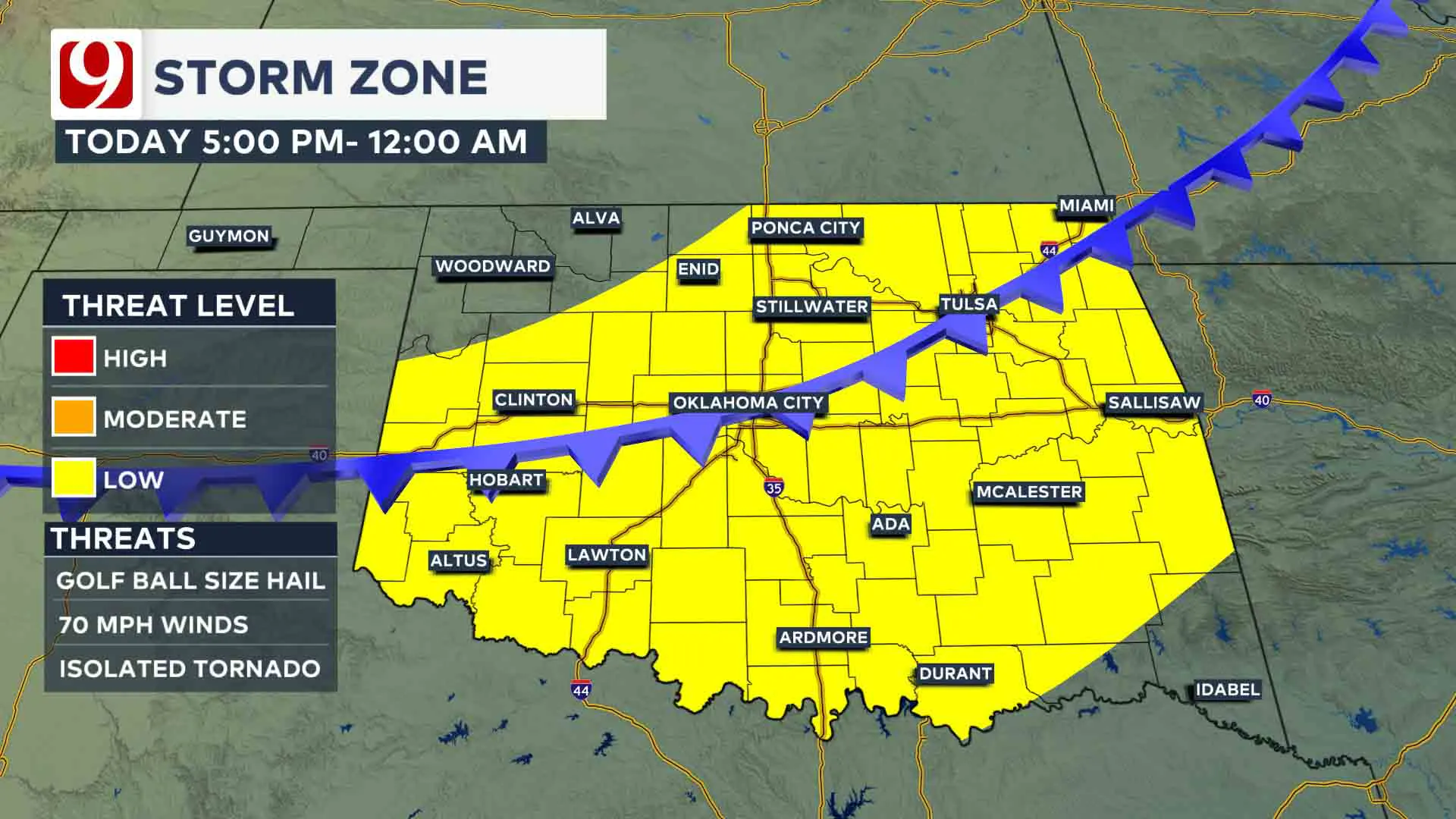
The air out ahead of the front is warm and moist, and behind the front, it is cool and dry.
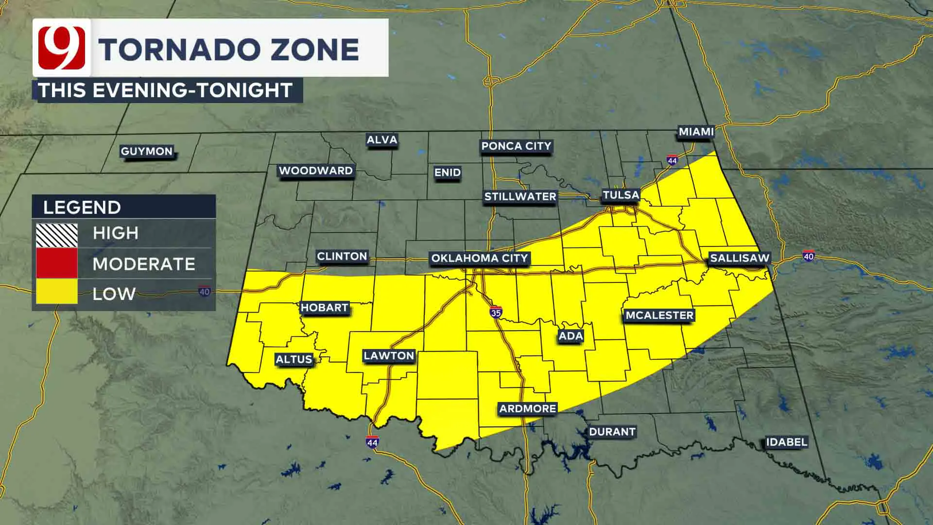
Scattered storms will develop near and out ahead of the cold front in this more favorable environment, and these storms will pose a low tornado threat.
Behind the cold front, our team will watch for elevated wind and hailstorms.
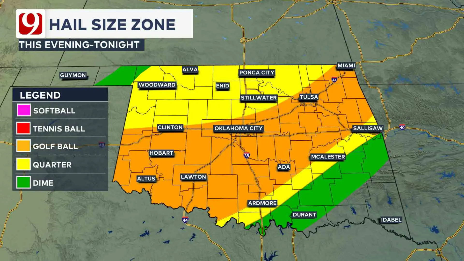
The severe weather threat for the Oklahoma City metro diminishes overnight into Saturday, and will be limited to southeast Oklahoma where the front has stalled.
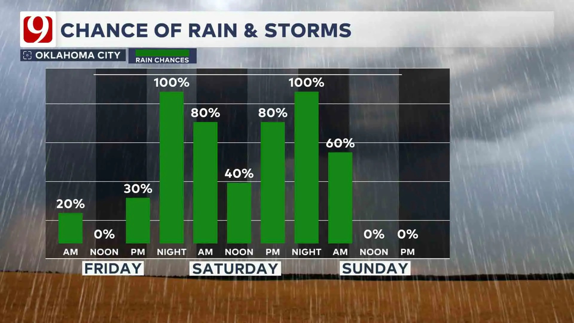
Additional rains build in with showers on and off through your Saturday.
Highs in the 40s and 50s, cold and dreary.
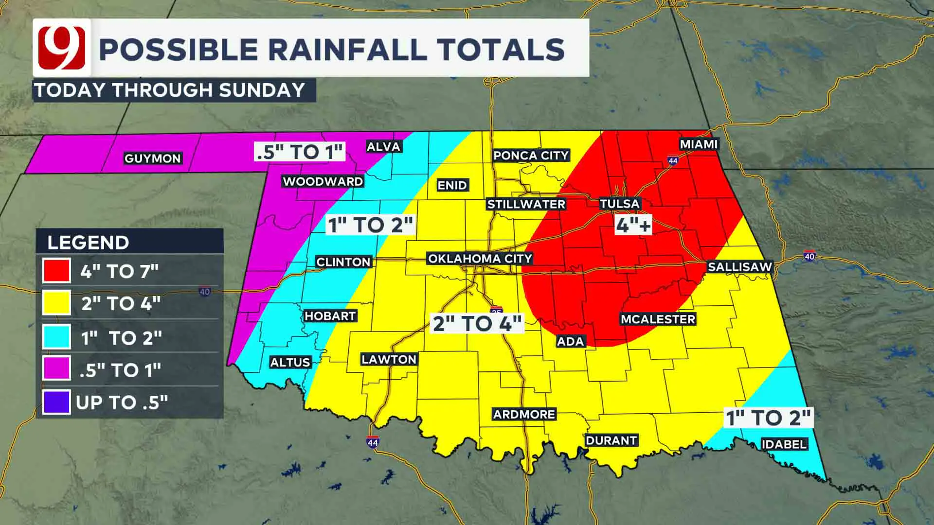
Another round of heavy storms builds in overnight Saturday and into your Sunday morning with heavy rain and flooding as the main concern.
Trackers will be out, and our team will bring you live updates all weekend.
STORM SAFETY:
🔗Severe weather safety: what to do before, during, and after a storm
🔗Tornado Watch vs. Tornado Warning: what they mean and what to do
🔗Severe weather safety: what you need to know to prepare
Emergency Info: Outages Across Oklahoma:
Northeast Oklahoma has various power companies and electric cooperatives, many of which have overlapping areas of coverage. Below is a link to various outage maps.
- PSO Outage Map
- OG&E Outage Map
- VVEC Outage Map
- Indian Electric Cooperative (IEC) Outage Map
- Oklahoma Association of Electric Cooperatives Outage Map — (Note Several Smaller Co-ops Included)
Follow our meteorologists!
More Like This
April 18th, 2025
April 18th, 2025
April 18th, 2025
Top Headlines
April 18th, 2025
April 18th, 2025


