Severe Storm Chances Go Up Wednesday
Oklahoma Weather Forecast: Bookmark this page and refresh it often for the latest forecast and daily updates.Wednesday, October 30th 2024, 7:21 am
OKLAHOMA CITY -
It's a quiet Wednesday morning, but weather conditions are expected to change rapidly later in the day.
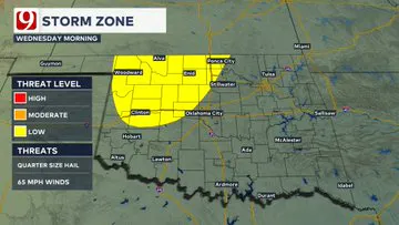
We are tracking several elements that could affect you in the coming days: record highs, rain chances, strong winds, fire danger, and more.
What is the weather like in Oklahoma on Wednesday?
Expect 80s Wednesday afternoon, but chances of rain go up, with storms expected to develop in the afternoon.
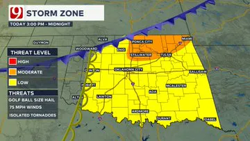
A dryline and then a cold front will move across the state.
East of the dryline, isolated storms will likely develop.
Pay close attention to the weather conditions. Fire danger and severe threat will max out later on Wednesday.
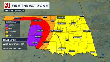
The severe threat will continue into the evening. All News 9 resources will be needed today. Looks like a busy day for the weather team!
The highest rain chances will be in eastern Oklahoma.
The overall threat is low, but a few severe storms are possible.
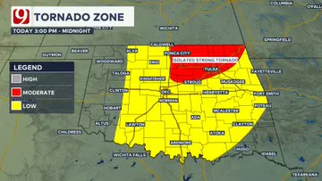
The tornado risk is low, but not zero.
What is the weather like in Oklahoma for the rest of the week?
Rain quickly moves east and ends by Thursday morning.
Winds could gust up to 40 mph again, but the focus will be on the storm system moving in.
Halloween looks dry and cool. After the storm system moves out, expect a clear and pleasant day for trick-or-treating!
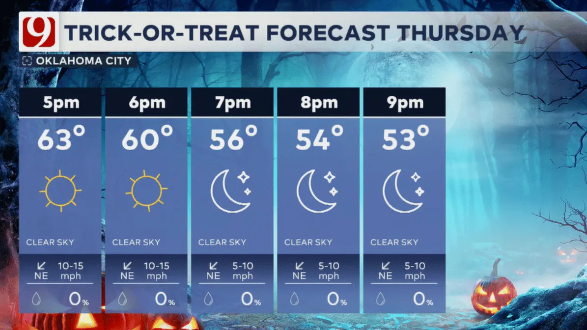
Temperatures will be in the mid-70s, with light winds making for a comfortable evening.
The weekend is shaping up to bring more rain into the forecast that could last through early next week.
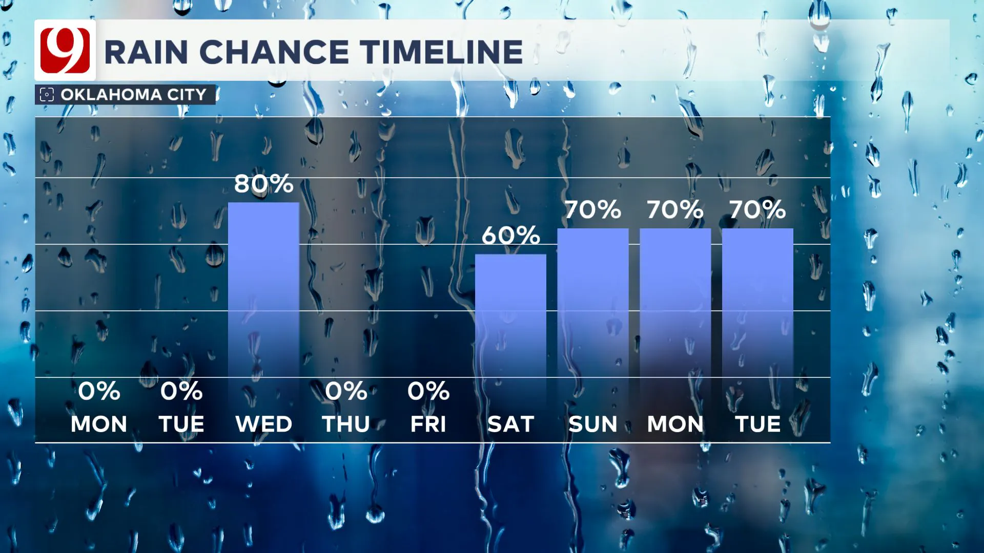
Some locations could see two to four inches by Tuesday night.

Follow our meteorologists!
More Like This
October 30th, 2024
October 30th, 2024
October 30th, 2024
October 30th, 2024
Top Headlines
October 30th, 2024
October 30th, 2024
October 30th, 2024
October 30th, 2024


