Slight Drizzle Saturday Before Arctic Front Arrives Sunday
Oklahoma Weather Forecast: Bookmark this page and refresh it often for the latest forecast and daily updates.Friday, January 3rd 2025, 10:42 pm
OKLAHOMA CITY -
Happy Friday, Oklahoma! It will be sunny and chilly on Friday.
What is the weather like this weekend?
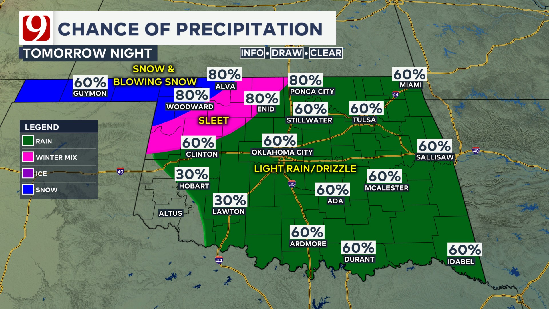
Temperatures will warm back to around 50 degrees tomorrow with drizzle on and off during the day.
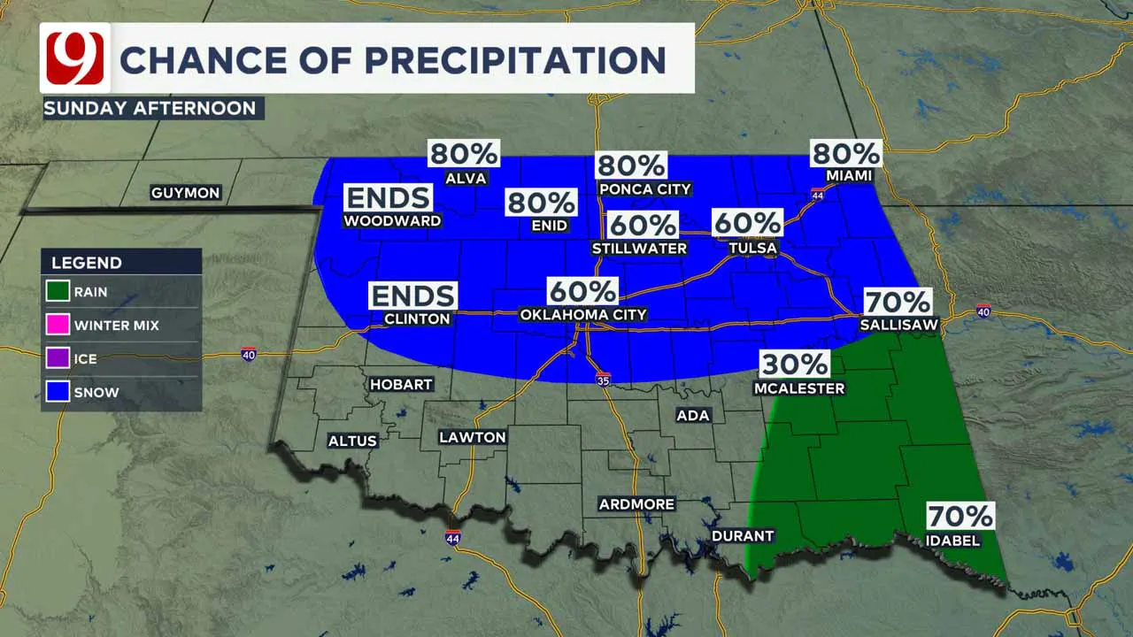
A cold front comes in late Saturday night with rain transitioning into snow Sunday morning and into the afternoon.
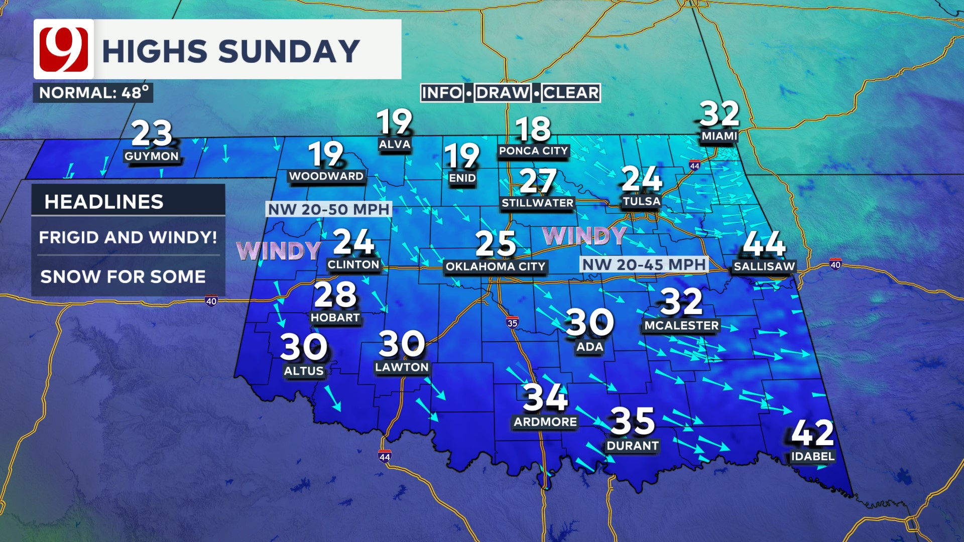
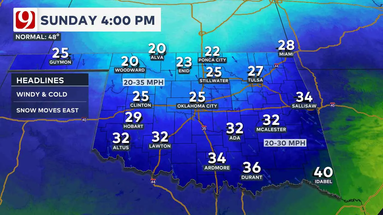
The Arctic blast hits Sunday! Temperatures will drop like a rock. Rain changes to freezing rain, then sleet, then all snow in the north and west.
Prepare for the cold Sunday and slick roads north.
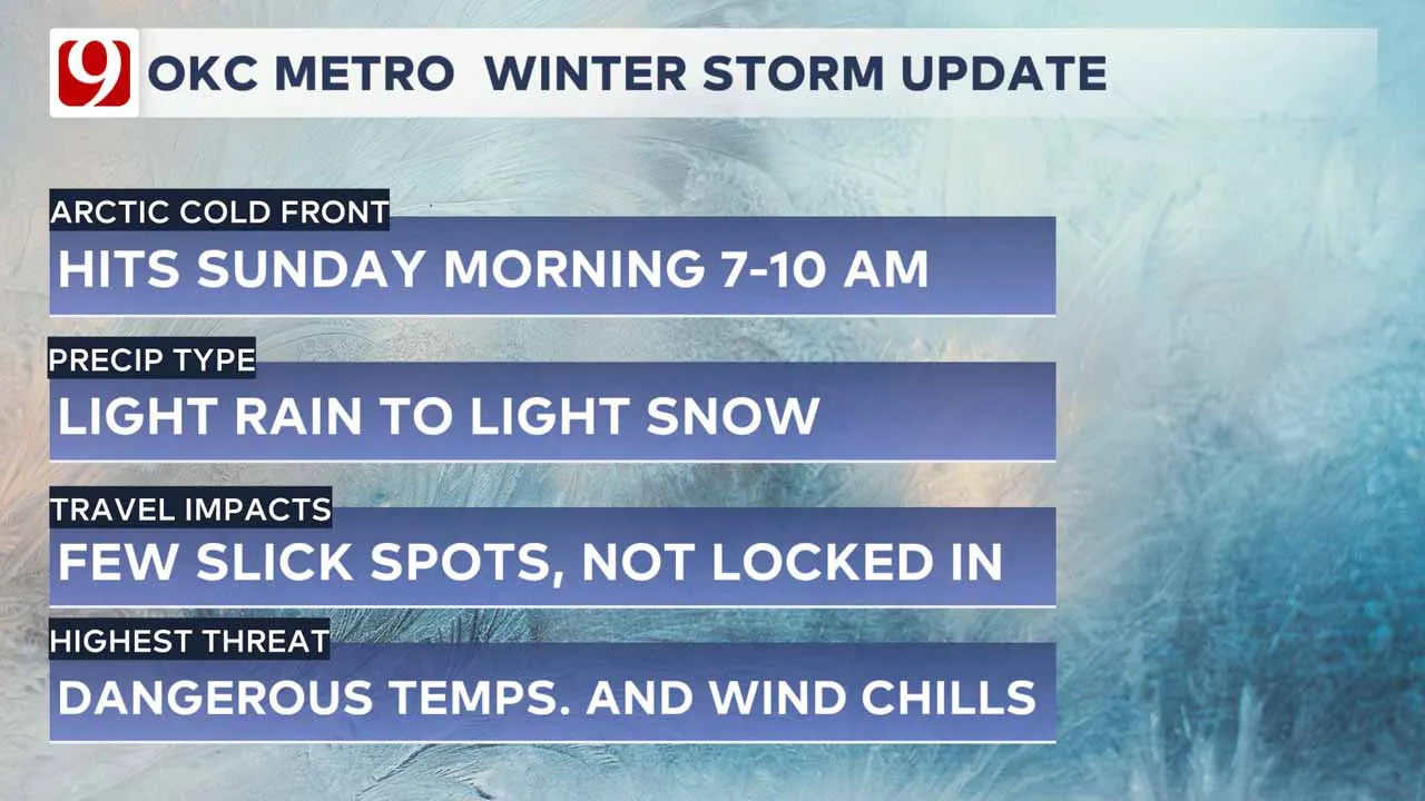
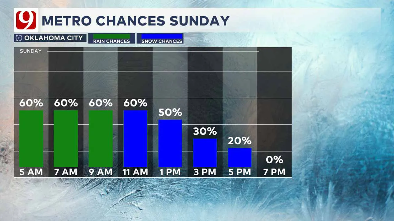
For the Oklahoma City metro, we have a chance for light rain that would transition to a mix and could become all light snow as the system ends.
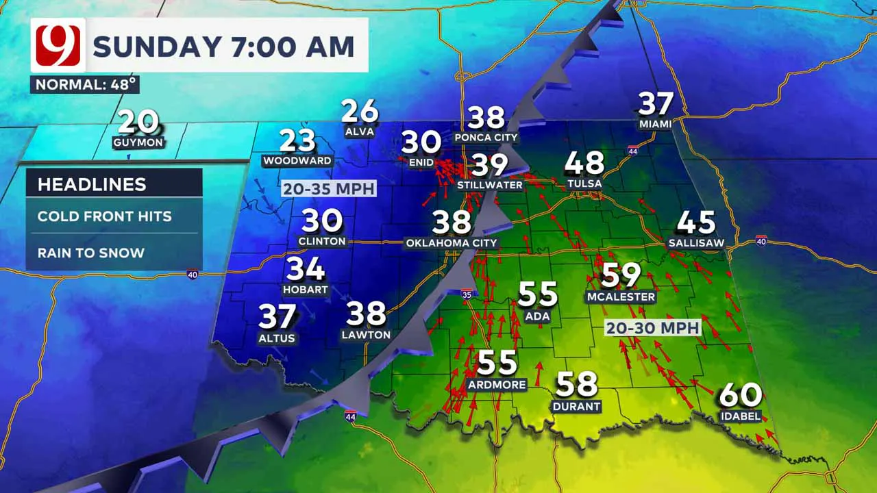
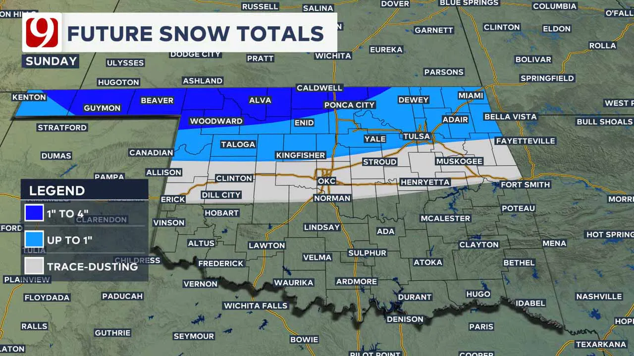
The window for snow in Oklahoma City is very narrow. If we see flakes, the totals look very minimal.
However, any light precipitation with temps dropping could lead to a few slick spots in the metro. Please stay plugged in.
The highest chance for accumulation of snow is to the north. Most will see less than 1 inch of snow, but there could be some higher totals in the far north.
The biggest impact statewide will be the cold. We drop below freezing on Sunday and will remain at or below 32 degrees until at least Wednesday, possibly Thursday. Please take this time to winterize your home and prepare your vehicle.
The upper-level storm moves onto the West Coast today. The forecast will become much more refined and the zone will still shift.
Most of our meteorological instruments are over land, so we get a lot more reliable data as the day rolls along.
2024 Weather Recap:
Weather Blog: Oklahoma's 2024 Severe Weather Season Breaks Records
This year brought Oklahoma a mix of highs and lows in weather trends:
- Snowfall: Oklahoma City recorded just 3.4 inches of snow this year, well below the average of 7.6 inches. We had small amounts in January, February, and March but nothing major.
- Rainfall: On the flip side, it was a wetter-than-average year with 37.11 inches of rain—three-quarters of an inch above normal. November stood out as the wettest month of the year, with a historic rainfall total, while August also brought significant amounts.
- Severe Weather: Oklahoma saw 152 tornadoes in 2024, beating the 149 record set in 2020. Among the most active counties were Roger Mills and Ottawa, with six tornadoes each. While there were no EF-5 tornadoes, two EF-4s caused devastating impacts to several communities. 196 tornado warnings were issued statewide, the highest number in the nation for 2024.
- 988 severe thunderstorm warnings covered every square inch of Oklahoma at some point during the year.
----
Follow our meteorologists!
More Like This
January 3rd, 2025
January 3rd, 2025
Top Headlines
January 3rd, 2025
January 3rd, 2025
January 3rd, 2025
January 3rd, 2025


