

Tracking showers, storms, and severe weather
Friday warms up, with strong winds expected before a weekend storm system moves in. Meteorologist Justin Rudicel has your full forecast.Sunday, March 2nd 2025, 4:07 pm
OKLAHOMA CITY -
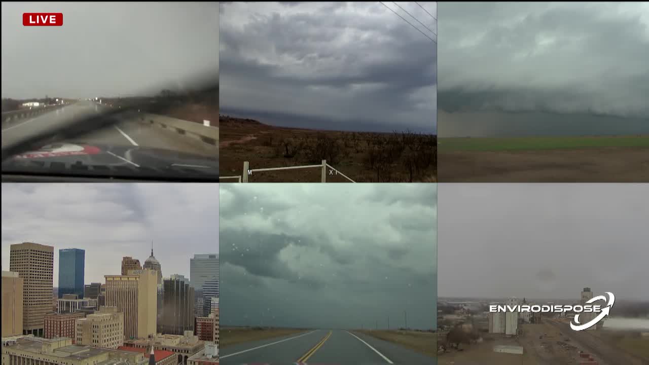
Our meteorologists are tracking severe storms as they head into the metro. While most storms will be non-severe, areas west of Oklahoma City could see hail, strong winds, and even a low tornado risk.

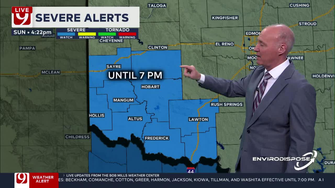
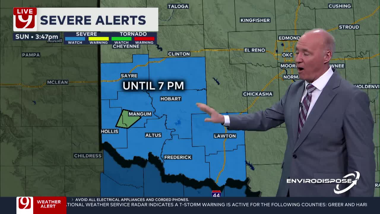
Watches and Warnings
- Severe Thunderstorm Watch for Beckham, Comanche, Greer, Harmon, Jackson, Tillman and Washita County until 7:00 p.m.
What's the weather like this weekend in OKC?


What's the storm timeline in OKC this weekend?
☀️ Sunday: A Tale of Two Forecasts
- Morning: Sunny & chilly with temperatures in the 30s & 40s
- Afternoon: Highs climb into the mid-to-upper 60s in central Oklahoma, low 70s in the south
- Evening: Storms move in from the west with heavy rain, lightning & a low-end severe threat
⏳ Timing of Storms
- 12 PM – 4 PM: Storms begin in western Oklahoma
- 4 PM – 10 PM: Showers & storms push into central & eastern Oklahoma
⛈️ Possible Threats:
- Hail & gusty winds, mainly west of OKC
- Brief spin-up tornado risk (low, but not zero)
Heavy rain & lightning across the metro
🔥 Fire Danger in Western Oklahoma
Once storms exit, dry air and breezy conditions could increase fire risk in far western and southwestern Oklahoma.


⚡ Storm System #2: Monday Night into Tuesday
- When: Rain & storms develop Monday night, peaking early Tuesday
- Threats:
- Low-end severe risk from central to eastern Oklahoma
- Higher severe potential east of Oklahoma into Arkansas
- Impact:
- Gusty winds & hail possible
- Storms clear by Tuesday morning, with lingering light showers
💡 What This Means for You:
- Enjoy Saturday’s sunshine—rain returns Sunday evening
- Fire risk Sunday afternoon in western Oklahoma
- Storms move in Monday night—wet roads for Tuesday’s commute
- Midweek dries out, but rain chances may return next weekend
LOOKING AHEAD
We are still watching Monday night into Tuesday for storms firing on the dryline.
These storms will have more upper-level support and more Gulf moisture to fuel them.
There is a low chance for severe weather in this timeframe, with wind and hail being the main threats.


Extended Forecast
- Friday: Highs back in the 60s and 70s, dry conditions.
- Saturday: Warm with highs in the 70s.
- Sunday: Rain and thunderstorms possible, highs in the 60s.
- Monday-Tuesday: Storm system could bring severe weather, followed by a cooldown.
As always, Oklahomans should stay updated on the latest forecasts for any changes in the storm outlook..
Our next cold front moves in on Wednesday next week.
It will be weak and will bring a slight chance for a few showers and storms. The highest chance will be in southeast Oklahoma.
WINTER WEATHER PREP:
- 3 Ways To Save Money On Energy Bills During The Winter
- Q&A With OKC Fire Captain On Ways Homeowners Can Prevent, Prepare For Winter Fires
- OG&E Shares Winter Readiness And Power Outage Tips
- Space Heater Safety Tips For The Winter Season
- Tips On How To Beat Seasonal Affective Disorder And The Winter Blues
----
Follow our meteorologists!

Get The Daily Update!
Be among the first to get breaking news, weather, and general news updates from News 9 delivered right to your inbox!
More Like This

March 2nd, 2025

March 2nd, 2025

March 2nd, 2025

March 2nd, 2025
Top Headlines

March 2nd, 2025

March 2nd, 2025

March 2nd, 2025
