Severe Weather Possible Sunday In Oklahoma
<p>Boy, it sure didn't feel like spring with that wind this morning! Wind chills were in the 30s and 40s Saturday morning! </p>Saturday, March 25th 2017, 4:30 pm
Boy, it sure didn't feel like spring with that wind this morning! Wind chills were in the 30s and 40s Saturday morning! The wind will thankfully relax Saturday afternoon and evening and the clouds will clear as temperatures warm to near normal values.
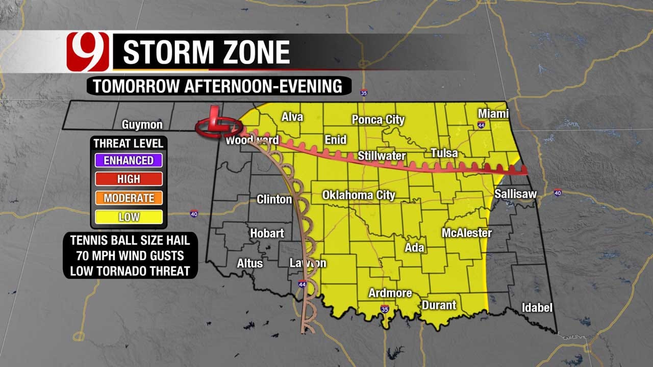
Sunday, though, is a day we need to watch. A powerful storm system will arrive Sunday afternoon and set up a dryline in western Oklahoma.
Strong to severe storms will be possible along and just east of the dryline, which will likely setup just southwest of Oklahoma City.
Any isolated storms that develop Sunday will have the potential of producing golf ball size hail, 70 mph wind gusts, and yes, possibly a tornado or two. The amount of moisture coming back into the state Sunday is still somewhat of a question mark, so we'll be watching that closely as well.
The things that are favoring severe storms for Sunday.
- Very dynamic storm system moving in
- Favorable speed & direction of the jetstream
- The timing of the storm system during peak heating.
- Lack of morning clouds to allow good heating through the day.
Now, for things that going against us having severe weather.
- Limited moisture and the depth of the moisture
- Capping or lid in the atmosphere is pretty strong.
- Lack of forcing in the warm sector along the dry line.
- Strongest low level winds are east of the great instability.
I'm telling you all this just to let you know this isn't a slam dunk. However, has the potential to produce some pretty nasty storms if things start to line up better in 24 hours.
Evening models will get a much better sample of the atmosphere and expect to have a better grasp of things for the 10 p.m. So, I'll update the graphics if I need to for the 10 p.m. after looking over the data.
Sunday may be the first true severe weather event of the season but it is no different than hundreds of others we've have gone through before. So there is absolutely NO reason to panic, worry or change your plans for Sunday. What you DO need to do is prepare today, be ready for Sunday and stay weather aware throughout Sunday.
More Like This
March 25th, 2017
November 13th, 2024
October 28th, 2024
October 17th, 2024
Top Headlines
January 11th, 2025
January 11th, 2025
January 11th, 2025
January 11th, 2025


