Cool Weather Continues Before Warmer Temps & Storm Chances Return
Chilly temperatures hang around, but a pleasant stretch of weather could soon be on the way for Green Country.Monday, March 27th 2023, 5:25 am
If you’re into podcasts or in a rush, check out my daily weather update. Search for NewsOn6 and ‘Weather Out The Door’ on most podcast providers, including Spotify, Stitcher and Tune-In, or Click Here to listen on Apple Podcasts.
TULSA, Okla. - Chilly temperatures hang around, but a pleasant stretch of weather could soon be on the way for Green Country.
Here are the details from News On 6 Meteorologist Alan Crone:

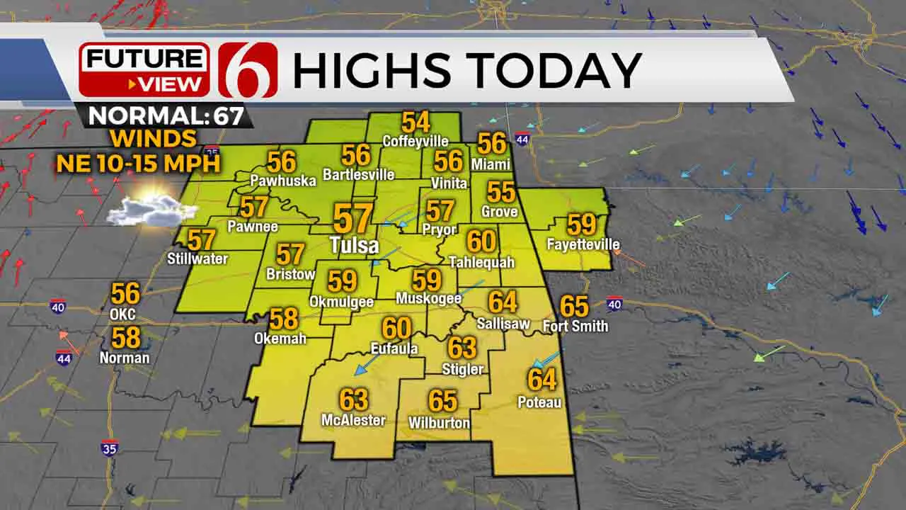
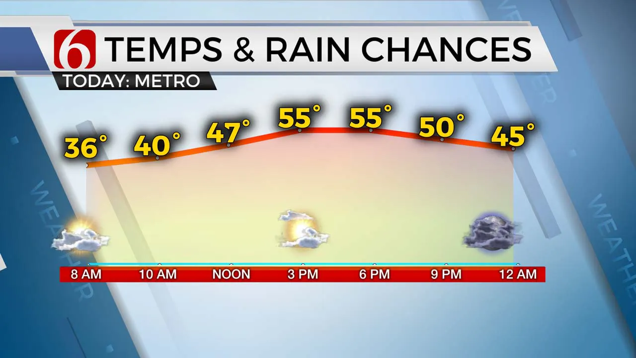
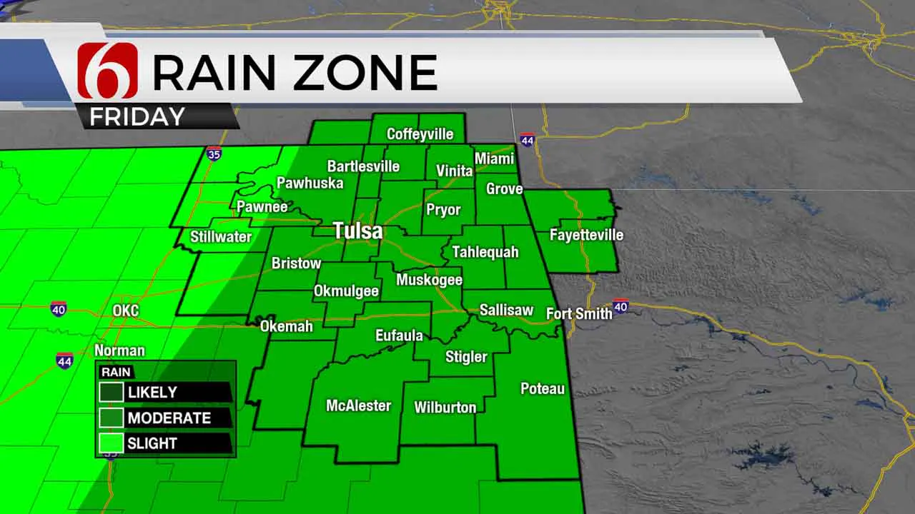
Morning lows in the 30s will bring highs into the mid and upper 50s north and 60s south on Monday and 50s on Tuesday before windy and relatively warmer weather arrives midweek before our next chance of storms. A sunshine-cloud mix is likely on Monday with more sunshine both Tuesday and Wednesday. North winds are likely both Monday and most of Tuesday before strong and gusty south winds return Wednesday and Thursday from 20 to 30 mph. Stronger wind gusts are possible along and west of the I-35 corridor both Thursday and Friday. We'll track at least two waves over the next few days, including a strong system by the end of the week with thunderstorm chances late Thursday evening into Friday. Some of the storms could be strong to severe Friday for part of eastern Oklahoma.

A fast mid-level wave will move across the central plains Monday night into early Tuesday with little impact across northeastern OK while providing impetus for storms across locations well to our southeast. A few showers or sprinkles will be possible across extreme northern OK and southern Kansas later today and this evening along with a small chance for a shower or rumble of thunder across extreme southeastern Oklahoma late tonight. These probabilities are very low.

A stronger storm system will arrive Thursday night into Friday bringing additional storm chances back to the state, including the threat of strong to severe storms based on the pattern and expected parameters over at least the eastern third of the state. Severe weather threats are also expected Thursday but may remain slightly west of the metro until late Thursday night into Friday. As the system passes the area Friday midday and afternoon, pleasant and uneventful weather is expected for most of the weekend. I'll have more specifics about the thunderstorm threat for the end of the week tomorrow.
Thanks for reading the Monday morning weather discussion and blog.
Have a super great day!
Alan Crone
KOTV
More Like This
March 27th, 2023
January 1st, 2025
January 1st, 2025
January 1st, 2025
Top Headlines
January 1st, 2025
January 1st, 2025
January 1st, 2025
January 1st, 2025


