More Wintry Weather Before A Weekend Warm-Up
More winter weather is on the way on Tuesday after a day of sleet and ice.Tuesday, January 31st 2023, 5:38 am
If you’re into podcasts or in a rush, check out my daily weather update. Search for NewsOn6 and ‘Weather Out The Door’ on most podcast providers, including Spotify, Stitcher and Tune-In, or Click Here to listen on Apple Podcasts.
TULSA, Okla. - More winter weather is on the way on Tuesday after a day of sleet and ice.
Here are the details from News On 6 Meteorologist Alan Crone:

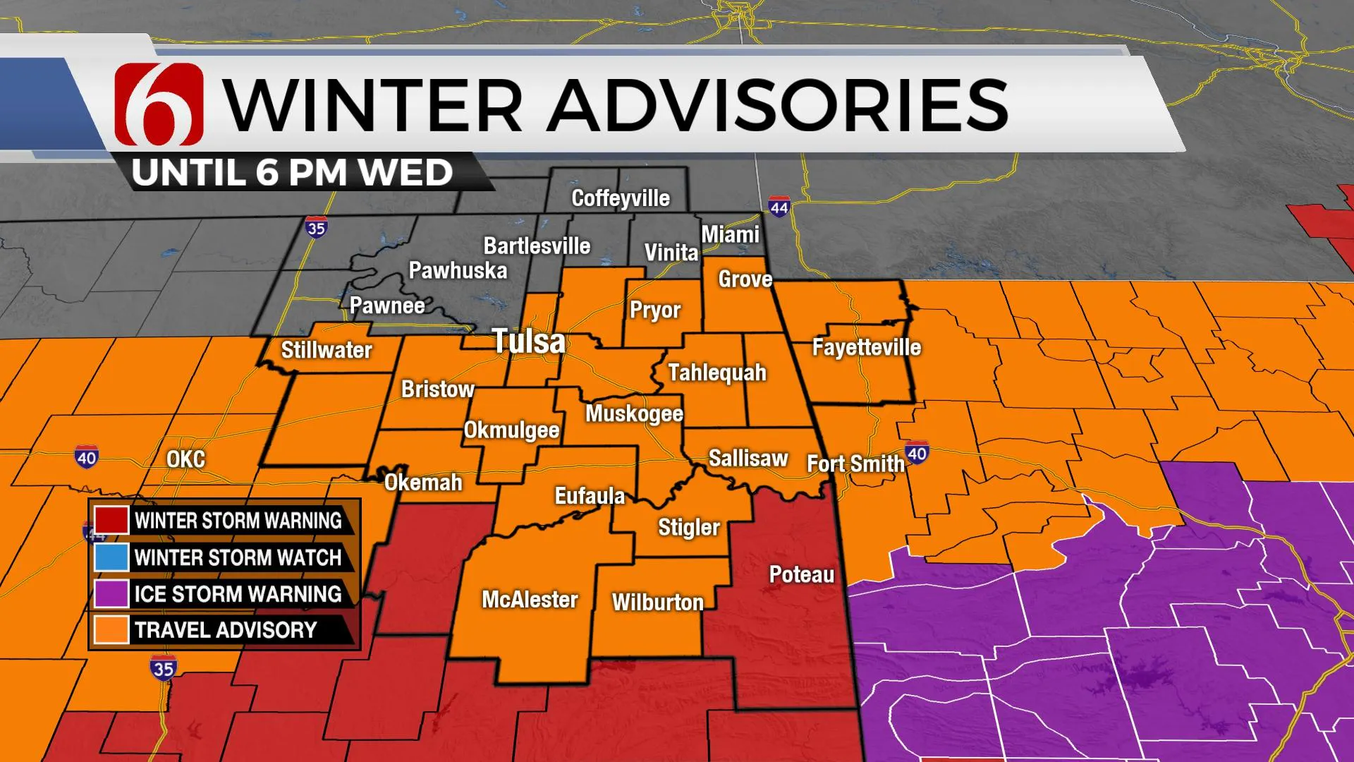
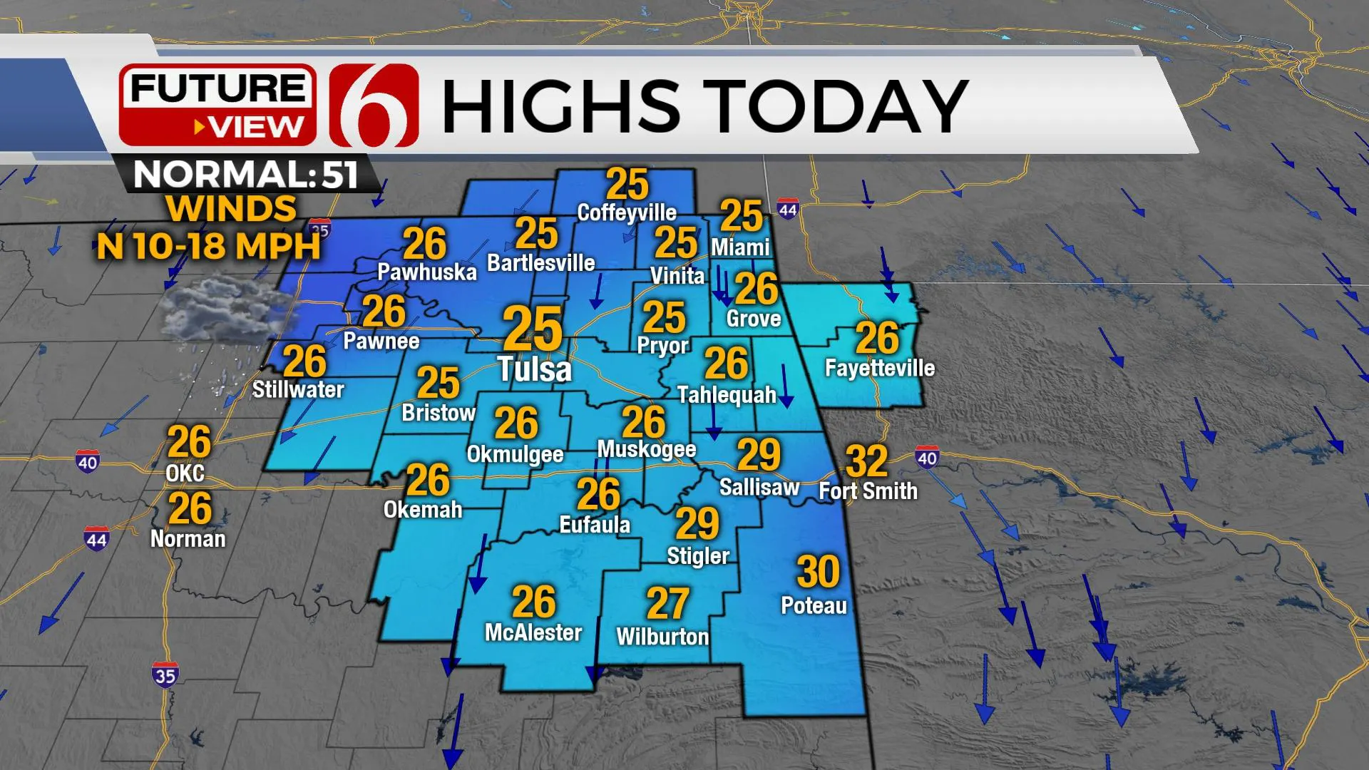
Another round of wintry weather is likely to arrive midday for some but not all locations. Additional winter weather advisories and winter storm warnings are posted for portions of the state, including the Tulsa metro. This active winter weather pattern will remain for the next two days. The main upper-level system will bring a final round of precipitation late Wednesday into early Thursday morning before a pattern change occurs with warmer weather this weekend.

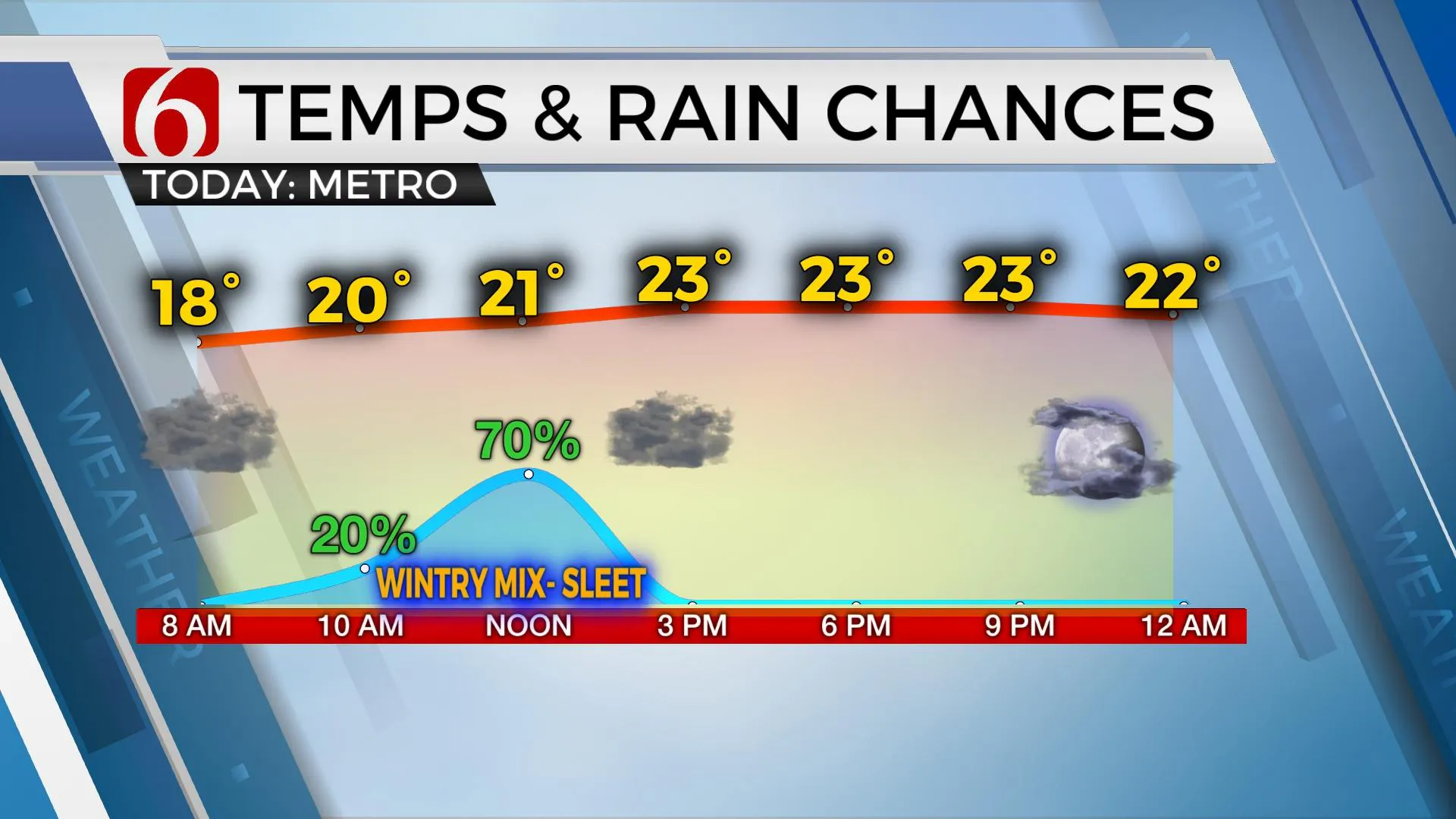
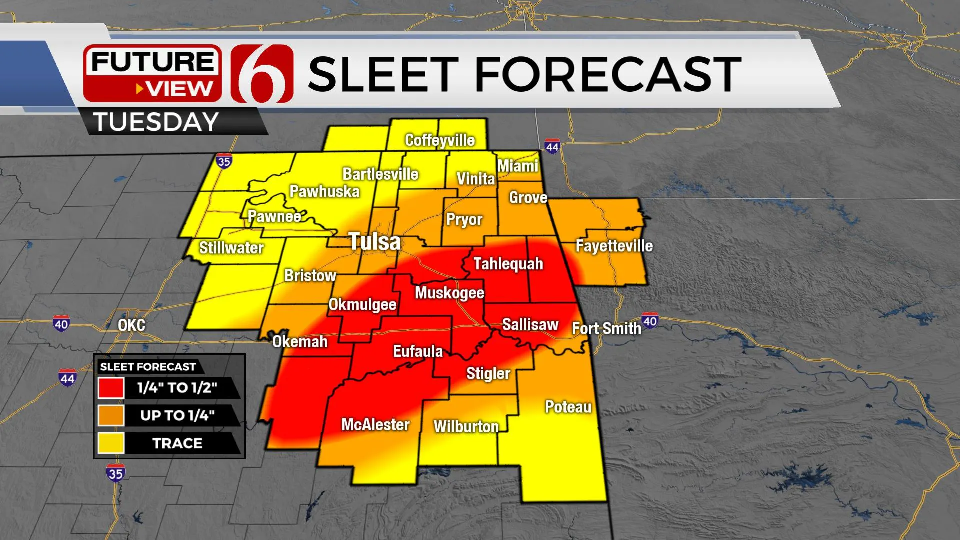
The main upper-level low located near southern California will draw closer to the region over the next 36 hours and should exit eastern sections sometime Thursday morning. Another wave of energy is rounding the base of this trough this morning and will spread relatively warm and moist air up and over the shallow cold air at the surface. The result will once again be a wintry mix, including the potential for sleet showers across the eastern third of the state, and some freezing rain across far southeastern sections of Oklahoma extending into the DFW region. This morning’s round is a quick-hitting system that should bring mostly light accumulations. The main window seems to be approximately from 10 a.m. to 3 p.m. area-wide, with the metro around the noon hour. Any sleet or wintry mix will result in additional slick and hazardous roadways. The depth of the cold air may support more freezing rain across the Red River into far southeastern Oklahoma. Please remain aware of your weather surroundings again today and this evening.

As the main upper-level trough nears the state Wednesday, additional precipitation is still likely, but may stay mostly across the southern half of the area with lower probabilities for the Tulsa metro for most of Wednesday morning through the afternoon. But the final wave of this system arrives Wednesday evening into Thursday. Temps are expected to be near or below freezing Wednesday evening as this slug of moisture arrives. The potential for freezing rain will be possible Wednesday evening into pre-dawn Thursday.

The final round will exit the area Thursday morning before with a gradual modification of air by afternoon. Thursday afternoon highs should reach the mid-40s. Friday morning drops back below freezing before reaching highs in the upper 40s and lower 50s Friday. A robust warm-up is expected this weekend with highs in the upper 50s Saturday and lower 60s Sunday into Monday.
Thanks for reading the Tuesday morning weather discussion and blog.
Have a super great and safe day.
Alan Crone
KOTV
More Like This
January 31st, 2023
January 11th, 2025
January 11th, 2025
January 11th, 2025
Top Headlines
January 11th, 2025
January 11th, 2025
January 10th, 2025
January 10th, 2025


