Stronger South Winds Returning Before Another Cold Front Arrives
Warm temperatures hang around for another day across Green Country, but showers and storms could soon make a return as the weekend approaches.Tuesday, April 18th 2023, 5:42 am
If you’re into podcasts or in a rush, check out my daily weather update. Search for NewsOn6 and ‘Weather Out The Door’ on most podcast providers, including Spotify, Stitcher and Tune-In, or Click Here to listen on Apple Podcasts.
Tulsa, Okla. - Warm temperatures hang around for another day across Green Country, but showers and storms could soon make a return as the weekend approaches.
Here are the details from News On 6 Meteorologist Alan Crone:

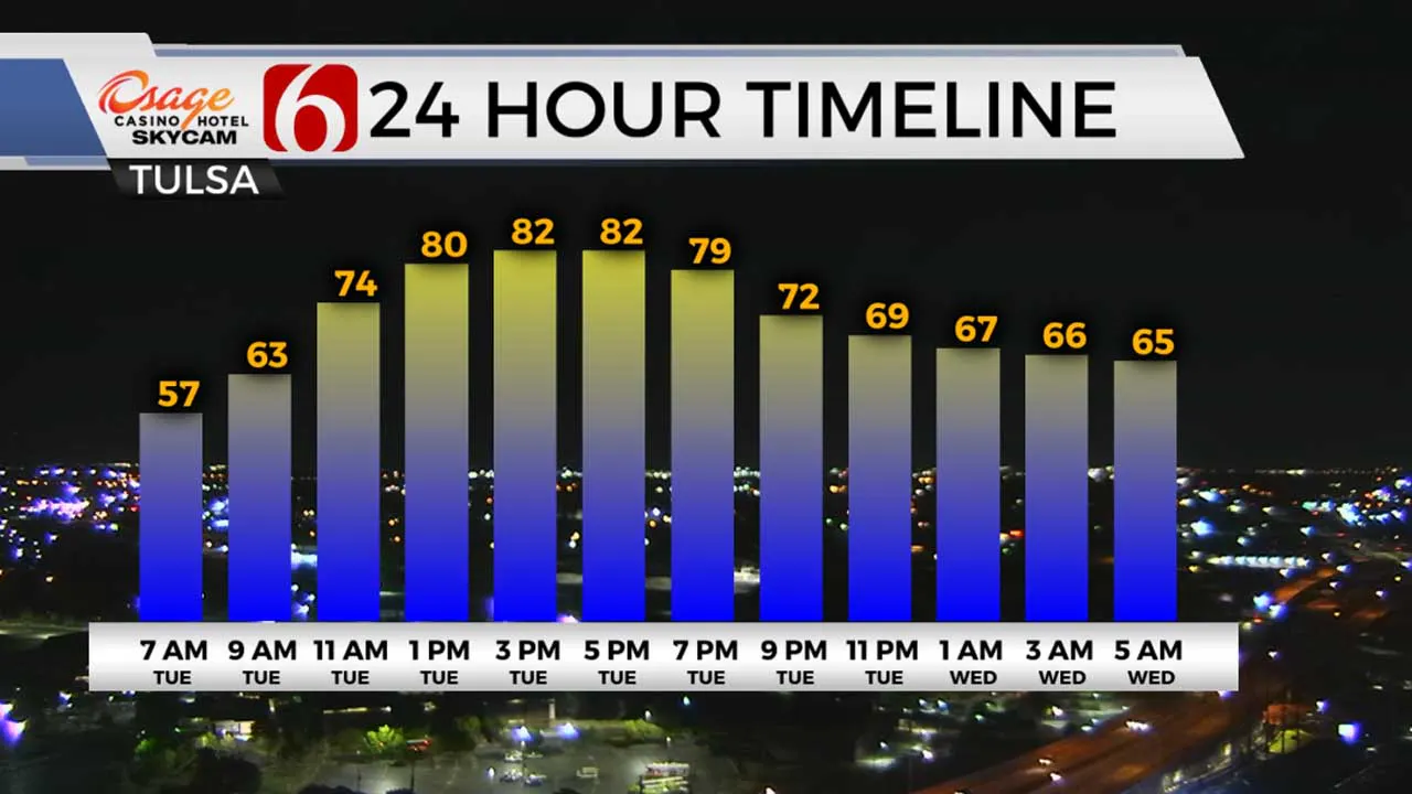
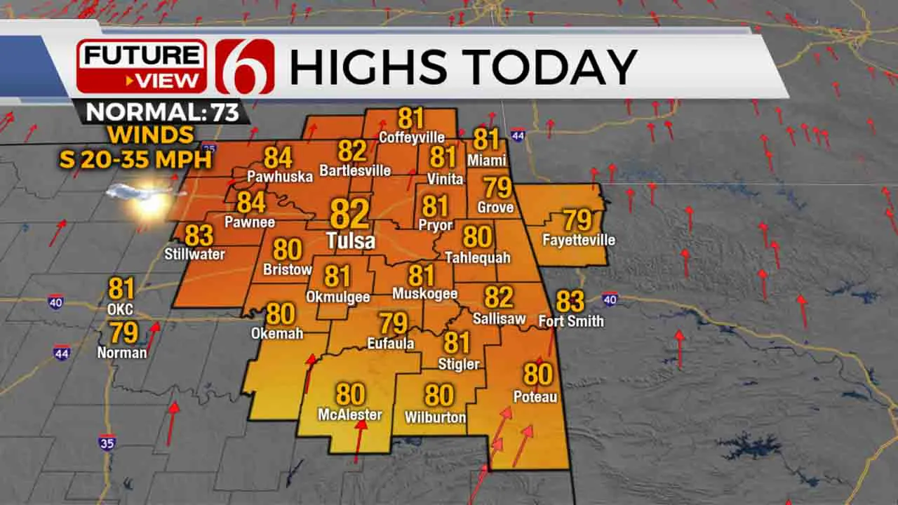
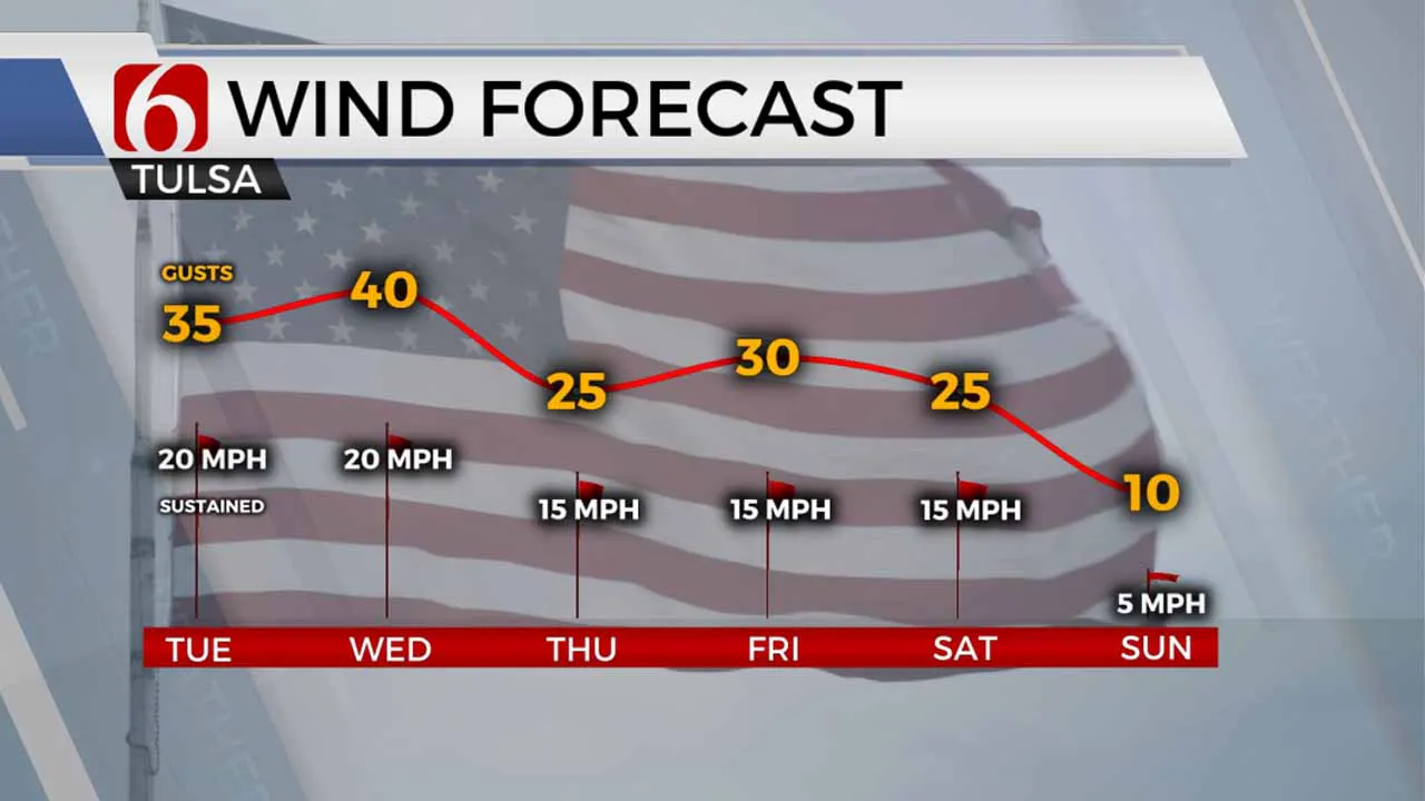
Gusty and strong south winds return on Tuesday with speeds from 20 to 35 mph. Afternoon highs are expected to be in the upper 70s and lower 80s with a mix of sun and clouds. Even stronger south winds are likely Wednesday from 20 to 40 mph as another storm system nears the region. A few showers or storms will be possible with this system before cooler to chilly weather returns Thursday evening into the weekend.

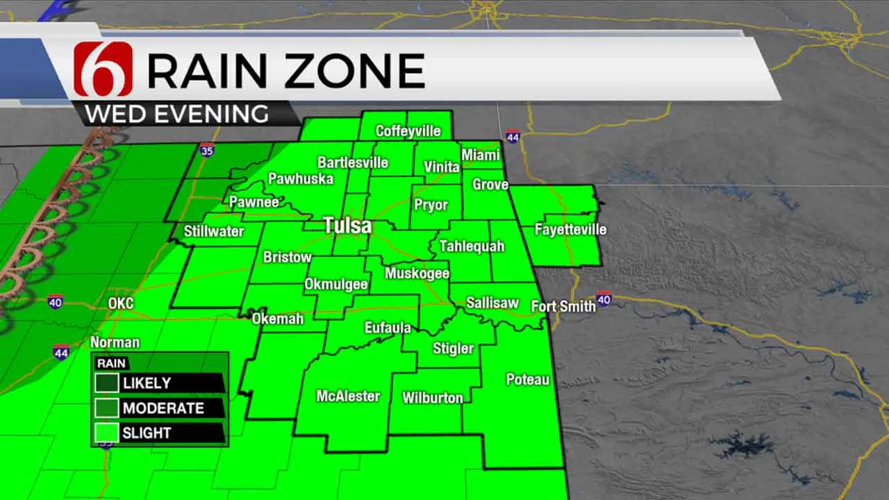
A few showers will zip across far northern OK and southern Kansas on Tuesday morning as a low-level jet brushes the region for the next few hours. This activity will remain spotty with a few lightning strikes but no severe weather threats. Another small chance will develop this afternoon across far southeastern OK where a few isolated showers or storms will be possible. Yet once again, another small window remains also Wednesday morning across the northern areas for the low-level jet to produce a few showers or even some drizzle in spots. The focus for storms for a larger area will be part of Wednesday night into Thursday as both upper-level energy and a surface cold front moves across the area. As the front moves southward, cooler weather arrives on Thursday into Friday and continues through the weekend.

A dry line is expected to sharpen across far western OK today and across west central OK Wednesday before slowly advancing eastward by Wednesday evening. Locations near and east of the dry line will have a probability for a few storms, including the threat of strong to severe storms. Another layer of warm air aloft (the CAP) is expected to suppress most, but not all storm activity ahead of the dry line for most of Wednesday afternoon and evening. But as colder air aloft nears, the capping inversion will slowly erode with scattered storms attempting to develop. Higher probabilities will remain along north-central OK into south-central OK. As the upper trough moves east, the surface cold front will arrive and advance across northern OK into the southeastern third of the state Thursday morning to midday. It’s these areas southeast of Tulsa Thursday that will have another chance for a few strong to severe storms before the cold front moves across the Red River into North TX. A second upper wave is possible Friday, but the data remains inconsistent. We’ll need to keep some shower chances Friday with cooler weather and northwest winds from 15 to 30 mph. Most of the weekend looks good but cool. A surface ridge of high pressure will be near northern Ok Saturday evening into Sunday morning bringing the potential for frost or even some freezing temps in a few valley locations.

Thanks for reading the Tuesday morning weather discussion and blog.
Have a super great day!
Alan Crone
KOTV
More Like This
April 18th, 2023
January 11th, 2025
January 11th, 2025
January 11th, 2025
Top Headlines
January 11th, 2025
January 11th, 2025
January 10th, 2025
January 10th, 2025


